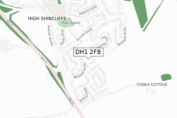
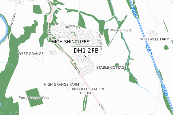
DH1 2FB lies on Grange Farm in High Shincliffe, Durham. DH1 2FB is located in the Durham South electoral ward, within the unitary authority of County Durham and the English Parliamentary constituency of City of Durham. The Sub Integrated Care Board (ICB) Location is NHS North East and North Cumbria ICB - 84H and the police force is Durham. This postcode has been in use since June 1999.


GetTheData
Source: OS Open Zoomstack (Ordnance Survey)
Licence: Open Government Licence (requires attribution)
Attribution: Contains OS data © Crown copyright and database right 2024
Source: Open Postcode Geo
Licence: Open Government Licence (requires attribution)
Attribution: Contains OS data © Crown copyright and database right 2024; Contains Royal Mail data © Royal Mail copyright and database right 2024; Source: Office for National Statistics licensed under the Open Government Licence v.3.0
| Easting | 429911 |
| Northing | 539807 |
| Latitude | 54.752338 |
| Longitude | -1.536814 |
GetTheData
Source: Open Postcode Geo
Licence: Open Government Licence
| Street | Grange Farm |
| Locality | High Shincliffe |
| Town/City | Durham |
| Country | England |
| Postcode District | DH1 |
| ➜ DH1 open data dashboard ➜ See where DH1 is on a map ➜ Where is High Shincliffe? | |
GetTheData
Source: Land Registry Price Paid Data
Licence: Open Government Licence
Elevation or altitude of DH1 2FB as distance above sea level:
| Metres | Feet | |
|---|---|---|
| Elevation | 90m | 295ft |
Elevation is measured from the approximate centre of the postcode, to the nearest point on an OS contour line from OS Terrain 50, which has contour spacing of ten vertical metres.
➜ How high above sea level am I? Find the elevation of your current position using your device's GPS.
GetTheData
Source: Open Postcode Elevation
Licence: Open Government Licence
| Ward | Durham South |
| Constituency | City Of Durham |
GetTheData
Source: ONS Postcode Database
Licence: Open Government Licence
BLAKEMORE, 2, GRANGE FARM, HIGH SHINCLIFFE, DURHAM, DH1 2FB 2010 21 MAY £715,000 |
THE SYCAMORES, GRANGE FARM, HIGH SHINCLIFFE, DURHAM, DH1 2FB 2006 18 OCT £455,000 |
THE SYCAMORES, GRANGE FARM, HIGH SHINCLIFFE, DURHAM, DH1 2FB 2003 8 AUG £425,000 |
BLAKEMORE, GRANGE FARM, HIGH SHINCLIFFE, DURHAM, DH1 2FB 2002 19 AUG £530,000 |
4, GRANGE FARM, HIGH SHINCLIFFE, DURHAM, DH1 2FB 1999 4 JUN £240,000 |
THE SYCAMORES, GRANGE FARM, HIGH SHINCLIFFE, DURHAM, DH1 2FB 1999 30 APR £240,000 |
3, GRANGE FARM, HIGH SHINCLIFFE, DURHAM, DH1 2FB 1999 14 APR £225,000 |
BLAKEMORE, GRANGE FARM, HIGH SHINCLIFFE, DURHAM, DH1 2FB 1999 12 MAR £260,000 |
➜ High Shincliffe house prices
GetTheData
Source: HM Land Registry Price Paid Data
Licence: Contains HM Land Registry data © Crown copyright and database right 2024. This data is licensed under the Open Government Licence v3.0.
| September 2023 | Violence and sexual offences | On or near Telford Close | 145m |
| July 2023 | Criminal damage and arson | On or near Telford Close | 145m |
| December 2022 | Burglary | On or near Telford Close | 145m |
| ➜ Grange Farm crime map and outcomes | |||
GetTheData
Source: data.police.uk
Licence: Open Government Licence
| The Avenue (Avenue Street) | High Shincliffe | 194m |
| The Avenue (Avenue Street) | High Shincliffe | 225m |
| Shincliffe Station (A177) | High Shincliffe Station | 272m |
| Chapel Place (Avenue Street) | High Shincliffe | 307m |
| Shincliffe Station (A177) | High Shincliffe Station | 335m |
| Durham Station | 4.2km |
GetTheData
Source: NaPTAN
Licence: Open Government Licence
| Percentage of properties with Next Generation Access | 100.0% |
| Percentage of properties with Superfast Broadband | 100.0% |
| Percentage of properties with Ultrafast Broadband | 0.0% |
| Percentage of properties with Full Fibre Broadband | 0.0% |
Superfast Broadband is between 30Mbps and 300Mbps
Ultrafast Broadband is > 300Mbps
| Percentage of properties unable to receive 2Mbps | 0.0% |
| Percentage of properties unable to receive 5Mbps | 0.0% |
| Percentage of properties unable to receive 10Mbps | 0.0% |
| Percentage of properties unable to receive 30Mbps | 0.0% |
GetTheData
Source: Ofcom
Licence: Ofcom Terms of Use (requires attribution)
GetTheData
Source: ONS Postcode Database
Licence: Open Government Licence


➜ Get more ratings from the Food Standards Agency
GetTheData
Source: Food Standards Agency
Licence: FSA terms & conditions
| Last Collection | |||
|---|---|---|---|
| Location | Mon-Fri | Sat | Distance |
| Whitwell Acres | 17:00 | 12:00 | 165m |
| Heathways, High Shincliffe | 17:00 | 09:15 | 397m |
| High Shincliffe | 17:00 | 12:00 | 503m |
GetTheData
Source: Dracos
Licence: Creative Commons Attribution-ShareAlike
| Facility | Distance |
|---|---|
| Shincliffe Primary School High Street, High Shincliffe, Durham Grass Pitches | 407m |
| Shincliffe Shincliffe, Durham Grass Pitches | 1.8km |
| Bowburn Junior School (Closed) Surtees Avenue, Bowburn, Durham Grass Pitches | 1.9km |
GetTheData
Source: Active Places
Licence: Open Government Licence
| School | Phase of Education | Distance |
|---|---|---|
| Shincliffe CofE (Controlled) Primary School Beal Walk, High Shincliffe, Shincliffe C of E Primary School, Durham, DH1 2PN | Primary | 407m |
| Bowburn Primary School Crowtrees Lane, Bowburn, DH6 5FP | Primary | 2.3km |
| Laurel Avenue Community Primary School Laurel Avenue, The Woodlands, Durham, DH1 2EY | Primary | 2.8km |
GetTheData
Source: Edubase
Licence: Open Government Licence
The below table lists the International Territorial Level (ITL) codes (formerly Nomenclature of Territorial Units for Statistics (NUTS) codes) and Local Administrative Units (LAU) codes for DH1 2FB:
| ITL 1 Code | Name |
|---|---|
| TLC | North East (England) |
| ITL 2 Code | Name |
| TLC1 | Tees Valley and Durham |
| ITL 3 Code | Name |
| TLC14 | Durham |
| LAU 1 Code | Name |
| E06000047 | County Durham |
GetTheData
Source: ONS Postcode Directory
Licence: Open Government Licence
The below table lists the Census Output Area (OA), Lower Layer Super Output Area (LSOA), and Middle Layer Super Output Area (MSOA) for DH1 2FB:
| Code | Name | |
|---|---|---|
| OA | E00105209 | |
| LSOA | E01020732 | County Durham 041D |
| MSOA | E02004318 | County Durham 041 |
GetTheData
Source: ONS Postcode Directory
Licence: Open Government Licence
| DH1 2PX | Whitwell Acres | 77m |
| DH1 2PR | 113m | |
| DH1 2TZ | Bromley Close | 133m |
| DH1 2UD | Ancroft Garth | 152m |
| DH1 2YJ | Telford Close | 153m |
| DH1 2PS | Pond Street | 189m |
| DH1 2UB | The Green | 206m |
| DH1 2TY | Apperley Avenue | 219m |
| DH1 2PT | Avenue Street | 244m |
| DH1 2PW | 259m |
GetTheData
Source: Open Postcode Geo; Land Registry Price Paid Data
Licence: Open Government Licence