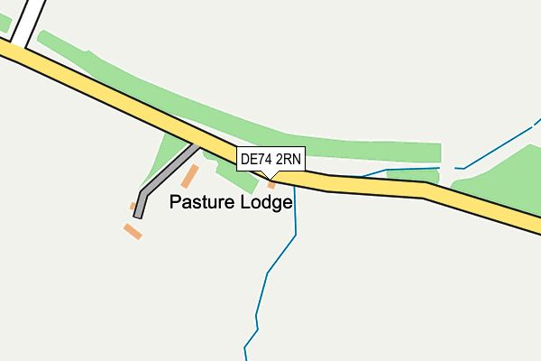
DE74 2RN is in Isley Walton, Derby. DE74 2RN is located in the Worthington & Breedon electoral ward, within the local authority district of North West Leicestershire and the English Parliamentary constituency of North West Leicestershire. The Sub Integrated Care Board (ICB) Location is NHS Leicester, Leicestershire and Rutland ICB - 04V and the police force is Leicestershire. This postcode has been in use since August 1992.


GetTheData
Source: OS OpenMap – Local (Ordnance Survey)
Source: OS VectorMap District (Ordnance Survey)
Licence: Open Government Licence (requires attribution)
| Easting | 441895 |
| Northing | 325171 |
| Latitude | 52.822469 |
| Longitude | -1.379727 |
GetTheData
Source: Open Postcode Geo
Licence: Open Government Licence
| Locality | Isley Walton |
| Town/City | Derby |
| Country | England |
| Postcode District | DE74 |
| ➜ DE74 open data dashboard ➜ See where DE74 is on a map | |
GetTheData
Source: Land Registry Price Paid Data
Licence: Open Government Licence
Elevation or altitude of DE74 2RN as distance above sea level:
| Metres | Feet | |
|---|---|---|
| Elevation | 70m | 230ft |
Elevation is measured from the approximate centre of the postcode, to the nearest point on an OS contour line from OS Terrain 50, which has contour spacing of ten vertical metres.
➜ How high above sea level am I? Find the elevation of your current position using your device's GPS.
GetTheData
Source: Open Postcode Elevation
Licence: Open Government Licence
| Ward | Worthington & Breedon |
| Constituency | North West Leicestershire |
GetTheData
Source: ONS Postcode Database
Licence: Open Government Licence
| Melbourne Road (Slade Lane) | Castle Donington | 460m |
| Slade Lane (Melbourne Road) | Castle Donington | 478m |
| Melbourne Road (Walton Hill) | Isley Walton | 647m |
| Melbourne Road (Walton Hill) | Isley Walton | 659m |
| Donington Park (Hill Top) | Castle Donington | 1,436m |
GetTheData
Source: NaPTAN
Licence: Open Government Licence
| Percentage of properties with Next Generation Access | 100.0% |
| Percentage of properties with Superfast Broadband | 60.0% |
| Percentage of properties with Ultrafast Broadband | 0.0% |
| Percentage of properties with Full Fibre Broadband | 0.0% |
Superfast Broadband is between 30Mbps and 300Mbps
Ultrafast Broadband is > 300Mbps
| Percentage of properties unable to receive 2Mbps | 0.0% |
| Percentage of properties unable to receive 5Mbps | 0.0% |
| Percentage of properties unable to receive 10Mbps | 40.0% |
| Percentage of properties unable to receive 30Mbps | 40.0% |
GetTheData
Source: Ofcom
Licence: Ofcom Terms of Use (requires attribution)
GetTheData
Source: ONS Postcode Database
Licence: Open Government Licence


➜ Get more ratings from the Food Standards Agency
GetTheData
Source: Food Standards Agency
Licence: FSA terms & conditions
| Last Collection | |||
|---|---|---|---|
| Location | Mon-Fri | Sat | Distance |
| Isley Walton | 16:00 | 10:30 | 647m |
| Wilson | 16:30 | 10:30 | 1,477m |
| Tonge Village | 16:00 | 10:30 | 1,933m |
GetTheData
Source: Dracos
Licence: Creative Commons Attribution-ShareAlike
| Facility | Distance |
|---|---|
| Breedon Priory Health Club Green Lane, Wilson, Melbourne, Derby Health and Fitness Gym, Swimming Pool, Studio | 1.9km |
| Breedon Priory Golf Centre (Closed) Green Lane, Wilson, Melbourne, Derby Golf | 1.9km |
| St Hardulphs C Of E Primary School Main Street, Breedon-on-the-hill, Derby Grass Pitches | 2.5km |
GetTheData
Source: Active Places
Licence: Open Government Licence
| School | Phase of Education | Distance |
|---|---|---|
| Foxbridge Primary School Welsted Road, Castle Donington, DE74 2SN | Primary | 2.3km |
| St Hardulph's Church of England Primary School Main Street, Breedon-on-the-Hill, Derby, DE73 8AN | Primary | 2.6km |
| Melbourne Infant School Packhorse Road, Melbourne, Derby, DE73 8JE | Primary | 3.1km |
GetTheData
Source: Edubase
Licence: Open Government Licence
The below table lists the International Territorial Level (ITL) codes (formerly Nomenclature of Territorial Units for Statistics (NUTS) codes) and Local Administrative Units (LAU) codes for DE74 2RN:
| ITL 1 Code | Name |
|---|---|
| TLF | East Midlands (England) |
| ITL 2 Code | Name |
| TLF2 | Leicestershire, Rutland and Northamptonshire |
| ITL 3 Code | Name |
| TLF22 | Leicestershire CC and Rutland |
| LAU 1 Code | Name |
| E07000134 | North West Leicestershire |
GetTheData
Source: ONS Postcode Directory
Licence: Open Government Licence
The below table lists the Census Output Area (OA), Lower Layer Super Output Area (LSOA), and Middle Layer Super Output Area (MSOA) for DE74 2RN:
| Code | Name | |
|---|---|---|
| OA | E00131556 | |
| LSOA | E01025924 | North West Leicestershire 001A |
| MSOA | E02005397 | North West Leicestershire 001 |
GetTheData
Source: ONS Postcode Directory
Licence: Open Government Licence
| DE74 2RL | 699m | |
| DE73 8AF | Short Hill | 1464m |
| DE73 8BL | Wilson Rise | 1484m |
| DE73 8AH | Dog Lane | 1524m |
| DE73 8BR | Station Road | 1582m |
| DE73 8AD | Main Street | 1680m |
| DE73 8BB | Moor Lane | 1715m |
| DE73 8AE | Bullshead Row | 1736m |
| DE73 8BA | Breedon Lane | 1908m |
| DE73 8HG | Dovecote | 1915m |
GetTheData
Source: Open Postcode Geo; Land Registry Price Paid Data
Licence: Open Government Licence