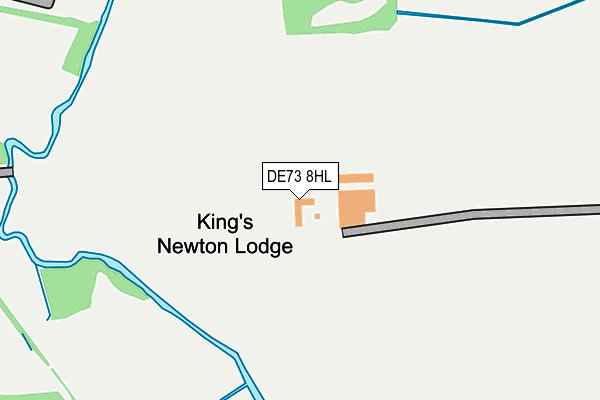
DE73 8HL is located in the Melbourne electoral ward, within the local authority district of South Derbyshire and the English Parliamentary constituency of South Derbyshire. The Sub Integrated Care Board (ICB) Location is NHS Derby and Derbyshire ICB - 15M and the police force is Derbyshire. This postcode has been in use since September 2004.


GetTheData
Source: OS OpenMap – Local (Ordnance Survey)
Source: OS VectorMap District (Ordnance Survey)
Licence: Open Government Licence (requires attribution)
| Easting | 439476 |
| Northing | 326507 |
| Latitude | 52.834642 |
| Longitude | -1.415468 |
GetTheData
Source: Open Postcode Geo
Licence: Open Government Licence
| Country | England |
| Postcode District | DE73 |
| ➜ DE73 open data dashboard ➜ See where DE73 is on a map | |
GetTheData
Source: Land Registry Price Paid Data
Licence: Open Government Licence
Elevation or altitude of DE73 8HL as distance above sea level:
| Metres | Feet | |
|---|---|---|
| Elevation | 50m | 164ft |
Elevation is measured from the approximate centre of the postcode, to the nearest point on an OS contour line from OS Terrain 50, which has contour spacing of ten vertical metres.
➜ How high above sea level am I? Find the elevation of your current position using your device's GPS.
GetTheData
Source: Open Postcode Elevation
Licence: Open Government Licence
| Ward | Melbourne |
| Constituency | South Derbyshire |
GetTheData
Source: ONS Postcode Database
Licence: Open Government Licence
| April 2022 | Other theft | On or near Trent Lane | 463m |
| June 2021 | Anti-social behaviour | On or near Trent Lane | 463m |
| June 2021 | Criminal damage and arson | On or near Trent Lane | 463m |
| ➜ Get more crime data in our Crime section | |||
GetTheData
Source: data.police.uk
Licence: Open Government Licence
| Station Yard (Station Road) | Melbourne | 571m |
| Station Yard (Station Road) | Melbourne | 611m |
| Station Road 167 (Station Road) | Melbourne | 740m |
| Station Road 167 (Station Road) | Melbourne | 762m |
| Nettlefold Crescent (Pack Horse Road) | King's Newton | 964m |
GetTheData
Source: NaPTAN
Licence: Open Government Licence
| Percentage of properties with Next Generation Access | 100.0% |
| Percentage of properties with Superfast Broadband | 0.0% |
| Percentage of properties with Ultrafast Broadband | 0.0% |
| Percentage of properties with Full Fibre Broadband | 0.0% |
Superfast Broadband is between 30Mbps and 300Mbps
Ultrafast Broadband is > 300Mbps
| Percentage of properties unable to receive 2Mbps | 0.0% |
| Percentage of properties unable to receive 5Mbps | 0.0% |
| Percentage of properties unable to receive 10Mbps | 0.0% |
| Percentage of properties unable to receive 30Mbps | 100.0% |
GetTheData
Source: Ofcom
Licence: Ofcom Terms of Use (requires attribution)
GetTheData
Source: ONS Postcode Database
Licence: Open Government Licence


➜ Get more ratings from the Food Standards Agency
GetTheData
Source: Food Standards Agency
Licence: FSA terms & conditions
| Last Collection | |||
|---|---|---|---|
| Location | Mon-Fri | Sat | Distance |
| Hardinge Arms | 17:00 | 10:30 | 793m |
| Packhorse Road | 17:00 | 10:30 | 1,009m |
| Station Road | 17:00 | 10:30 | 1,185m |
GetTheData
Source: Dracos
Licence: Creative Commons Attribution-ShareAlike
| Facility | Distance |
|---|---|
| Melbourne Junior School Pack Horse Road, Melbourne, Derby Grass Pitches | 1.1km |
| Ukranian Youth Centre Weston-on-trent, Derby Grass Pitches | 1.3km |
| Picture Of Health Fitness Studio (Derby) (Closed) Derby Road, Melbourne, Derby Health and Fitness Gym, Studio | 1.4km |
GetTheData
Source: Active Places
Licence: Open Government Licence
| School | Phase of Education | Distance |
|---|---|---|
| Melbourne Infant School Packhorse Road, Melbourne, Derby, DE73 8JE | Primary | 1km |
| Melbourne Junior School Packhorse Road, Melbourne, Derby, DE73 8JE | Primary | 1.1km |
| Weston-on-Trent CofE (VA) Primary School Forrester Avenue, Weston-on-Trent, Derby, DE72 2HX | Primary | 1.9km |
GetTheData
Source: Edubase
Licence: Open Government Licence
The below table lists the International Territorial Level (ITL) codes (formerly Nomenclature of Territorial Units for Statistics (NUTS) codes) and Local Administrative Units (LAU) codes for DE73 8HL:
| ITL 1 Code | Name |
|---|---|
| TLF | East Midlands (England) |
| ITL 2 Code | Name |
| TLF1 | Derbyshire and Nottinghamshire |
| ITL 3 Code | Name |
| TLF13 | South and West Derbyshire |
| LAU 1 Code | Name |
| E07000039 | South Derbyshire |
GetTheData
Source: ONS Postcode Directory
Licence: Open Government Licence
The below table lists the Census Output Area (OA), Lower Layer Super Output Area (LSOA), and Middle Layer Super Output Area (MSOA) for DE73 8HL:
| Code | Name | |
|---|---|---|
| OA | E00100473 | |
| LSOA | E01019855 | South Derbyshire 006D |
| MSOA | E02004123 | South Derbyshire 006 |
GetTheData
Source: ONS Postcode Directory
Licence: Open Government Licence
| DE73 8BT | Trent Lane | 452m |
| DE73 8BS | Main Street | 490m |
| DE73 8BW | Jawbone Lane | 528m |
| DE73 8BQ | Station Road | 643m |
| DE73 8BX | Main Street | 689m |
| DE73 8HE | Newton Wonder Court | 826m |
| DE73 8HN | Jawbone Lane | 902m |
| DE73 8DB | Smith Avenue | 903m |
| DE73 8DA | Nettlefold Crescent | 916m |
| DE73 8LZ | Huntingdon Court | 928m |
GetTheData
Source: Open Postcode Geo; Land Registry Price Paid Data
Licence: Open Government Licence