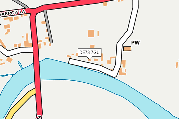
DE73 7GU lies on Trent Side in Swarkestone, Derby. DE73 7GU is located in the Aston electoral ward, within the local authority district of South Derbyshire and the English Parliamentary constituency of South Derbyshire. The Sub Integrated Care Board (ICB) Location is NHS Derby and Derbyshire ICB - 15M and the police force is Derbyshire. This postcode has been in use since September 2004.


GetTheData
Source: OS OpenMap – Local (Ordnance Survey)
Source: OS VectorMap District (Ordnance Survey)
Licence: Open Government Licence (requires attribution)
| Easting | 437071 |
| Northing | 328556 |
| Latitude | 52.853231 |
| Longitude | -1.450934 |
GetTheData
Source: Open Postcode Geo
Licence: Open Government Licence
| Street | Trent Side |
| Locality | Swarkestone |
| Town/City | Derby |
| Country | England |
| Postcode District | DE73 |
➜ See where DE73 is on a map ➜ Where is Swarkestone? | |
GetTheData
Source: Land Registry Price Paid Data
Licence: Open Government Licence
Elevation or altitude of DE73 7GU as distance above sea level:
| Metres | Feet | |
|---|---|---|
| Elevation | 40m | 131ft |
Elevation is measured from the approximate centre of the postcode, to the nearest point on an OS contour line from OS Terrain 50, which has contour spacing of ten vertical metres.
➜ How high above sea level am I? Find the elevation of your current position using your device's GPS.
GetTheData
Source: Open Postcode Elevation
Licence: Open Government Licence
| Ward | Aston |
| Constituency | South Derbyshire |
GetTheData
Source: ONS Postcode Database
Licence: Open Government Licence
| Crewe And Harpur (A514) | Swarkestone | 191m |
| Crewe And Harpur (A514) | Swarkestone | 204m |
| Cottage Garage (A514) | Swarkestone | 257m |
| Cottage Garage (A514) | Swarkestone | 275m |
| Woodshop Lane (Barrow Lane) | Swarkestone | 402m |
| Peartree Station | 5.1km |
GetTheData
Source: NaPTAN
Licence: Open Government Licence
| Percentage of properties with Next Generation Access | 100.0% |
| Percentage of properties with Superfast Broadband | 0.0% |
| Percentage of properties with Ultrafast Broadband | 0.0% |
| Percentage of properties with Full Fibre Broadband | 0.0% |
Superfast Broadband is between 30Mbps and 300Mbps
Ultrafast Broadband is > 300Mbps
| Median download speed | 18.0Mbps |
| Average download speed | 20.0Mbps |
| Maximum download speed | 36.59Mbps |
| Median upload speed | 3.3Mbps |
| Average upload speed | 3.5Mbps |
| Maximum upload speed | 7.49Mbps |
| Percentage of properties unable to receive 2Mbps | 0.0% |
| Percentage of properties unable to receive 5Mbps | 0.0% |
| Percentage of properties unable to receive 10Mbps | 0.0% |
| Percentage of properties unable to receive 30Mbps | 100.0% |
GetTheData
Source: Ofcom
Licence: Ofcom Terms of Use (requires attribution)
GetTheData
Source: ONS Postcode Database
Licence: Open Government Licence


➜ Get more ratings from the Food Standards Agency
GetTheData
Source: Food Standards Agency
Licence: FSA terms & conditions
| Last Collection | |||
|---|---|---|---|
| Location | Mon-Fri | Sat | Distance |
| Crewe And Harper | 17:00 | 10:30 | 196m |
| Homeleigh Way | 17:00 | 10:30 | 1,254m |
| Stanton By Bridge | 17:00 | 10:30 | 1,311m |
GetTheData
Source: Dracos
Licence: Creative Commons Attribution-ShareAlike
| Risk of DE73 7GU flooding from rivers and sea | High |
| ➜ DE73 7GU flood map | |
GetTheData
Source: Open Flood Risk by Postcode
Licence: Open Government Licence
The below table lists the International Territorial Level (ITL) codes (formerly Nomenclature of Territorial Units for Statistics (NUTS) codes) and Local Administrative Units (LAU) codes for DE73 7GU:
| ITL 1 Code | Name |
|---|---|
| TLF | East Midlands (England) |
| ITL 2 Code | Name |
| TLF1 | Derbyshire and Nottinghamshire |
| ITL 3 Code | Name |
| TLF13 | South and West Derbyshire |
| LAU 1 Code | Name |
| E07000039 | South Derbyshire |
GetTheData
Source: ONS Postcode Directory
Licence: Open Government Licence
The below table lists the Census Output Area (OA), Lower Layer Super Output Area (LSOA), and Middle Layer Super Output Area (MSOA) for DE73 7GU:
| Code | Name | |
|---|---|---|
| OA | E00100375 | |
| LSOA | E01019834 | South Derbyshire 004C |
| MSOA | E02004121 | South Derbyshire 004 |
GetTheData
Source: ONS Postcode Directory
Licence: Open Government Licence
| DE73 7GT | Church Lane | 107m |
| DE73 7GW | Derby Road | 150m |
| DE73 7JB | Derby Road | 223m |
| DE73 7JA | Woodshop Lane | 308m |
| DE73 7GR | Barrow Lane | 313m |
| DE73 7GN | Pingle Lane | 584m |
| DE73 7GS | Swarkestoneroad | 674m |
| DE73 7GQ | Lowes Lane | 1079m |
| DE73 5NX | Kingsdale Grove | 1219m |
| DE73 5UJ | Bradgate Park View | 1221m |
GetTheData
Source: Open Postcode Geo; Land Registry Price Paid Data
Licence: Open Government Licence