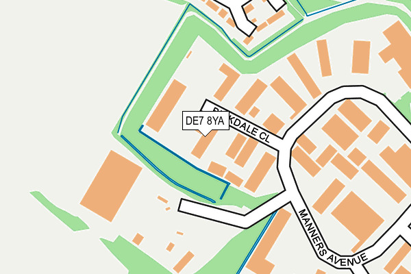
DE7 8YA lies on Birkdale Close in Manners Industrial Estate, Ilkeston. DE7 8YA is located in the Little Hallam electoral ward, within the local authority district of Erewash and the English Parliamentary constituency of Erewash. The Sub Integrated Care Board (ICB) Location is NHS Derby and Derbyshire ICB - 15M and the police force is Derbyshire. This postcode has been in use since February 1990.


GetTheData
Source: OS OpenMap – Local (Ordnance Survey)
Source: OS VectorMap District (Ordnance Survey)
Licence: Open Government Licence (requires attribution)
| Easting | 445526 |
| Northing | 342427 |
| Latitude | 52.977285 |
| Longitude | -1.323441 |
GetTheData
Source: Open Postcode Geo
Licence: Open Government Licence
| Street | Birkdale Close |
| Locality | Manners Industrial Estate |
| Town/City | Ilkeston |
| Country | England |
| Postcode District | DE7 |
| ➜ DE7 open data dashboard ➜ See where DE7 is on a map ➜ Where is Ilkeston? | |
GetTheData
Source: Land Registry Price Paid Data
Licence: Open Government Licence
Elevation or altitude of DE7 8YA as distance above sea level:
| Metres | Feet | |
|---|---|---|
| Elevation | 70m | 230ft |
Elevation is measured from the approximate centre of the postcode, to the nearest point on an OS contour line from OS Terrain 50, which has contour spacing of ten vertical metres.
➜ How high above sea level am I? Find the elevation of your current position using your device's GPS.
GetTheData
Source: Open Postcode Elevation
Licence: Open Government Licence
| Ward | Little Hallam |
| Constituency | Erewash |
GetTheData
Source: ONS Postcode Database
Licence: Open Government Licence
| August 2023 | Anti-social behaviour | On or near Park/Open Space | 412m |
| November 2022 | Other theft | On or near Birkdale Close | 43m |
| June 2022 | Violence and sexual offences | On or near Harcourt Close | 318m |
| ➜ Birkdale Close crime map and outcomes | |||
GetTheData
Source: data.police.uk
Licence: Open Government Licence
| Huckerby Road | Shipley View | 370m |
| Mason Road | Shipley View | 476m |
| Pentridge Drive (Barling Drive) | Shipley View | 525m |
| Summerfields Way | Shipley View | 547m |
| Summerfields Way South | Shipley View | 610m |
| Ilkeston Station | 1.9km |
| Langley Mill Station | 4.6km |
GetTheData
Source: NaPTAN
Licence: Open Government Licence
Estimated total energy consumption in DE7 8YA by fuel type, 2015.
| Consumption (kWh) | 89,927 |
|---|---|
| Meter count | 6 |
| Mean (kWh/meter) | 14,988 |
| Median (kWh/meter) | 12,066 |
GetTheData
Source: Postcode level gas estimates: 2015 (experimental)
Source: Postcode level electricity estimates: 2015 (experimental)
Licence: Open Government Licence
GetTheData
Source: ONS Postcode Database
Licence: Open Government Licence


➜ Get more ratings from the Food Standards Agency
GetTheData
Source: Food Standards Agency
Licence: FSA terms & conditions
| Last Collection | |||
|---|---|---|---|
| Location | Mon-Fri | Sat | Distance |
| Manners Business Box | 18:30 | 375m | |
| Ilkeston Pdo | 17:30 | 10:00 | 386m |
| Summerfields Way P.o. Box | 17:30 | 10:30 | 550m |
GetTheData
Source: Dracos
Licence: Creative Commons Attribution-ShareAlike
| Facility | Distance |
|---|---|
| Abbotsford Playing Fields (The Pod) Summerfields Way South, Ilkeston Grass Pitches | 501m |
| Victoria Park Leisure Centre Manners Road, Ilkeston Swimming Pool, Health and Fitness Gym | 674m |
| Manor Fitness And Squash Club Manners Road, Ilkeston Health and Fitness Gym, Studio, Squash Courts | 728m |
GetTheData
Source: Active Places
Licence: Open Government Licence
| School | Phase of Education | Distance |
|---|---|---|
| Ormiston Ilkeston Enterprise Academy King George Avenue, Ilkeston, DE7 5HS | Secondary | 793m |
| Granby Junior School Heanor Road, Ilkeston, DE7 8DX | Primary | 893m |
| Charlotte Nursery and Infant School Trinity Close, Ilkeston, DE7 8LQ | Primary | 1km |
GetTheData
Source: Edubase
Licence: Open Government Licence
The below table lists the International Territorial Level (ITL) codes (formerly Nomenclature of Territorial Units for Statistics (NUTS) codes) and Local Administrative Units (LAU) codes for DE7 8YA:
| ITL 1 Code | Name |
|---|---|
| TLF | East Midlands (England) |
| ITL 2 Code | Name |
| TLF1 | Derbyshire and Nottinghamshire |
| ITL 3 Code | Name |
| TLF13 | South and West Derbyshire |
| LAU 1 Code | Name |
| E07000036 | Erewash |
GetTheData
Source: ONS Postcode Directory
Licence: Open Government Licence
The below table lists the Census Output Area (OA), Lower Layer Super Output Area (LSOA), and Middle Layer Super Output Area (MSOA) for DE7 8YA:
| Code | Name | |
|---|---|---|
| OA | E00099364 | |
| LSOA | E01019640 | Erewash 016C |
| MSOA | E02006828 | Erewash 016 |
GetTheData
Source: ONS Postcode Directory
Licence: Open Government Licence
| DE7 9LP | Mason Road | 226m |
| DE7 8EF | Manners Avenue | 240m |
| DE7 9LE | Turnberry Close | 297m |
| DE7 9JP | Mason Road | 301m |
| DE7 9LB | Huckerby Road | 342m |
| DE7 9JU | Eley Close | 371m |
| DE7 8EW | Enterprise Court | 376m |
| DE7 9JT | Hays Close | 394m |
| DE7 9LN | Sanders Close | 396m |
| DE7 9LA | Watson Road | 412m |
GetTheData
Source: Open Postcode Geo; Land Registry Price Paid Data
Licence: Open Government Licence