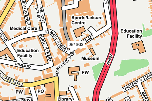
DE7 8GS is located in the Little Hallam electoral ward, within the local authority district of Erewash and the English Parliamentary constituency of Erewash. The Sub Integrated Care Board (ICB) Location is NHS Derby and Derbyshire ICB - 15M and the police force is Derbyshire. This postcode has been in use since January 1980.


GetTheData
Source: OS OpenMap – Local (Ordnance Survey)
Source: OS VectorMap District (Ordnance Survey)
Licence: Open Government Licence (requires attribution)
| Easting | 446558 |
| Northing | 341811 |
| Latitude | 52.971641 |
| Longitude | -1.308165 |
GetTheData
Source: Open Postcode Geo
Licence: Open Government Licence
| Country | England |
| Postcode District | DE7 |
| ➜ DE7 open data dashboard ➜ See where DE7 is on a map ➜ Where is Ilkeston? | |
GetTheData
Source: Land Registry Price Paid Data
Licence: Open Government Licence
Elevation or altitude of DE7 8GS as distance above sea level:
| Metres | Feet | |
|---|---|---|
| Elevation | 100m | 328ft |
Elevation is measured from the approximate centre of the postcode, to the nearest point on an OS contour line from OS Terrain 50, which has contour spacing of ten vertical metres.
➜ How high above sea level am I? Find the elevation of your current position using your device's GPS.
GetTheData
Source: Open Postcode Elevation
Licence: Open Government Licence
| Ward | Little Hallam |
| Constituency | Erewash |
GetTheData
Source: ONS Postcode Database
Licence: Open Government Licence
| January 2024 | Anti-social behaviour | On or near Shopping Area | 220m |
| January 2024 | Public order | On or near Shopping Area | 220m |
| January 2024 | Shoplifting | On or near Shopping Area | 220m |
| ➜ Get more crime data in our Crime section | |||
GetTheData
Source: data.police.uk
Licence: Open Government Licence
| Market Place (Wharncliffe Road) | Ilkeston | 157m |
| Market Place (Wharncliffe Road) | Ilkeston | 172m |
| Market Place (Wharncliffe Road) | Ilkeston | 173m |
| Market Place (Wharncliffe Road) | Ilkeston | 190m |
| Market Place (Wharncliffe Road) | Ilkeston | 198m |
| Ilkeston Station | 1.3km |
GetTheData
Source: NaPTAN
Licence: Open Government Licence
GetTheData
Source: ONS Postcode Database
Licence: Open Government Licence


➜ Get more ratings from the Food Standards Agency
GetTheData
Source: Food Standards Agency
Licence: FSA terms & conditions
| Last Collection | |||
|---|---|---|---|
| Location | Mon-Fri | Sat | Distance |
| Ilkeston Co-op Post Office | 18:30 | 12:00 | 203m |
| Lord Haddon Road | 17:30 | 07:15 | 325m |
| Bath Street Post Office | 17:30 | 11:15 | 422m |
GetTheData
Source: Dracos
Licence: Creative Commons Attribution-ShareAlike
| Facility | Distance |
|---|---|
| Albion Leisure Centre (Closed) East Street, Ilkeston Sports Hall, Health and Fitness Gym | 77m |
| Snap Fitness (Ilkeston) South Street, Ilkeston Health and Fitness Gym | 211m |
| Chaucer Junior School Cranmer Street, Ilkeston Grass Pitches | 326m |
GetTheData
Source: Active Places
Licence: Open Government Licence
| School | Phase of Education | Distance |
|---|---|---|
| Chaucer Infant School Cantelupe Road, Ilkeston, DE7 5LN | Primary | 250m |
| Chaucer Junior School Cranmer Street, Ilkeston, DE7 5JH | Primary | 330m |
| Ormiston Ilkeston Enterprise Academy King George Avenue, Ilkeston, DE7 5HS | Secondary | 514m |
GetTheData
Source: Edubase
Licence: Open Government Licence
The below table lists the International Territorial Level (ITL) codes (formerly Nomenclature of Territorial Units for Statistics (NUTS) codes) and Local Administrative Units (LAU) codes for DE7 8GS:
| ITL 1 Code | Name |
|---|---|
| TLF | East Midlands (England) |
| ITL 2 Code | Name |
| TLF1 | Derbyshire and Nottinghamshire |
| ITL 3 Code | Name |
| TLF13 | South and West Derbyshire |
| LAU 1 Code | Name |
| E07000036 | Erewash |
GetTheData
Source: ONS Postcode Directory
Licence: Open Government Licence
The below table lists the Census Output Area (OA), Lower Layer Super Output Area (LSOA), and Middle Layer Super Output Area (MSOA) for DE7 8GS:
| Code | Name | |
|---|---|---|
| OA | E00099476 | |
| LSOA | E01019661 | Erewash 003C |
| MSOA | E02004080 | Erewash 003 |
GetTheData
Source: ONS Postcode Directory
Licence: Open Government Licence
| DE7 5QA | Market Place | 57m |
| DE7 8AQ | St Mary Court | 59m |
| DE7 8FB | Bath Street | 80m |
| DE7 8AF | St Mary Street | 97m |
| DE7 5JB | East Street | 98m |
| DE7 5QB | Market Place | 127m |
| DE7 8AA | Burns Street | 135m |
| DE7 8AH | Bath Street | 147m |
| DE7 5GF | Wharncliffe Road | 201m |
| DE7 8AE | Gregory Street | 207m |
GetTheData
Source: Open Postcode Geo; Land Registry Price Paid Data
Licence: Open Government Licence