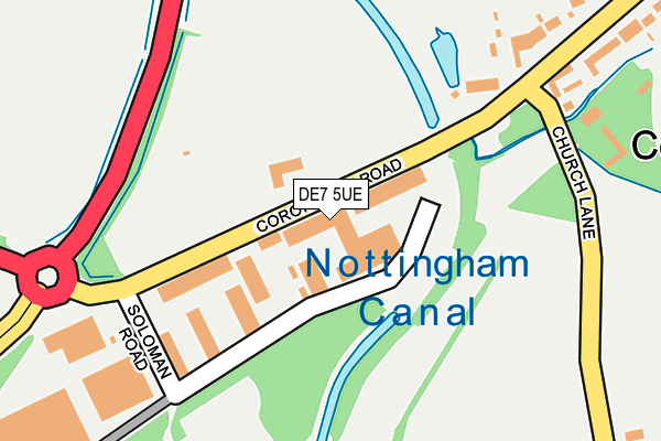
DE7 5UE is located in the Awsworth, Cossall & Trowell electoral ward, within the local authority district of Broxtowe and the English Parliamentary constituency of Broxtowe. The Sub Integrated Care Board (ICB) Location is NHS Nottingham and Nottinghamshire ICB - 52R and the police force is Nottinghamshire. This postcode has been in use since June 1996.


GetTheData
Source: OS OpenMap – Local (Ordnance Survey)
Source: OS VectorMap District (Ordnance Survey)
Licence: Open Government Licence (requires attribution)
| Easting | 447875 |
| Northing | 342744 |
| Latitude | 52.979931 |
| Longitude | -1.288415 |
GetTheData
Source: Open Postcode Geo
Licence: Open Government Licence
| Country | England |
| Postcode District | DE7 |
| ➜ DE7 open data dashboard ➜ See where DE7 is on a map ➜ Where is Ilkeston? | |
GetTheData
Source: Land Registry Price Paid Data
Licence: Open Government Licence
Elevation or altitude of DE7 5UE as distance above sea level:
| Metres | Feet | |
|---|---|---|
| Elevation | 60m | 197ft |
Elevation is measured from the approximate centre of the postcode, to the nearest point on an OS contour line from OS Terrain 50, which has contour spacing of ten vertical metres.
➜ How high above sea level am I? Find the elevation of your current position using your device's GPS.
GetTheData
Source: Open Postcode Elevation
Licence: Open Government Licence
| Ward | Awsworth, Cossall & Trowell |
| Constituency | Broxtowe |
GetTheData
Source: ONS Postcode Database
Licence: Open Government Licence
| June 2022 | Criminal damage and arson | On or near Church Lane | 430m |
| May 2022 | Criminal damage and arson | On or near Church Lane | 430m |
| May 2022 | Criminal damage and arson | On or near Church Lane | 430m |
| ➜ Get more crime data in our Crime section | |||
GetTheData
Source: data.police.uk
Licence: Open Government Licence
| Church Lane (Awsworth Lane) | Cossall Marsh | 167m |
| Soloman Road (Coronation Road) | Cossall Marsh | 187m |
| Soloman Road (Coronation Road) | Cossall Marsh | 197m |
| Church Lane (Awsworth Lane) | Cossall Marsh | 235m |
| Awsworth Lane | Cossall Marsh | 480m |
| Ilkeston Station | 0.4km |
| Langley Mill Station | 5.1km |
GetTheData
Source: NaPTAN
Licence: Open Government Licence
GetTheData
Source: ONS Postcode Database
Licence: Open Government Licence


➜ Get more ratings from the Food Standards Agency
GetTheData
Source: Food Standards Agency
Licence: FSA terms & conditions
| Last Collection | |||
|---|---|---|---|
| Location | Mon-Fri | Sat | Distance |
| Cossall Marsh | 16:00 | 10:30 | 493m |
| Ilkeston Junction | 17:30 | 07:15 | 531m |
| Cossall | 16:00 | 10:30 | 678m |
GetTheData
Source: Dracos
Licence: Creative Commons Attribution-ShareAlike
| Facility | Distance |
|---|---|
| Gordon Street Recreation Ground Gordon Street, Ilkeston Grass Pitches | 955m |
| Ilkeston Town Football Club Awsworth Road, Ilkeston Grass Pitches, Artificial Grass Pitch | 960m |
| Booths Playing Field Awsworth Road, Ilkeston Grass Pitches | 1km |
GetTheData
Source: Active Places
Licence: Open Government Licence
| School | Phase of Education | Distance |
|---|---|---|
| Blue Mountain Education Willow Farm, Off Newton Lane, Ilkeston, Cossall, NG16 2SD | Not applicable | 459m |
| Awsworth Primary and Nursery School The Lane, Awsworth, Nottingham, NG16 2QS | Primary | 1.1km |
| Chaucer Junior School Cranmer Street, Ilkeston, DE7 5JH | Primary | 1.3km |
GetTheData
Source: Edubase
Licence: Open Government Licence
The below table lists the International Territorial Level (ITL) codes (formerly Nomenclature of Territorial Units for Statistics (NUTS) codes) and Local Administrative Units (LAU) codes for DE7 5UE:
| ITL 1 Code | Name |
|---|---|
| TLF | East Midlands (England) |
| ITL 2 Code | Name |
| TLF1 | Derbyshire and Nottinghamshire |
| ITL 3 Code | Name |
| TLF16 | South Nottinghamshire |
| LAU 1 Code | Name |
| E07000172 | Broxtowe |
GetTheData
Source: ONS Postcode Directory
Licence: Open Government Licence
The below table lists the Census Output Area (OA), Lower Layer Super Output Area (LSOA), and Middle Layer Super Output Area (MSOA) for DE7 5UE:
| Code | Name | |
|---|---|---|
| OA | E00143192 | |
| LSOA | E01028106 | Broxtowe 016B |
| MSOA | E02006906 | Broxtowe 016 |
GetTheData
Source: ONS Postcode Directory
Licence: Open Government Licence
| DE7 5UA | Soloman Road | 158m |
| NG16 2RU | Coronation Road | 175m |
| NG16 2RW | Church Lane | 432m |
| NG16 2RZ | Awsworth Lane | 491m |
| NG16 2SA | Awsworth Lane | 497m |
| NG16 2SE | 522m | |
| DE7 5TE | Station Street | 547m |
| DE7 5TF | Wentworth Street | 582m |
| DE7 5TG | Digby Street | 637m |
| DE7 5TD | Albert Villas | 696m |
GetTheData
Source: Open Postcode Geo; Land Registry Price Paid Data
Licence: Open Government Licence