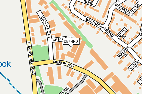
DE7 4RD is located in the Hallam Fields electoral ward, within the local authority district of Erewash and the English Parliamentary constituency of Erewash. The Sub Integrated Care Board (ICB) Location is NHS Derby and Derbyshire ICB - 15M and the police force is Derbyshire. This postcode has been in use since March 1988.


GetTheData
Source: OS OpenMap – Local (Ordnance Survey)
Source: OS VectorMap District (Ordnance Survey)
Licence: Open Government Licence (requires attribution)
| Easting | 446821 |
| Northing | 339930 |
| Latitude | 52.954729 |
| Longitude | -1.304517 |
GetTheData
Source: Open Postcode Geo
Licence: Open Government Licence
| Country | England |
| Postcode District | DE7 |
| ➜ DE7 open data dashboard ➜ See where DE7 is on a map ➜ Where is Ilkeston? | |
GetTheData
Source: Land Registry Price Paid Data
Licence: Open Government Licence
Elevation or altitude of DE7 4RD as distance above sea level:
| Metres | Feet | |
|---|---|---|
| Elevation | 50m | 164ft |
Elevation is measured from the approximate centre of the postcode, to the nearest point on an OS contour line from OS Terrain 50, which has contour spacing of ten vertical metres.
➜ How high above sea level am I? Find the elevation of your current position using your device's GPS.
GetTheData
Source: Open Postcode Elevation
Licence: Open Government Licence
| Ward | Hallam Fields |
| Constituency | Erewash |
GetTheData
Source: ONS Postcode Database
Licence: Open Government Licence
| January 2024 | Violence and sexual offences | On or near Bestwick Close | 335m |
| January 2024 | Violence and sexual offences | On or near Bestwick Close | 335m |
| January 2024 | Vehicle crime | On or near Hexham Avenue | 442m |
| ➜ Get more crime data in our Crime section | |||
GetTheData
Source: data.police.uk
Licence: Open Government Licence
| Industrial Estate (Quarry Hill Road) | Ilkeston | 193m |
| Industrial Estate (Quarry Hill Road) | Ilkeston | 201m |
| Hedges Drive (Longfield Lane) | Hallam Fields | 299m |
| Garden Avenue (Longfield Lane) | Hallam Fields | 306m |
| Hedges Drive (Longfield Lane) | Hallam Fields | 308m |
| Ilkeston Station | 2.8km |
GetTheData
Source: NaPTAN
Licence: Open Government Licence
GetTheData
Source: ONS Postcode Database
Licence: Open Government Licence


➜ Get more ratings from the Food Standards Agency
GetTheData
Source: Food Standards Agency
Licence: FSA terms & conditions
| Last Collection | |||
|---|---|---|---|
| Location | Mon-Fri | Sat | Distance |
| Quarry Hill Ind Est | 17:30 | 08:00 | 161m |
| Merlin Way Business Box | 18:30 | 164m | |
| Queens Avenue | 17:30 | 07:15 | 480m |
GetTheData
Source: Dracos
Licence: Creative Commons Attribution-ShareAlike
| Facility | Distance |
|---|---|
| Hallam Fields Junior School Longfield Lane, Ilkeston Grass Pitches | 339m |
| The Stute Hallam Fields Road, Ilkeston Grass Pitches, Outdoor Tennis Courts | 683m |
| Kirk Hallam Playing Fields Windsor Crescent, Ilkeston Grass Pitches | 766m |
GetTheData
Source: Active Places
Licence: Open Government Licence
| School | Phase of Education | Distance |
|---|---|---|
| Hallam Fields Junior School Longfield Lane, Ilkeston, DE7 4DB | Primary | 339m |
| Field House Infant School Lower Whitworth Road, Ilkeston, DE7 4LT | Primary | 923m |
| R.E.A.L Independent Schools Ilkeston Gallows Inn Playing Fields, Nottingham Road, Ilkeston, Derbyshire, DE7 5BB | Not applicable | 924m |
GetTheData
Source: Edubase
Licence: Open Government Licence
The below table lists the International Territorial Level (ITL) codes (formerly Nomenclature of Territorial Units for Statistics (NUTS) codes) and Local Administrative Units (LAU) codes for DE7 4RD:
| ITL 1 Code | Name |
|---|---|
| TLF | East Midlands (England) |
| ITL 2 Code | Name |
| TLF1 | Derbyshire and Nottinghamshire |
| ITL 3 Code | Name |
| TLF13 | South and West Derbyshire |
| LAU 1 Code | Name |
| E07000036 | Erewash |
GetTheData
Source: ONS Postcode Directory
Licence: Open Government Licence
The below table lists the Census Output Area (OA), Lower Layer Super Output Area (LSOA), and Middle Layer Super Output Area (MSOA) for DE7 4RD:
| Code | Name | |
|---|---|---|
| OA | E00099459 | |
| LSOA | E01019659 | Erewash 006B |
| MSOA | E02004083 | Erewash 006 |
GetTheData
Source: ONS Postcode Directory
Licence: Open Government Licence
| DE7 4RB | Eagle Road | 101m |
| DE7 4PX | Malthouse Road | 106m |
| DE7 4PA | Malthouse Road | 157m |
| DE7 4PU | Hedges Drive | 159m |
| DE7 4PY | Butts Close | 221m |
| DE7 4PZ | Walker Close | 235m |
| DE7 4PW | Sparrow Close | 258m |
| DE7 4RN | Threeleys Close | 260m |
| DE7 4PB | Slade Close | 267m |
| DE7 4QY | Harrow Drive | 286m |
GetTheData
Source: Open Postcode Geo; Land Registry Price Paid Data
Licence: Open Government Licence