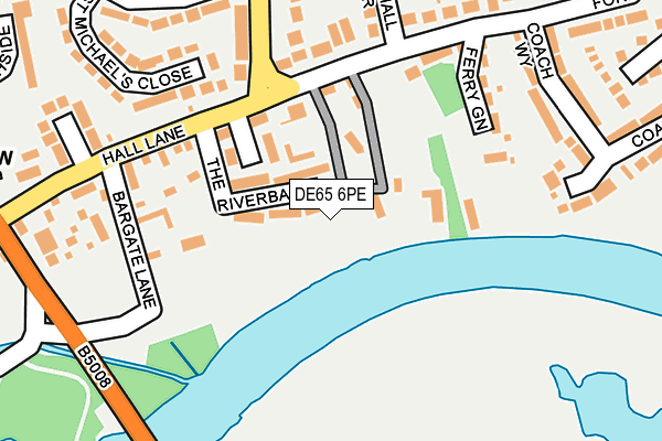
DE65 6PE is located in the Etwall electoral ward, within the local authority district of South Derbyshire and the English Parliamentary constituency of South Derbyshire. The Sub Integrated Care Board (ICB) Location is NHS Derby and Derbyshire ICB - 15M and the police force is Derbyshire. This postcode has been in use since August 2016.


GetTheData
Source: OS OpenMap – Local (Ordnance Survey)
Source: OS VectorMap District (Ordnance Survey)
Licence: Open Government Licence (requires attribution)
| Easting | 428051 |
| Northing | 328646 |
| Latitude | 52.854601 |
| Longitude | -1.584866 |
GetTheData
Source: Open Postcode Geo
Licence: Open Government Licence
| Country | England |
| Postcode District | DE65 |
| ➜ DE65 open data dashboard ➜ See where DE65 is on a map | |
GetTheData
Source: Land Registry Price Paid Data
Licence: Open Government Licence
Elevation or altitude of DE65 6PE as distance above sea level:
| Metres | Feet | |
|---|---|---|
| Elevation | 40m | 131ft |
Elevation is measured from the approximate centre of the postcode, to the nearest point on an OS contour line from OS Terrain 50, which has contour spacing of ten vertical metres.
➜ How high above sea level am I? Find the elevation of your current position using your device's GPS.
GetTheData
Source: Open Postcode Elevation
Licence: Open Government Licence
| Ward | Etwall |
| Constituency | South Derbyshire |
GetTheData
Source: ONS Postcode Database
Licence: Open Government Licence
| January 2024 | Vehicle crime | On or near Petrol Station | 181m |
| December 2023 | Drugs | On or near Petrol Station | 181m |
| December 2023 | Anti-social behaviour | On or near Petrol Station | 181m |
| ➜ Get more crime data in our Crime section | |||
GetTheData
Source: data.police.uk
Licence: Open Government Licence
| Main Street (Ash Grove Lane) | Egginton | 1,071m |
| William Newton Close (Main Street) | Egginton | 1,209m |
| Church Road End (Church Road) | Egginton | 1,225m |
| Main Street | Egginton | 1,317m |
| The Green (Canal Bridge) | Willington | 1,353m |
| Willington Station | 1.5km |
GetTheData
Source: NaPTAN
Licence: Open Government Licence
GetTheData
Source: ONS Postcode Database
Licence: Open Government Licence


➜ Get more ratings from the Food Standards Agency
GetTheData
Source: Food Standards Agency
Licence: FSA terms & conditions
| Last Collection | |||
|---|---|---|---|
| Location | Mon-Fri | Sat | Distance |
| Castleway Road | 17:00 | 10:30 | 323m |
| Duck Street | 17:00 | 10:30 | 1,311m |
| Willington Post Office | 17:15 | 10:30 | 1,317m |
GetTheData
Source: Dracos
Licence: Creative Commons Attribution-ShareAlike
| Facility | Distance |
|---|---|
| The Catherine Johnathon Recreation Ground (Closed) Church Road, Egginton, Derby Grass Pitches | 1.6km |
| Twyford Road Playing Field Orchard Close, Willington, Derby Grass Pitches | 1.7km |
| Willington Primary School Trent Avenue, Willington, Derby Grass Pitches | 1.9km |
GetTheData
Source: Active Places
Licence: Open Government Licence
| School | Phase of Education | Distance |
|---|---|---|
| Egginton Primary School Church Road, Egginton, Derby, DE65 6HP | Primary | 1.4km |
| Longdon Park School Park Hill, Hilton Road, Egginton, Derbyshire, DE65 6GU | Not applicable | 1.7km |
| Willington Primary School Trent Avenue, Willington, Derby, DE65 6DN | Primary | 1.9km |
GetTheData
Source: Edubase
Licence: Open Government Licence
The below table lists the International Territorial Level (ITL) codes (formerly Nomenclature of Territorial Units for Statistics (NUTS) codes) and Local Administrative Units (LAU) codes for DE65 6PE:
| ITL 1 Code | Name |
|---|---|
| TLF | East Midlands (England) |
| ITL 2 Code | Name |
| TLF1 | Derbyshire and Nottinghamshire |
| ITL 3 Code | Name |
| TLF13 | South and West Derbyshire |
| LAU 1 Code | Name |
| E07000039 | South Derbyshire |
GetTheData
Source: ONS Postcode Directory
Licence: Open Government Licence
The below table lists the Census Output Area (OA), Lower Layer Super Output Area (LSOA), and Middle Layer Super Output Area (MSOA) for DE65 6PE:
| Code | Name | |
|---|---|---|
| OA | E00100398 | |
| LSOA | E01019841 | South Derbyshire 002B |
| MSOA | E02004119 | South Derbyshire 002 |
GetTheData
Source: ONS Postcode Directory
Licence: Open Government Licence
| DE65 6GY | Derby Road | 269m |
| DE65 6BW | Castle Way | 299m |
| DE65 6GZ | Burton Road | 810m |
| DE65 6BU | Castle Way | 824m |
| DE65 6GX | South Boundary Cottage | 1013m |
| DE65 6HN | William Newton Close | 1137m |
| DE65 6BS | Ivy Close | 1174m |
| DE65 6ET | Waterside | 1200m |
| DE65 6BT | Castle Way | 1225m |
| DE65 6QU | Avocet Drive | 1243m |
GetTheData
Source: Open Postcode Geo; Land Registry Price Paid Data
Licence: Open Government Licence