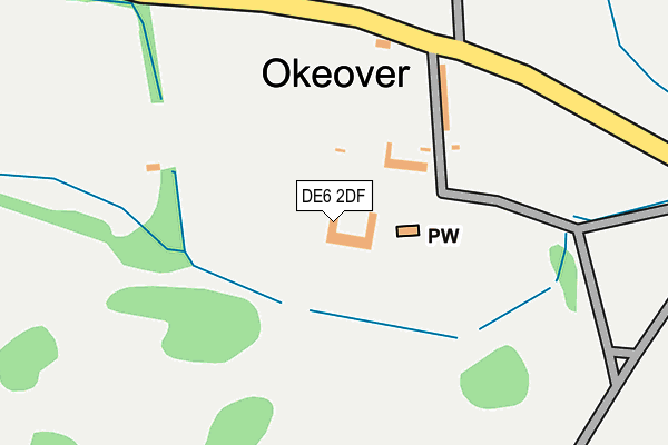
DE6 2DF is located in the Stramshall & Weaver electoral ward, within the local authority district of East Staffordshire and the English Parliamentary constituency of Burton. The Sub Integrated Care Board (ICB) Location is NHS Staffordshire and Stoke-on-Trent ICB - 05D and the police force is Staffordshire. This postcode has been in use since March 2015.


GetTheData
Source: OS OpenMap – Local (Ordnance Survey)
Source: OS VectorMap District (Ordnance Survey)
Licence: Open Government Licence (requires attribution)
| Easting | 412286 |
| Northing | 347164 |
| Latitude | 53.021650 |
| Longitude | -1.818288 |
GetTheData
Source: Open Postcode Geo
Licence: Open Government Licence
| Country | England |
| Postcode District | DE6 |
| ➜ DE6 open data dashboard ➜ See where DE6 is on a map | |
GetTheData
Source: Land Registry Price Paid Data
Licence: Open Government Licence
Elevation or altitude of DE6 2DF as distance above sea level:
| Metres | Feet | |
|---|---|---|
| Elevation | 130m | 427ft |
Elevation is measured from the approximate centre of the postcode, to the nearest point on an OS contour line from OS Terrain 50, which has contour spacing of ten vertical metres.
➜ How high above sea level am I? Find the elevation of your current position using your device's GPS.
GetTheData
Source: Open Postcode Elevation
Licence: Open Government Licence
| Ward | Stramshall & Weaver |
| Constituency | Burton |
GetTheData
Source: ONS Postcode Database
Licence: Open Government Licence
| April 2022 | Burglary | On or near Bullgap Lane | 285m |
| February 2021 | Criminal damage and arson | On or near Bullgap Lane | 285m |
| ➜ Get more crime data in our Crime section | |||
GetTheData
Source: data.police.uk
Licence: Open Government Licence
| Town End Lane (Swinscoe Hill) | Swinscoe | 1,515m |
| Town End Lane (Swinscoe Hill) | Swinscoe | 1,532m |
GetTheData
Source: NaPTAN
Licence: Open Government Licence
GetTheData
Source: ONS Postcode Database
Licence: Open Government Licence

➜ Get more ratings from the Food Standards Agency
GetTheData
Source: Food Standards Agency
Licence: FSA terms & conditions
| Last Collection | |||
|---|---|---|---|
| Location | Mon-Fri | Sat | Distance |
| Old Stanton Post Office | 16:30 | 10:45 | 1,222m |
| Stanton Dale | 16:30 | 09:00 | 1,418m |
| Old Swinscoe Post Office | 16:30 | 08:30 | 1,482m |
GetTheData
Source: Dracos
Licence: Creative Commons Attribution-ShareAlike
| Facility | Distance |
|---|---|
| Mayfield Playing Field Weirside, Mayfield, Ashbourne Grass Pitches | 4.1km |
| Mappleton Village Social Club Mapleton Road, Mapleton Grass Pitches | 4.2km |
| Clifton Cricket Club Chapel Lane, Clifton Grass Pitches | 5.1km |
GetTheData
Source: Active Places
Licence: Open Government Licence
| School | Phase of Education | Distance |
|---|---|---|
| Ilam CofE (VA) Primary School Ilam, Ashbourne, DE6 2AZ | Primary | 4km |
| Clifton CofE Primary School Cross Side, Clifton Village, Ashbourne, DE6 2GJ | Primary | 5km |
| Waterhouses CofE Primary Academy Waterfall Lane, Waterhouses, Stoke-on-Trent, ST10 3HY | Primary | 5.8km |
GetTheData
Source: Edubase
Licence: Open Government Licence
The below table lists the International Territorial Level (ITL) codes (formerly Nomenclature of Territorial Units for Statistics (NUTS) codes) and Local Administrative Units (LAU) codes for DE6 2DF:
| ITL 1 Code | Name |
|---|---|
| TLG | West Midlands (England) |
| ITL 2 Code | Name |
| TLG2 | Shropshire and Staffordshire |
| ITL 3 Code | Name |
| TLG24 | Staffordshire CC |
| LAU 1 Code | Name |
| E07000193 | East Staffordshire |
GetTheData
Source: ONS Postcode Directory
Licence: Open Government Licence
The below table lists the Census Output Area (OA), Lower Layer Super Output Area (LSOA), and Middle Layer Super Output Area (MSOA) for DE6 2DF:
| Code | Name | |
|---|---|---|
| OA | E00150137 | |
| LSOA | E01029467 | East Staffordshire 001E |
| MSOA | E02006131 | East Staffordshire 001 |
GetTheData
Source: ONS Postcode Directory
Licence: Open Government Licence
| DE6 2BY | 412m | |
| DE6 2BZ | 1006m | |
| DE6 2DA | 1224m | |
| DE6 2BW | 1353m | |
| DE6 2HS | Town End Lane | 1475m |
| DE6 2DB | Field Lane | 1615m |
| DE6 2DD | 1629m | |
| DE6 2BU | 1659m | |
| DE6 2BX | Stanton Dale | 1732m |
| DE6 2GW | Wootton | 2620m |
GetTheData
Source: Open Postcode Geo; Land Registry Price Paid Data
Licence: Open Government Licence