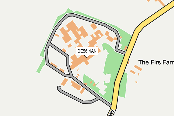
DE56 4AN is located in the Alport & South West Parishes electoral ward, within the local authority district of Amber Valley and the English Parliamentary constituency of Derbyshire Dales. The Sub Integrated Care Board (ICB) Location is NHS Derby and Derbyshire ICB - 15M and the police force is Derbyshire. This postcode has been in use since August 1992.


GetTheData
Source: OS OpenMap – Local (Ordnance Survey)
Source: OS VectorMap District (Ordnance Survey)
Licence: Open Government Licence (requires attribution)
| Easting | 432072 |
| Northing | 345602 |
| Latitude | 53.006776 |
| Longitude | -1.523488 |
GetTheData
Source: Open Postcode Geo
Licence: Open Government Licence
| Country | England |
| Postcode District | DE56 |
| ➜ DE56 open data dashboard ➜ See where DE56 is on a map | |
GetTheData
Source: Land Registry Price Paid Data
Licence: Open Government Licence
Elevation or altitude of DE56 4AN as distance above sea level:
| Metres | Feet | |
|---|---|---|
| Elevation | 110m | 361ft |
Elevation is measured from the approximate centre of the postcode, to the nearest point on an OS contour line from OS Terrain 50, which has contour spacing of ten vertical metres.
➜ How high above sea level am I? Find the elevation of your current position using your device's GPS.
GetTheData
Source: Open Postcode Elevation
Licence: Open Government Licence
| Ward | Alport & South West Parishes |
| Constituency | Derbyshire Dales |
GetTheData
Source: ONS Postcode Database
Licence: Open Government Licence
| December 2021 | Violence and sexual offences | On or near Nether Lane | 286m |
| ➜ Get more crime data in our Crime section | |||
GetTheData
Source: data.police.uk
Licence: Open Government Licence
| Wirksworth Road (B5023 Wirksworth Road) | Windley | 845m |
| Wirksworth Road (B5023 Wirksworth Road) | Windley | 850m |
| Church (Over Lane) | Hazelwood | 918m |
| Church (Over Lane) | Hazelwood | 926m |
| Overlane Farm (Over Lane) | Hazelwood | 976m |
| Duffield Station | 3.2km |
| Belper Station | 3.3km |
GetTheData
Source: NaPTAN
Licence: Open Government Licence
GetTheData
Source: ONS Postcode Database
Licence: Open Government Licence


➜ Get more ratings from the Food Standards Agency
GetTheData
Source: Food Standards Agency
Licence: FSA terms & conditions
| Last Collection | |||
|---|---|---|---|
| Location | Mon-Fri | Sat | Distance |
| Nether Lane | 17:00 | 08:45 | 517m |
| Hazelwood | 17:00 | 08:30 | 937m |
| Hazelwood | 17:00 | 07:00 | 987m |
GetTheData
Source: Dracos
Licence: Creative Commons Attribution-ShareAlike
| Facility | Distance |
|---|---|
| Chevin Golf Club Golf Lane, Duffield, Belper Golf | 2.6km |
| Herbert Strutt Playing Fields Derby Road, Derby Road, Belper Grass Pitches | 2.7km |
| Ecclesbourne School Grass Pitches Park Road, Duffield, Belper Grass Pitches | 2.7km |
GetTheData
Source: Active Places
Licence: Open Government Licence
| School | Phase of Education | Distance |
|---|---|---|
| Turnditch Church of England Primary School Ashbourne Road, Turnditch, Belper, DE56 2LH | Primary | 2.7km |
| William Gilbert Endowed Church of England Primary School Vicarage Lane, Duffield, Belper, DE56 4EB | Primary | 2.8km |
| Milford Primary School Chevin Road, Milford, Belper, DE56 0QH | Primary | 3km |
GetTheData
Source: Edubase
Licence: Open Government Licence
The below table lists the International Territorial Level (ITL) codes (formerly Nomenclature of Territorial Units for Statistics (NUTS) codes) and Local Administrative Units (LAU) codes for DE56 4AN:
| ITL 1 Code | Name |
|---|---|
| TLF | East Midlands (England) |
| ITL 2 Code | Name |
| TLF1 | Derbyshire and Nottinghamshire |
| ITL 3 Code | Name |
| TLF13 | South and West Derbyshire |
| LAU 1 Code | Name |
| E07000032 | Amber Valley |
GetTheData
Source: ONS Postcode Directory
Licence: Open Government Licence
The below table lists the Census Output Area (OA), Lower Layer Super Output Area (LSOA), and Middle Layer Super Output Area (MSOA) for DE56 4AN:
| Code | Name | |
|---|---|---|
| OA | E00098145 | |
| LSOA | E01019405 | Amber Valley 007A |
| MSOA | E02004035 | Amber Valley 007 |
GetTheData
Source: ONS Postcode Directory
Licence: Open Government Licence
| DE56 4AP | Nether Lane | 499m |
| DE56 4AL | Hob Hill | 669m |
| DE56 4AG | Over Lane | 948m |
| DE56 4AD | Hazelwood Hill | 983m |
| DE56 4AW | Spring Hollow | 1376m |
| DE56 2LP | 1476m | |
| DE56 4AF | Goodwins Lane | 1480m |
| DE56 4AE | Firestone | 1503m |
| DE56 2LB | The Drive | 1576m |
| DE56 2LX | 1637m |
GetTheData
Source: Open Postcode Geo; Land Registry Price Paid Data
Licence: Open Government Licence