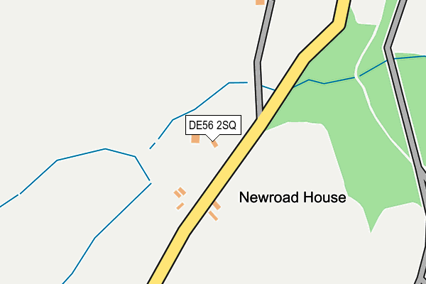
DE56 2SQ lies on New Road in Alderwasley, Belper. DE56 2SQ is located in the Alport & South West Parishes electoral ward, within the local authority district of Amber Valley and the English Parliamentary constituency of Derbyshire Dales. The Sub Integrated Care Board (ICB) Location is NHS Derby and Derbyshire ICB - 15M and the police force is Derbyshire. This postcode has been in use since August 1992.


GetTheData
Source: OS OpenMap – Local (Ordnance Survey)
Source: OS VectorMap District (Ordnance Survey)
Licence: Open Government Licence (requires attribution)
| Easting | 432758 |
| Northing | 353903 |
| Latitude | 53.081369 |
| Longitude | -1.512421 |
GetTheData
Source: Open Postcode Geo
Licence: Open Government Licence
| Street | New Road |
| Locality | Alderwasley |
| Town/City | Belper |
| Country | England |
| Postcode District | DE56 |
| ➜ DE56 open data dashboard ➜ See where DE56 is on a map | |
GetTheData
Source: Land Registry Price Paid Data
Licence: Open Government Licence
Elevation or altitude of DE56 2SQ as distance above sea level:
| Metres | Feet | |
|---|---|---|
| Elevation | 140m | 459ft |
Elevation is measured from the approximate centre of the postcode, to the nearest point on an OS contour line from OS Terrain 50, which has contour spacing of ten vertical metres.
➜ How high above sea level am I? Find the elevation of your current position using your device's GPS.
GetTheData
Source: Open Postcode Elevation
Licence: Open Government Licence
| Ward | Alport & South West Parishes |
| Constituency | Derbyshire Dales |
GetTheData
Source: ONS Postcode Database
Licence: Open Government Licence
| Railway Station (A6) | Whatstandwell | 551m |
| Railway Station (A6) | Whatstandwell | 559m |
| Derwent Bridge (A6) | Whatstandwell | 573m |
| Derwent Bridge (A6) | Whatstandwell | 613m |
| Crich Carr Primary School (Main Road) | Whatstandwell | 664m |
| Whatstandwell Station | 0.6km |
| Ambergate Station | 3.1km |
| Cromford Station | 4.3km |
GetTheData
Source: NaPTAN
Licence: Open Government Licence
| Percentage of properties with Next Generation Access | 90.0% |
| Percentage of properties with Superfast Broadband | 90.0% |
| Percentage of properties with Ultrafast Broadband | 20.0% |
| Percentage of properties with Full Fibre Broadband | 20.0% |
Superfast Broadband is between 30Mbps and 300Mbps
Ultrafast Broadband is > 300Mbps
| Percentage of properties unable to receive 2Mbps | 0.0% |
| Percentage of properties unable to receive 5Mbps | 0.0% |
| Percentage of properties unable to receive 10Mbps | 0.0% |
| Percentage of properties unable to receive 30Mbps | 10.0% |
GetTheData
Source: Ofcom
Licence: Ofcom Terms of Use (requires attribution)
Estimated total energy consumption in DE56 2SQ by fuel type, 2015.
| Consumption (kWh) | 67,236 |
|---|---|
| Meter count | 8 |
| Mean (kWh/meter) | 8,404 |
| Median (kWh/meter) | 6,245 |
GetTheData
Source: Postcode level gas estimates: 2015 (experimental)
Source: Postcode level electricity estimates: 2015 (experimental)
Licence: Open Government Licence
GetTheData
Source: ONS Postcode Database
Licence: Open Government Licence


➜ Get more ratings from the Food Standards Agency
GetTheData
Source: Food Standards Agency
Licence: FSA terms & conditions
| Last Collection | |||
|---|---|---|---|
| Location | Mon-Fri | Sat | Distance |
| Whatstandwell Bridge | 16:30 | 10:00 | 622m |
| Whatstandwell Village | 16:30 | 10:00 | 687m |
| Crich Carr | 16:30 | 07:45 | 1,168m |
GetTheData
Source: Dracos
Licence: Creative Commons Attribution-ShareAlike
| Facility | Distance |
|---|---|
| Crich Junior School School Lane, Crich, Matlock Grass Pitches | 2.4km |
| The Packhorse Ground Sandyford Lane, Alderwashley, Belper Grass Pitches | 2.4km |
| Ambergate Sports & Social Club (Closed) Matlock Road (A6), Ambergate Grass Pitches | 2.8km |
GetTheData
Source: Active Places
Licence: Open Government Licence
| School | Phase of Education | Distance |
|---|---|---|
| Alderwasley Hall School Higg Lane, Alderwasley, Belper, Derbyshire, DE56 2SR | Not applicable | 605m |
| Crich Carr CofE Primary School Main Road, Whatstandwell, Matlock, DE4 5EF | Primary | 745m |
| Crich Church of England Infant School Bowns Hill, Crich, Matlock, DE4 5DG | Primary | 2.3km |
GetTheData
Source: Edubase
Licence: Open Government Licence
The below table lists the International Territorial Level (ITL) codes (formerly Nomenclature of Territorial Units for Statistics (NUTS) codes) and Local Administrative Units (LAU) codes for DE56 2SQ:
| ITL 1 Code | Name |
|---|---|
| TLF | East Midlands (England) |
| ITL 2 Code | Name |
| TLF1 | Derbyshire and Nottinghamshire |
| ITL 3 Code | Name |
| TLF13 | South and West Derbyshire |
| LAU 1 Code | Name |
| E07000032 | Amber Valley |
GetTheData
Source: ONS Postcode Directory
Licence: Open Government Licence
The below table lists the Census Output Area (OA), Lower Layer Super Output Area (LSOA), and Middle Layer Super Output Area (MSOA) for DE56 2SQ:
| Code | Name | |
|---|---|---|
| OA | E00098139 | |
| LSOA | E01019405 | Amber Valley 007A |
| MSOA | E02004035 | Amber Valley 007 |
GetTheData
Source: ONS Postcode Directory
Licence: Open Government Licence
| DE4 5EE | Main Road | 689m |
| DE4 5HE | Main Road | 760m |
| DE56 2RB | 801m | |
| DE4 5HG | Derby Road | 843m |
| DE4 5EG | Middle Lane | 948m |
| DE4 5EF | Hindersitch Lane | 973m |
| DE4 5HS | Wirksworth Road | 1019m |
| DE4 5NN | Derwent Terrace | 1045m |
| DE4 5JZ | The Glade | 1075m |
| DE4 5EH | Glen Road | 1084m |
GetTheData
Source: Open Postcode Geo; Land Registry Price Paid Data
Licence: Open Government Licence