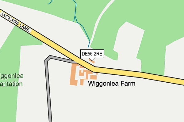
DE56 2RE is located in the Alport & South West Parishes electoral ward, within the local authority district of Amber Valley and the English Parliamentary constituency of Derbyshire Dales. The Sub Integrated Care Board (ICB) Location is NHS Derby and Derbyshire ICB - 15M and the police force is Derbyshire. This postcode has been in use since August 1992.


GetTheData
Source: OS OpenMap – Local (Ordnance Survey)
Source: OS VectorMap District (Ordnance Survey)
Licence: Open Government Licence (requires attribution)
| Easting | 433283 |
| Northing | 351639 |
| Latitude | 53.060987 |
| Longitude | -1.504818 |
GetTheData
Source: Open Postcode Geo
Licence: Open Government Licence
| Country | England |
| Postcode District | DE56 |
| ➜ DE56 open data dashboard ➜ See where DE56 is on a map | |
GetTheData
Source: Land Registry Price Paid Data
Licence: Open Government Licence
Elevation or altitude of DE56 2RE as distance above sea level:
| Metres | Feet | |
|---|---|---|
| Elevation | 180m | 591ft |
Elevation is measured from the approximate centre of the postcode, to the nearest point on an OS contour line from OS Terrain 50, which has contour spacing of ten vertical metres.
➜ How high above sea level am I? Find the elevation of your current position using your device's GPS.
GetTheData
Source: Open Postcode Elevation
Licence: Open Government Licence
| Ward | Alport & South West Parishes |
| Constituency | Derbyshire Dales |
GetTheData
Source: ONS Postcode Database
Licence: Open Government Licence
| Oak Hurst (Matlock Road) | Ambergate | 1,159m |
| Oak Hurst (Matlock Road) | Ambergate | 1,165m |
| Chase Road (Matlock Road) | Ambergate | 1,429m |
| Chase Road (Matlock Road) | Ambergate | 1,453m |
| Ambergate Station | 1.6km |
| Whatstandwell Station | 2.5km |
| Belper Station | 4.4km |
GetTheData
Source: NaPTAN
Licence: Open Government Licence
| Percentage of properties with Next Generation Access | 100.0% |
| Percentage of properties with Superfast Broadband | 0.0% |
| Percentage of properties with Ultrafast Broadband | 0.0% |
| Percentage of properties with Full Fibre Broadband | 0.0% |
Superfast Broadband is between 30Mbps and 300Mbps
Ultrafast Broadband is > 300Mbps
| Percentage of properties unable to receive 2Mbps | 0.0% |
| Percentage of properties unable to receive 5Mbps | 0.0% |
| Percentage of properties unable to receive 10Mbps | 50.0% |
| Percentage of properties unable to receive 30Mbps | 100.0% |
GetTheData
Source: Ofcom
Licence: Ofcom Terms of Use (requires attribution)
GetTheData
Source: ONS Postcode Database
Licence: Open Government Licence


➜ Get more ratings from the Food Standards Agency
GetTheData
Source: Food Standards Agency
Licence: FSA terms & conditions
| Last Collection | |||
|---|---|---|---|
| Location | Mon-Fri | Sat | Distance |
| Ambergate Post Office | 17:00 | 09:30 | 1,522m |
| 7 St James Court | 17:30 | 08:00 | 1,610m |
| Toadmoor | 17:00 | 07:45 | 1,682m |
GetTheData
Source: Dracos
Licence: Creative Commons Attribution-ShareAlike
| Facility | Distance |
|---|---|
| The Packhorse Ground Sandyford Lane, Alderwashley, Belper Grass Pitches | 1.2km |
| Ambergate Sports & Social Club (Closed) Matlock Road (A6), Ambergate Grass Pitches | 1.3km |
| Fritchley C Of E Aided Primary School Church Street, Fritchley, Belper Grass Pitches | 2.7km |
GetTheData
Source: Active Places
Licence: Open Government Licence
| School | Phase of Education | Distance |
|---|---|---|
| Ambergate Primary School Toadmoor Lane, Ambergate, Belper, DE56 2GN | Primary | 1.7km |
| Alderwasley Hall School Higg Lane, Alderwasley, Belper, Derbyshire, DE56 2SR | Not applicable | 1.8km |
| Crich Carr CofE Primary School Main Road, Whatstandwell, Matlock, DE4 5EF | Primary | 2.6km |
GetTheData
Source: Edubase
Licence: Open Government Licence
The below table lists the International Territorial Level (ITL) codes (formerly Nomenclature of Territorial Units for Statistics (NUTS) codes) and Local Administrative Units (LAU) codes for DE56 2RE:
| ITL 1 Code | Name |
|---|---|
| TLF | East Midlands (England) |
| ITL 2 Code | Name |
| TLF1 | Derbyshire and Nottinghamshire |
| ITL 3 Code | Name |
| TLF13 | South and West Derbyshire |
| LAU 1 Code | Name |
| E07000032 | Amber Valley |
GetTheData
Source: ONS Postcode Directory
Licence: Open Government Licence
The below table lists the Census Output Area (OA), Lower Layer Super Output Area (LSOA), and Middle Layer Super Output Area (MSOA) for DE56 2RE:
| Code | Name | |
|---|---|---|
| OA | E00098139 | |
| LSOA | E01019405 | Amber Valley 007A |
| MSOA | E02004035 | Amber Valley 007 |
GetTheData
Source: ONS Postcode Directory
Licence: Open Government Licence
| DE56 2HF | Beggarswell Wood | 903m |
| DE56 2HD | Matlock Road | 1152m |
| DE56 2DP | Ashbourne Road | 1163m |
| DE56 2DN | Whitewells Lane | 1293m |
| DE56 2HB | Canal Side | 1359m |
| DE56 2EL | Matlock Road | 1483m |
| DE56 2GX | Riverside Court | 1490m |
| DE56 2EJ | Derby Road | 1516m |
| DE56 2GQ | Longlands Villas | 1602m |
| DE56 2HA | Chase Road | 1617m |
GetTheData
Source: Open Postcode Geo; Land Registry Price Paid Data
Licence: Open Government Licence