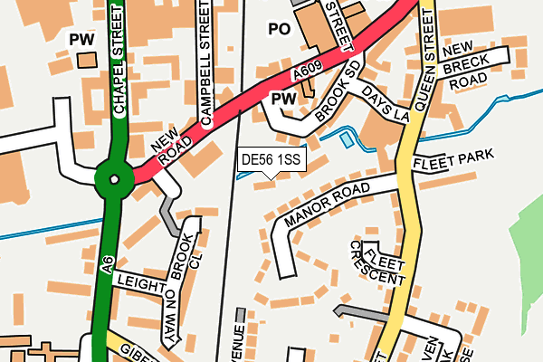
DE56 1SS is located in the Belper South electoral ward, within the local authority district of Amber Valley and the English Parliamentary constituency of Mid Derbyshire. The Sub Integrated Care Board (ICB) Location is NHS Derby and Derbyshire ICB - 15M and the police force is Derbyshire. This postcode has been in use since August 1992.


GetTheData
Source: OS OpenMap – Local (Ordnance Survey)
Source: OS VectorMap District (Ordnance Survey)
Licence: Open Government Licence (requires attribution)
| Easting | 434845 |
| Northing | 347191 |
| Latitude | 53.020887 |
| Longitude | -1.481993 |
GetTheData
Source: Open Postcode Geo
Licence: Open Government Licence
| Country | England |
| Postcode District | DE56 |
| ➜ DE56 open data dashboard ➜ See where DE56 is on a map ➜ Where is Belper? | |
GetTheData
Source: Land Registry Price Paid Data
Licence: Open Government Licence
Elevation or altitude of DE56 1SS as distance above sea level:
| Metres | Feet | |
|---|---|---|
| Elevation | 70m | 230ft |
Elevation is measured from the approximate centre of the postcode, to the nearest point on an OS contour line from OS Terrain 50, which has contour spacing of ten vertical metres.
➜ How high above sea level am I? Find the elevation of your current position using your device's GPS.
GetTheData
Source: Open Postcode Elevation
Licence: Open Government Licence
| Ward | Belper South |
| Constituency | Mid Derbyshire |
GetTheData
Source: ONS Postcode Database
Licence: Open Government Licence
| April 2023 | Other theft | On or near Hillside Rise | 452m |
| April 2023 | Anti-social behaviour | On or near Hillside Rise | 452m |
| June 2022 | Public order | On or near New Road | 95m |
| ➜ Get more crime data in our Crime section | |||
GetTheData
Source: data.police.uk
Licence: Open Government Licence
| New Road | Belper | 91m |
| Fleet Park (The Fleet) | Belper | 150m |
| Meadow View (Derby Road) | Belper | 194m |
| Meadow View (Derby Road) | Belper | 199m |
| Bus Garage (Chapel Street) | Belper | 227m |
| Belper Station | 0.3km |
| Duffield Station | 3.6km |
| Ambergate Station | 4.4km |
GetTheData
Source: NaPTAN
Licence: Open Government Licence
| Percentage of properties with Next Generation Access | 100.0% |
| Percentage of properties with Superfast Broadband | 100.0% |
| Percentage of properties with Ultrafast Broadband | 0.0% |
| Percentage of properties with Full Fibre Broadband | 0.0% |
Superfast Broadband is between 30Mbps and 300Mbps
Ultrafast Broadband is > 300Mbps
| Percentage of properties unable to receive 2Mbps | 0.0% |
| Percentage of properties unable to receive 5Mbps | 0.0% |
| Percentage of properties unable to receive 10Mbps | 0.0% |
| Percentage of properties unable to receive 30Mbps | 0.0% |
GetTheData
Source: Ofcom
Licence: Ofcom Terms of Use (requires attribution)
GetTheData
Source: ONS Postcode Database
Licence: Open Government Licence


➜ Get more ratings from the Food Standards Agency
GetTheData
Source: Food Standards Agency
Licence: FSA terms & conditions
| Last Collection | |||
|---|---|---|---|
| Location | Mon-Fri | Sat | Distance |
| Belper Co-op Post Office | 18:30 | 12:00 | 191m |
| King Street | 17:30 | 09:15 | 268m |
| The Orangery | 17:30 | 09:30 | 277m |
GetTheData
Source: Dracos
Licence: Creative Commons Attribution-ShareAlike
| Facility | Distance |
|---|---|
| Herbert Strutt Playing Fields Derby Road, Derby Road, Belper Grass Pitches | 475m |
| Thorntons Playing Fields Derwent Street, Belper Grass Pitches | 482m |
| Manor Rec Park Road, Belper Grass Pitches | 574m |
GetTheData
Source: Active Places
Licence: Open Government Licence
| School | Phase of Education | Distance |
|---|---|---|
| Long Row Primary School Long Row, Belper, DE56 1DR | Primary | 772m |
| Herbert Strutt Primary School Thornhill Avenue, Belper, DE56 1SH | Primary | 1km |
| St Elizabeth's Catholic Voluntary Academy Matlock Road, Belper, DE56 2JD | Primary | 1.1km |
GetTheData
Source: Edubase
Licence: Open Government Licence
The below table lists the International Territorial Level (ITL) codes (formerly Nomenclature of Territorial Units for Statistics (NUTS) codes) and Local Administrative Units (LAU) codes for DE56 1SS:
| ITL 1 Code | Name |
|---|---|
| TLF | East Midlands (England) |
| ITL 2 Code | Name |
| TLF1 | Derbyshire and Nottinghamshire |
| ITL 3 Code | Name |
| TLF13 | South and West Derbyshire |
| LAU 1 Code | Name |
| E07000032 | Amber Valley |
GetTheData
Source: ONS Postcode Directory
Licence: Open Government Licence
The below table lists the Census Output Area (OA), Lower Layer Super Output Area (LSOA), and Middle Layer Super Output Area (MSOA) for DE56 1SS:
| Code | Name | |
|---|---|---|
| OA | E00170715 | |
| LSOA | E01019417 | Amber Valley 010C |
| MSOA | E02004038 | Amber Valley 010 |
GetTheData
Source: ONS Postcode Directory
Licence: Open Government Licence
| DE56 1NT | Manor Road | 66m |
| DE56 1TZ | Kedleston Close | 83m |
| DE56 1UR | Brookside | 89m |
| DE56 1US | New Road | 99m |
| DE56 1SY | Brooke Close | 100m |
| DE56 1NX | Fleet Crescent | 125m |
| DE56 1NP | Days Lane | 135m |
| DE56 1SU | Leighton Way | 171m |
| DE56 1AP | Campbell Street | 182m |
| DE56 1WB | The Avenue | 195m |
GetTheData
Source: Open Postcode Geo; Land Registry Price Paid Data
Licence: Open Government Licence