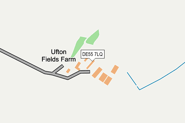
DE55 7LQ lies on Chesterfield Road in Alfreton. DE55 7LQ is located in the Crich & South Wingfield electoral ward, within the local authority district of Amber Valley and the English Parliamentary constituency of Amber Valley. The Sub Integrated Care Board (ICB) Location is NHS Derby and Derbyshire ICB - 15M and the police force is Derbyshire. This postcode has been in use since August 1992.


GetTheData
Source: OS OpenMap – Local (Ordnance Survey)
Source: OS VectorMap District (Ordnance Survey)
Licence: Open Government Licence (requires attribution)
| Easting | 439581 |
| Northing | 356313 |
| Latitude | 53.102553 |
| Longitude | -1.410276 |
GetTheData
Source: Open Postcode Geo
Licence: Open Government Licence
| Street | Chesterfield Road |
| Town/City | Alfreton |
| Country | England |
| Postcode District | DE55 |
| ➜ DE55 open data dashboard ➜ See where DE55 is on a map | |
GetTheData
Source: Land Registry Price Paid Data
Licence: Open Government Licence
Elevation or altitude of DE55 7LQ as distance above sea level:
| Metres | Feet | |
|---|---|---|
| Elevation | 110m | 361ft |
Elevation is measured from the approximate centre of the postcode, to the nearest point on an OS contour line from OS Terrain 50, which has contour spacing of ten vertical metres.
➜ How high above sea level am I? Find the elevation of your current position using your device's GPS.
GetTheData
Source: Open Postcode Elevation
Licence: Open Government Licence
| Ward | Crich & South Wingfield |
| Constituency | Amber Valley |
GetTheData
Source: ONS Postcode Database
Licence: Open Government Licence
| Chesterfield Road | Oakerthorpe | 686m |
| Chesterfield Road | Oakerthorpe | 689m |
| Fourlane Ends (Chesterfield Road) | Oakerthorpe | 785m |
| Fourlane Ends (Wingfield Road) | Oakerthorpe | 793m |
| Fourlane Ends (Chesterfield Road) | Oakerthorpe | 858m |
| Alfreton Station | 2.7km |
| Ambergate Station | 6.6km |
GetTheData
Source: NaPTAN
Licence: Open Government Licence
| Percentage of properties with Next Generation Access | 100.0% |
| Percentage of properties with Superfast Broadband | 20.0% |
| Percentage of properties with Ultrafast Broadband | 0.0% |
| Percentage of properties with Full Fibre Broadband | 0.0% |
Superfast Broadband is between 30Mbps and 300Mbps
Ultrafast Broadband is > 300Mbps
| Percentage of properties unable to receive 2Mbps | 0.0% |
| Percentage of properties unable to receive 5Mbps | 0.0% |
| Percentage of properties unable to receive 10Mbps | 0.0% |
| Percentage of properties unable to receive 30Mbps | 80.0% |
GetTheData
Source: Ofcom
Licence: Ofcom Terms of Use (requires attribution)
GetTheData
Source: ONS Postcode Database
Licence: Open Government Licence


➜ Get more ratings from the Food Standards Agency
GetTheData
Source: Food Standards Agency
Licence: FSA terms & conditions
| Last Collection | |||
|---|---|---|---|
| Location | Mon-Fri | Sat | Distance |
| Four Lane End | 16:30 | 11:00 | 777m |
| Birches Lane | 16:00 | 08:00 | 1,262m |
| Holm Lane | 16:00 | 07:00 | 1,369m |
GetTheData
Source: Dracos
Licence: Creative Commons Attribution-ShareAlike
| Facility | Distance |
|---|---|
| Alfreton Park Alfreton Park, Alfreton Grass Pitches | 1.1km |
| Alfreton Golf Club Wingfield Road, Oakerthorpe, Alfreton Golf | 1.2km |
| Shirland Golf Club Pit Lane, Shirland, Alfreton Golf | 1.3km |
GetTheData
Source: Active Places
Licence: Open Government Licence
| School | Phase of Education | Distance |
|---|---|---|
| Alfreton Park Community Special School Alfreton Park, Wingfield Road, Alfreton, DE55 7AL | Not applicable | 1.3km |
| Watchorn Christian School 2,Derby Road, Alfreton, Derbyshire, DE55 7AQ | Not applicable | 1.6km |
| Copthorne Community Infant School Rodgers Lane, Alfreton, DE55 7FF | Primary | 1.7km |
GetTheData
Source: Edubase
Licence: Open Government Licence
The below table lists the International Territorial Level (ITL) codes (formerly Nomenclature of Territorial Units for Statistics (NUTS) codes) and Local Administrative Units (LAU) codes for DE55 7LQ:
| ITL 1 Code | Name |
|---|---|
| TLF | East Midlands (England) |
| ITL 2 Code | Name |
| TLF1 | Derbyshire and Nottinghamshire |
| ITL 3 Code | Name |
| TLF13 | South and West Derbyshire |
| LAU 1 Code | Name |
| E07000032 | Amber Valley |
GetTheData
Source: ONS Postcode Directory
Licence: Open Government Licence
The below table lists the Census Output Area (OA), Lower Layer Super Output Area (LSOA), and Middle Layer Super Output Area (MSOA) for DE55 7LQ:
| Code | Name | |
|---|---|---|
| OA | E00098503 | |
| LSOA | E01019477 | Amber Valley 002D |
| MSOA | E02004030 | Amber Valley 002 |
GetTheData
Source: ONS Postcode Directory
Licence: Open Government Licence
| DE55 7NF | Linberry Close | 734m |
| DE55 7LN | Chesterfield Road | 741m |
| DE55 7LH | Wingfield Road | 742m |
| DE55 7PF | Melrose Way | 864m |
| DE55 7LL | Furnace | 928m |
| DE55 7NR | Hillside Park | 929m |
| DE55 7NA | Amber Terrace | 1040m |
| DE55 7AP | Wingfield Road | 1053m |
| DE55 6AU | Pit Lane | 1182m |
| DE55 7LJ | Holm Lane | 1230m |
GetTheData
Source: Open Postcode Geo; Land Registry Price Paid Data
Licence: Open Government Licence