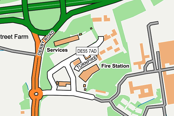
DE55 7AD lies on Turnpike Business Park in Alfreton. DE55 7AD is located in the Swanwick electoral ward, within the local authority district of Amber Valley and the English Parliamentary constituency of Amber Valley. The Sub Integrated Care Board (ICB) Location is NHS Derby and Derbyshire ICB - 15M and the police force is Derbyshire. This postcode has been in use since December 2000.


GetTheData
Source: OS OpenMap – Local (Ordnance Survey)
Source: OS VectorMap District (Ordnance Survey)
Licence: Open Government Licence (requires attribution)
| Easting | 440707 |
| Northing | 354579 |
| Latitude | 53.086882 |
| Longitude | -1.393678 |
GetTheData
Source: Open Postcode Geo
Licence: Open Government Licence
| Street | Turnpike Business Park |
| Town/City | Alfreton |
| Country | England |
| Postcode District | DE55 |
| ➜ DE55 open data dashboard ➜ See where DE55 is on a map ➜ Where is Alfreton? | |
GetTheData
Source: Land Registry Price Paid Data
Licence: Open Government Licence
Elevation or altitude of DE55 7AD as distance above sea level:
| Metres | Feet | |
|---|---|---|
| Elevation | 120m | 394ft |
Elevation is measured from the approximate centre of the postcode, to the nearest point on an OS contour line from OS Terrain 50, which has contour spacing of ten vertical metres.
➜ How high above sea level am I? Find the elevation of your current position using your device's GPS.
GetTheData
Source: Open Postcode Elevation
Licence: Open Government Licence
| Ward | Swanwick |
| Constituency | Amber Valley |
GetTheData
Source: ONS Postcode Database
Licence: Open Government Licence
| June 2022 | Anti-social behaviour | On or near Turnpike Close | 12m |
| June 2022 | Vehicle crime | On or near Turnpike Close | 12m |
| June 2022 | Violence and sexual offences | On or near Turnpike Close | 12m |
| ➜ Get more crime data in our Crime section | |||
GetTheData
Source: data.police.uk
Licence: Open Government Licence
| Old Swanwick Colliery Road (Derby Road) | Alfreton | 167m |
| Old Swanwick Colliery Road (Derby Road) | Alfreton | 246m |
| Derwent Grove (Long Meadow Road) | Alfreton | 429m |
| Derwent Grove (Long Meadow Road) | Alfreton | 438m |
| Derby Road (Long Meadow Road) | Alfreton | 552m |
| Alfreton Station | 2.2km |
GetTheData
Source: NaPTAN
Licence: Open Government Licence
GetTheData
Source: ONS Postcode Database
Licence: Open Government Licence


➜ Get more ratings from the Food Standards Agency
GetTheData
Source: Food Standards Agency
Licence: FSA terms & conditions
| Last Collection | |||
|---|---|---|---|
| Location | Mon-Fri | Sat | Distance |
| King Street | 17:30 | 09:30 | 665m |
| South Wingfield | 17:00 | 09:30 | 701m |
| Grange Street | 17:30 | 09:30 | 1,024m |
GetTheData
Source: Dracos
Licence: Creative Commons Attribution-ShareAlike
| Facility | Distance |
|---|---|
| Ewart Watchorn Recreational Ground Watchorn Lawns, Alfreton Grass Pitches | 326m |
| The New Watchorn Tennis Centre (Closed) Ewart Lane, Alfreton Indoor Tennis Centre | 384m |
| Sleetmoor United Fc Sleetmoor Lane, Swanwick, Alfreton Grass Pitches, Artificial Grass Pitch | 823m |
GetTheData
Source: Active Places
Licence: Open Government Licence
| School | Phase of Education | Distance |
|---|---|---|
| Watchorn Christian School 2,Derby Road, Alfreton, Derbyshire, DE55 7AQ | Not applicable | 604m |
| Alfreton Nursery School Stanton Close, Alfreton, DE55 7SH | Nursery | 825m |
| Alfreton Park Community Special School Alfreton Park, Wingfield Road, Alfreton, DE55 7AL | Not applicable | 904m |
GetTheData
Source: Edubase
Licence: Open Government Licence
The below table lists the International Territorial Level (ITL) codes (formerly Nomenclature of Territorial Units for Statistics (NUTS) codes) and Local Administrative Units (LAU) codes for DE55 7AD:
| ITL 1 Code | Name |
|---|---|
| TLF | East Midlands (England) |
| ITL 2 Code | Name |
| TLF1 | Derbyshire and Nottinghamshire |
| ITL 3 Code | Name |
| TLF13 | South and West Derbyshire |
| LAU 1 Code | Name |
| E07000032 | Amber Valley |
GetTheData
Source: ONS Postcode Directory
Licence: Open Government Licence
The below table lists the Census Output Area (OA), Lower Layer Super Output Area (LSOA), and Middle Layer Super Output Area (MSOA) for DE55 7AD:
| Code | Name | |
|---|---|---|
| OA | E00098495 | |
| LSOA | E01019473 | Amber Valley 004C |
| MSOA | E02004032 | Amber Valley 004 |
GetTheData
Source: ONS Postcode Directory
Licence: Open Government Licence
| DE55 7AT | Watchorn Lane | 343m |
| DE55 7PB | Derwent Grove | 360m |
| DE55 7TL | Watchorn Lawns | 385m |
| DE55 7AU | Ewart Lane | 425m |
| DE55 7PD | Long Meadow Road | 465m |
| DE55 7PA | Amber Grove | 476m |
| DE55 7JH | Trent Grove | 505m |
| DE55 7AQ | Derby Road | 545m |
| DE55 7AX | Watchorn Cottages | 588m |
| DE55 7AY | Nuttall Street | 596m |
GetTheData
Source: Open Postcode Geo; Land Registry Price Paid Data
Licence: Open Government Licence