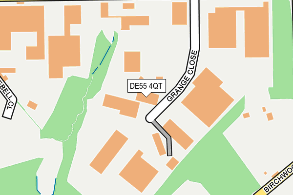
DE55 4QT is located in the Pinxton electoral ward, within the local authority district of Bolsover and the English Parliamentary constituency of Bolsover. The Sub Integrated Care Board (ICB) Location is NHS Derby and Derbyshire ICB - 15M and the police force is Derbyshire. This postcode has been in use since February 1990.


GetTheData
Source: OS OpenMap – Local (Ordnance Survey)
Source: OS VectorMap District (Ordnance Survey)
Licence: Open Government Licence (requires attribution)
| Easting | 443613 |
| Northing | 354851 |
| Latitude | 53.089117 |
| Longitude | -1.350254 |
GetTheData
Source: Open Postcode Geo
Licence: Open Government Licence
| Country | England |
| Postcode District | DE55 |
| ➜ DE55 open data dashboard ➜ See where DE55 is on a map ➜ Where is Somercotes? | |
GetTheData
Source: Land Registry Price Paid Data
Licence: Open Government Licence
Elevation or altitude of DE55 4QT as distance above sea level:
| Metres | Feet | |
|---|---|---|
| Elevation | 120m | 394ft |
Elevation is measured from the approximate centre of the postcode, to the nearest point on an OS contour line from OS Terrain 50, which has contour spacing of ten vertical metres.
➜ How high above sea level am I? Find the elevation of your current position using your device's GPS.
GetTheData
Source: Open Postcode Elevation
Licence: Open Government Licence
| Ward | Pinxton |
| Constituency | Bolsover |
GetTheData
Source: ONS Postcode Database
Licence: Open Government Licence
| June 2022 | Burglary | On or near Grange Close | 96m |
| June 2022 | Burglary | On or near Grange Close | 96m |
| June 2022 | Public order | On or near Bramble Way | 345m |
| ➜ Get more crime data in our Crime section | |||
GetTheData
Source: data.police.uk
Licence: Open Government Licence
| Cockshutt Lane (Birchwood Lane) | Lower Birchwood | 801m |
| Cockshutt Lane (Birchwood Lane) | Lower Birchwood | 816m |
| Crossfire Garage (Birchwood Lane) | Lower Birchwood | 903m |
| Crossfire Garage (Birchwood Lane) | Lower Birchwood | 911m |
| Kennels (Birchwood Lane) | Lower Birchwood | 1,038m |
| Alfreton Station | 1.8km |
GetTheData
Source: NaPTAN
Licence: Open Government Licence
GetTheData
Source: ONS Postcode Database
Licence: Open Government Licence


➜ Get more ratings from the Food Standards Agency
GetTheData
Source: Food Standards Agency
Licence: FSA terms & conditions
| Last Collection | |||
|---|---|---|---|
| Location | Mon-Fri | Sat | Distance |
| Red Lane | 16:30 | 09:30 | 796m |
| Birchwood Lane | 17:30 | 08:00 | 920m |
| Lea Vale | 16:30 | 08:30 | 1,132m |
GetTheData
Source: Dracos
Licence: Creative Commons Attribution-ShareAlike
| Facility | Distance |
|---|---|
| Broadmeadows Recreation Ground Lea Bank, Broadmeadows, South Normanton, Alfreton Grass Pitches | 1.3km |
| Amber Valley Fitness Centre Nottingham Road, Somercotes, Alfreton Health and Fitness Gym, Studio | 1.6km |
| Glebe Junior School Hamlet Lane, South Normanton, Alfreton Grass Pitches | 1.6km |
GetTheData
Source: Active Places
Licence: Open Government Licence
| School | Phase of Education | Distance |
|---|---|---|
| Somercotes Infant and Nursery School Nottingham Road, Somercotes, Alfreton, DE55 4LY | Primary | 1.6km |
| South Normanton Nursery School Hamlet Lane, South Normanton, Alfreton, DE55 2JB | Nursery | 1.6km |
| Glebe Junior School Hamlet Lane, South Normanton, Alfreton, DE55 2JB | Primary | 1.7km |
GetTheData
Source: Edubase
Licence: Open Government Licence
The below table lists the International Territorial Level (ITL) codes (formerly Nomenclature of Territorial Units for Statistics (NUTS) codes) and Local Administrative Units (LAU) codes for DE55 4QT:
| ITL 1 Code | Name |
|---|---|
| TLF | East Midlands (England) |
| ITL 2 Code | Name |
| TLF1 | Derbyshire and Nottinghamshire |
| ITL 3 Code | Name |
| TLF12 | East Derbyshire |
| LAU 1 Code | Name |
| E07000033 | Bolsover |
GetTheData
Source: ONS Postcode Directory
Licence: Open Government Licence
The below table lists the Census Output Area (OA), Lower Layer Super Output Area (LSOA), and Middle Layer Super Output Area (MSOA) for DE55 4QT:
| Code | Name | |
|---|---|---|
| OA | E00098626 | |
| LSOA | E01019499 | Bolsover 010A |
| MSOA | E02004054 | Bolsover 010 |
GetTheData
Source: ONS Postcode Directory
Licence: Open Government Licence
| DE55 3DE | Birchwood Lane | 385m |
| DE55 3HB | Michaels Meadow | 606m |
| DE55 3HA | Red Lane | 654m |
| DE55 3DD | Birchwood Lane | 716m |
| DE55 3NS | Mount Crescent | 728m |
| DE55 3NU | Hill Fields | 776m |
| DE55 3HD | Longwood Hall Rise | 793m |
| DE55 3NR | Hillcrest Avenue | 803m |
| DE55 3NT | Dalewood Close | 844m |
| DE55 3BS | Rangewood Road | 845m |
GetTheData
Source: Open Postcode Geo; Land Registry Price Paid Data
Licence: Open Government Licence