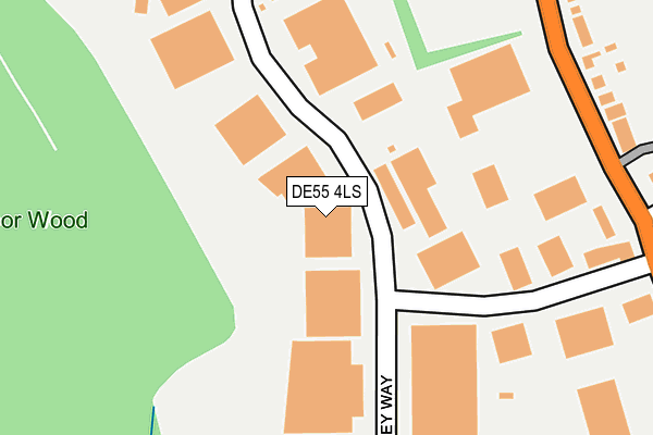
DE55 4LS is located in the Somercotes electoral ward, within the local authority district of Amber Valley and the English Parliamentary constituency of Amber Valley. The Sub Integrated Care Board (ICB) Location is NHS Derby and Derbyshire ICB - 15M and the police force is Derbyshire. This postcode has been in use since January 1980.


GetTheData
Source: OS OpenMap – Local (Ordnance Survey)
Source: OS VectorMap District (Ordnance Survey)
Licence: Open Government Licence (requires attribution)
| Easting | 441735 |
| Northing | 354367 |
| Latitude | 53.084916 |
| Longitude | -1.378356 |
GetTheData
Source: Open Postcode Geo
Licence: Open Government Licence
| Country | England |
| Postcode District | DE55 |
| ➜ DE55 open data dashboard ➜ See where DE55 is on a map ➜ Where is Somercotes? | |
GetTheData
Source: Land Registry Price Paid Data
Licence: Open Government Licence
Elevation or altitude of DE55 4LS as distance above sea level:
| Metres | Feet | |
|---|---|---|
| Elevation | 140m | 459ft |
Elevation is measured from the approximate centre of the postcode, to the nearest point on an OS contour line from OS Terrain 50, which has contour spacing of ten vertical metres.
➜ How high above sea level am I? Find the elevation of your current position using your device's GPS.
GetTheData
Source: Open Postcode Elevation
Licence: Open Government Licence
| Ward | Somercotes |
| Constituency | Amber Valley |
GetTheData
Source: ONS Postcode Database
Licence: Open Government Licence
| June 2022 | Other theft | On or near Wimsey Way | 82m |
| June 2022 | Shoplifting | On or near Wimsey Way | 82m |
| June 2022 | Shoplifting | On or near Wimsey Way | 82m |
| ➜ Get more crime data in our Crime section | |||
GetTheData
Source: data.police.uk
Licence: Open Government Licence
| Wimsey Way (Nottingham Road) | Cotes Park | 285m |
| Cotes Park Lane (Nottingham Road) | Cotes Park | 304m |
| Cotes Park Lane (Nottingham Road) | Cotes Park | 318m |
| Wimsey Way (Nottingham Road) | Cotes Park | 358m |
| Whites Lane (Sleetmoor Lane) | Somercotes | 409m |
| Alfreton Station | 1.8km |
GetTheData
Source: NaPTAN
Licence: Open Government Licence
| Median download speed | 20.0Mbps |
| Average download speed | 25.4Mbps |
| Maximum download speed | 80.00Mbps |
| Median upload speed | 2.8Mbps |
| Average upload speed | 6.0Mbps |
| Maximum upload speed | 20.00Mbps |
GetTheData
Source: Ofcom
Licence: Ofcom Terms of Use (requires attribution)
Estimated total energy consumption in DE55 4LS by fuel type, 2015.
| Consumption (kWh) | 136,848 |
|---|---|
| Meter count | 9 |
| Mean (kWh/meter) | 15,205 |
| Median (kWh/meter) | 1,950 |
GetTheData
Source: Postcode level gas estimates: 2015 (experimental)
Source: Postcode level electricity estimates: 2015 (experimental)
Licence: Open Government Licence
GetTheData
Source: ONS Postcode Database
Licence: Open Government Licence


➜ Get more ratings from the Food Standards Agency
GetTheData
Source: Food Standards Agency
Licence: FSA terms & conditions
| Last Collection | |||
|---|---|---|---|
| Location | Mon-Fri | Sat | Distance |
| Alfreton Delivery Office Box | 17:30 | 12:00 | 398m |
| Sleetmoor Lane | 17:30 | 09:30 | 507m |
| Cotes Park Business Box | 18:30 | 649m | |
GetTheData
Source: Dracos
Licence: Creative Commons Attribution-ShareAlike
| Facility | Distance |
|---|---|
| Sleetmoor United Fc Sleetmoor Lane, Swanwick, Alfreton Grass Pitches, Artificial Grass Pitch | 601m |
| Amber Valley Fitness Centre Nottingham Road, Somercotes, Alfreton Health and Fitness Gym, Studio | 614m |
| Somerlea Park Junior School Bank Street, Somercotes, Alfreton Grass Pitches | 948m |
GetTheData
Source: Active Places
Licence: Open Government Licence
| School | Phase of Education | Distance |
|---|---|---|
| Somercotes Infant and Nursery School Nottingham Road, Somercotes, Alfreton, DE55 4LY | Primary | 731m |
| Somerlea Park Junior School Bank Street, Somercotes, Alfreton, DE55 4JE | Primary | 963m |
| David Nieper Academy Grange Street, Alfreton, DE55 7JA | Secondary | 1.1km |
GetTheData
Source: Edubase
Licence: Open Government Licence
The below table lists the International Territorial Level (ITL) codes (formerly Nomenclature of Territorial Units for Statistics (NUTS) codes) and Local Administrative Units (LAU) codes for DE55 4LS:
| ITL 1 Code | Name |
|---|---|
| TLF | East Midlands (England) |
| ITL 2 Code | Name |
| TLF1 | Derbyshire and Nottinghamshire |
| ITL 3 Code | Name |
| TLF13 | South and West Derbyshire |
| LAU 1 Code | Name |
| E07000032 | Amber Valley |
GetTheData
Source: ONS Postcode Directory
Licence: Open Government Licence
The below table lists the Census Output Area (OA), Lower Layer Super Output Area (LSOA), and Middle Layer Super Output Area (MSOA) for DE55 4LS:
| Code | Name | |
|---|---|---|
| OA | E00098466 | |
| LSOA | E01019471 | Amber Valley 003E |
| MSOA | E02004031 | Amber Valley 003 |
GetTheData
Source: ONS Postcode Directory
Licence: Open Government Licence
| DE55 4HQ | Nottingham Road | 285m |
| DE55 7RB | Whites Close | 362m |
| DE55 1SF | Belvoir Way | 413m |
| DE55 1RF | Sleetmoor Lane | 414m |
| DE55 4QJ | West Way | 430m |
| DE55 1SE | Warwick Court | 440m |
| DE55 1RG | Sleetmoor Lane | 459m |
| DE55 1SG | Ash Close | 463m |
| DE55 1RE | Sleetmoor Lane | 470m |
| DE55 1SD | Warwick Road | 477m |
GetTheData
Source: Open Postcode Geo; Land Registry Price Paid Data
Licence: Open Government Licence