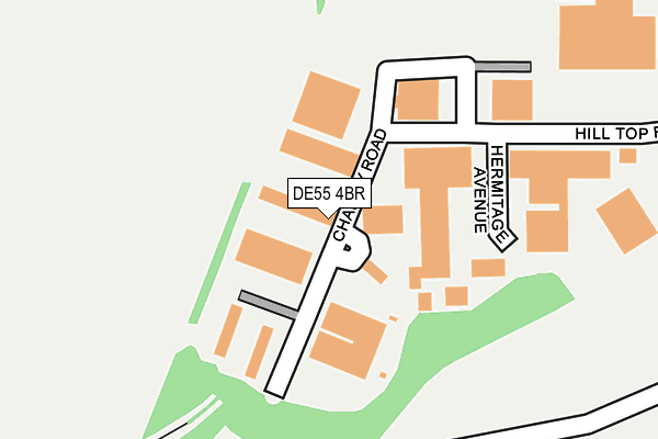
DE55 4BR is located in the Ironville & Riddings electoral ward, within the local authority district of Amber Valley and the English Parliamentary constituency of Amber Valley. The Sub Integrated Care Board (ICB) Location is NHS Derby and Derbyshire ICB - 15M and the police force is Derbyshire. This postcode has been in use since January 1992.


GetTheData
Source: OS OpenMap – Local (Ordnance Survey)
Source: OS VectorMap District (Ordnance Survey)
Licence: Open Government Licence (requires attribution)
| Easting | 441978 |
| Northing | 352387 |
| Latitude | 53.067081 |
| Longitude | -1.374988 |
GetTheData
Source: Open Postcode Geo
Licence: Open Government Licence
| Country | England |
| Postcode District | DE55 |
| ➜ DE55 open data dashboard ➜ See where DE55 is on a map ➜ Where is Riddings? | |
GetTheData
Source: Land Registry Price Paid Data
Licence: Open Government Licence
Elevation or altitude of DE55 4BR as distance above sea level:
| Metres | Feet | |
|---|---|---|
| Elevation | 120m | 394ft |
Elevation is measured from the approximate centre of the postcode, to the nearest point on an OS contour line from OS Terrain 50, which has contour spacing of ten vertical metres.
➜ How high above sea level am I? Find the elevation of your current position using your device's GPS.
GetTheData
Source: Open Postcode Elevation
Licence: Open Government Licence
| Ward | Ironville & Riddings |
| Constituency | Amber Valley |
GetTheData
Source: ONS Postcode Database
Licence: Open Government Licence
| June 2022 | Violence and sexual offences | On or near Peveril Close | 331m |
| May 2022 | Anti-social behaviour | On or near George Crescent | 485m |
| January 2022 | Public order | On or near Charity Road | 37m |
| ➜ Get more crime data in our Crime section | |||
GetTheData
Source: data.police.uk
Licence: Open Government Licence
| Doctors Corner (Newlands Road) | Riddings | 457m |
| Amber Business Park (Greenhill Lane) | Riddings | 463m |
| Doctors Corner (Greenhill Lane) | Riddings | 465m |
| Doctors Corner (South Street) | Riddings | 477m |
| Amber Business Park (Greenhill Lane) | Riddings | 480m |
| Alfreton Station | 3.7km |
GetTheData
Source: NaPTAN
Licence: Open Government Licence
| Median download speed | 15.2Mbps |
| Average download speed | 14.7Mbps |
| Maximum download speed | 21.72Mbps |
| Median upload speed | 1.2Mbps |
| Average upload speed | 1.1Mbps |
| Maximum upload speed | 1.28Mbps |
GetTheData
Source: Ofcom
Licence: Ofcom Terms of Use (requires attribution)
GetTheData
Source: ONS Postcode Database
Licence: Open Government Licence


➜ Get more ratings from the Food Standards Agency
GetTheData
Source: Food Standards Agency
Licence: FSA terms & conditions
| Last Collection | |||
|---|---|---|---|
| Location | Mon-Fri | Sat | Distance |
| Greenhill Lane | 17:30 | 09:30 | 460m |
| Castleton Avenue | 17:30 | 09:30 | 524m |
| West Street | 17:30 | 09:30 | 577m |
GetTheData
Source: Dracos
Licence: Creative Commons Attribution-ShareAlike
| Facility | Distance |
|---|---|
| Riddings Park Shaw Street, Riddings, Alfreton Grass Pitches | 728m |
| The Hayes Conference Centre Swanwick, Alfreton Sports Hall, Grass Pitches | 1km |
| Somerlea Park Community Centre Sherwood Street, Leabrooks, Alfreton Grass Pitches, Artificial Grass Pitch, Sports Hall | 1.2km |
GetTheData
Source: Active Places
Licence: Open Government Licence
| School | Phase of Education | Distance |
|---|---|---|
| Riddings Infant and Nursery School West Street, Riddings, Alfreton, DE55 4EW | Primary | 665m |
| Riddings Junior School Church Street, Riddings, Alfreton, DE55 4BW | Primary | 854m |
| Swanwick School and Sports College Hayes Lane, Swanwick, Alfreton, DE55 1AR | Not applicable | 1.2km |
GetTheData
Source: Edubase
Licence: Open Government Licence
The below table lists the International Territorial Level (ITL) codes (formerly Nomenclature of Territorial Units for Statistics (NUTS) codes) and Local Administrative Units (LAU) codes for DE55 4BR:
| ITL 1 Code | Name |
|---|---|
| TLF | East Midlands (England) |
| ITL 2 Code | Name |
| TLF1 | Derbyshire and Nottinghamshire |
| ITL 3 Code | Name |
| TLF13 | South and West Derbyshire |
| LAU 1 Code | Name |
| E07000032 | Amber Valley |
GetTheData
Source: ONS Postcode Directory
Licence: Open Government Licence
The below table lists the Census Output Area (OA), Lower Layer Super Output Area (LSOA), and Middle Layer Super Output Area (MSOA) for DE55 4BR:
| Code | Name | |
|---|---|---|
| OA | E00098346 | |
| LSOA | E01019443 | Amber Valley 004A |
| MSOA | E02004032 | Amber Valley 004 |
GetTheData
Source: ONS Postcode Directory
Licence: Open Government Licence
| DE55 4ET | Slack Lane | 232m |
| DE55 4BD | Peveril Close | 251m |
| DE55 4AP | Peveril Drive | 362m |
| DE55 4AQ | Lea Crescent | 414m |
| DE55 4AN | Peak Avenue | 441m |
| DE55 4AL | George Crescent | 460m |
| DE55 4AY | Greenhill Lane | 471m |
| DE55 4AH | Tor Avenue | 483m |
| DE55 4EQ | Newlands Road | 493m |
| DE55 4DS | Melton Court | 503m |
GetTheData
Source: Open Postcode Geo; Land Registry Price Paid Data
Licence: Open Government Licence