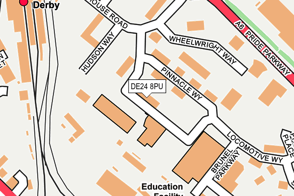
DE24 8PU is located in the Alvaston North electoral ward, within the unitary authority of Derby and the English Parliamentary constituency of Derby South. The Sub Integrated Care Board (ICB) Location is NHS Derby and Derbyshire ICB - 15M and the police force is Derbyshire. This postcode has been in use since June 2000.


GetTheData
Source: OS OpenMap – Local (Ordnance Survey)
Source: OS VectorMap District (Ordnance Survey)
Licence: Open Government Licence (requires attribution)
| Easting | 436462 |
| Northing | 335353 |
| Latitude | 52.914388 |
| Longitude | -1.459213 |
GetTheData
Source: Open Postcode Geo
Licence: Open Government Licence
| Country | England |
| Postcode District | DE24 |
| ➜ DE24 open data dashboard ➜ See where DE24 is on a map ➜ Where is Derby? | |
GetTheData
Source: Land Registry Price Paid Data
Licence: Open Government Licence
Elevation or altitude of DE24 8PU as distance above sea level:
| Metres | Feet | |
|---|---|---|
| Elevation | 50m | 164ft |
Elevation is measured from the approximate centre of the postcode, to the nearest point on an OS contour line from OS Terrain 50, which has contour spacing of ten vertical metres.
➜ How high above sea level am I? Find the elevation of your current position using your device's GPS.
GetTheData
Source: Open Postcode Elevation
Licence: Open Government Licence
| Ward | Alvaston North |
| Constituency | Derby South |
GetTheData
Source: ONS Postcode Database
Licence: Open Government Licence
| January 2024 | Other theft | On or near Nelson Street | 377m |
| January 2024 | Anti-social behaviour | On or near Nelson Street | 377m |
| December 2023 | Violence and sexual offences | On or near Nelson Street | 377m |
| ➜ Get more crime data in our Crime section | |||
GetTheData
Source: data.police.uk
Licence: Open Government Licence
| Railway Station East (Roundhouse Road) | Derby | 232m |
| Pride Parkway Egg (Pride Parkway) | Pride Park | 235m |
| Pride Parkway Egg (Pride Parkway) | Pride Park | 258m |
| Roundhouse Road (Pride Parkway) | Pride Park | 296m |
| Locomotive Way (Pride Parkway) | Pride Park | 296m |
| Derby Station | 0.4km |
| Peartree Station | 2.2km |
| Spondon Station | 3.2km |
GetTheData
Source: NaPTAN
Licence: Open Government Licence
GetTheData
Source: ONS Postcode Database
Licence: Open Government Licence


➜ Get more ratings from the Food Standards Agency
GetTheData
Source: Food Standards Agency
Licence: FSA terms & conditions
| Last Collection | |||
|---|---|---|---|
| Location | Mon-Fri | Sat | Distance |
| Midland Station | 18:30 | 12:30 | 355m |
| Midland Road Head Post Office | 18:30 | 15:00 | 467m |
| Midland Road Head Post Office | 18:30 | 15:00 | 472m |
GetTheData
Source: Dracos
Licence: Creative Commons Attribution-ShareAlike
| Facility | Distance |
|---|---|
| Derby College (Johnson Building) Locomotive Way, Derby Sports Hall, Health and Fitness Gym, Studio | 74m |
| David Lloyd (Derby) Riverside Road, Pride Park, Derby Sports Hall, Swimming Pool, Health and Fitness Gym, Indoor Tennis Centre, Studio, Squash Courts, Outdoor Tennis Courts | 382m |
| Funktion Fitness (Closed) Pride Park, Derby Health and Fitness Gym, Studio | 450m |
GetTheData
Source: Active Places
Licence: Open Government Licence
| School | Phase of Education | Distance |
|---|---|---|
| UTC Derby Pride Park Locomotive Way, Derby, DE24 8PU | Secondary | 67m |
| Derby College The Roundhouse, Roundhouse Road, Pride Park, Derby, DE24 8JE | 16 plus | 299m |
| Zaytouna Primary School 500 London Road, Derby, DE24 8WH | Primary | 501m |
GetTheData
Source: Edubase
Licence: Open Government Licence
The below table lists the International Territorial Level (ITL) codes (formerly Nomenclature of Territorial Units for Statistics (NUTS) codes) and Local Administrative Units (LAU) codes for DE24 8PU:
| ITL 1 Code | Name |
|---|---|
| TLF | East Midlands (England) |
| ITL 2 Code | Name |
| TLF1 | Derbyshire and Nottinghamshire |
| ITL 3 Code | Name |
| TLF11 | Derby |
| LAU 1 Code | Name |
| E06000015 | Derby |
GetTheData
Source: ONS Postcode Directory
Licence: Open Government Licence
The below table lists the Census Output Area (OA), Lower Layer Super Output Area (LSOA), and Middle Layer Super Output Area (MSOA) for DE24 8PU:
| Code | Name | |
|---|---|---|
| OA | E00068038 | |
| LSOA | E01033172 | Derby 024F |
| MSOA | E02002819 | Derby 024 |
GetTheData
Source: ONS Postcode Directory
Licence: Open Government Licence
| DE24 8ZS | Pinnacle Way | 102m |
| DE24 8HR | Brunel Parkway | 293m |
| DE24 8QR | Pride Place | 335m |
| DE1 2NH | Carrington Street | 383m |
| DE24 8HY | Riverside Road | 451m |
| DE1 2RR | Midland Place | 453m |
| DE1 2RU | Railway Terrace | 460m |
| DE1 2SU | London Road | 466m |
| DE1 2RX | Leeds Place | 479m |
| DE23 8JQ | Bateman Street | 481m |
GetTheData
Source: Open Postcode Geo; Land Registry Price Paid Data
Licence: Open Government Licence