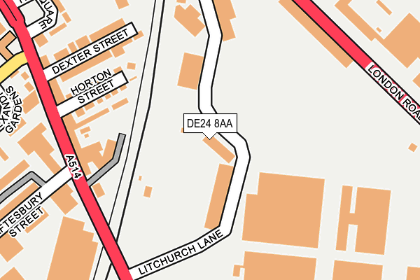
DE24 8AA is located in the Alvaston North electoral ward, within the unitary authority of Derby and the English Parliamentary constituency of Derby South. The Sub Integrated Care Board (ICB) Location is NHS Derby and Derbyshire ICB - 15M and the police force is Derbyshire. This postcode has been in use since August 1992.


GetTheData
Source: OS OpenMap – Local (Ordnance Survey)
Source: OS VectorMap District (Ordnance Survey)
Licence: Open Government Licence (requires attribution)
| Easting | 436307 |
| Northing | 334702 |
| Latitude | 52.908547 |
| Longitude | -1.461591 |
GetTheData
Source: Open Postcode Geo
Licence: Open Government Licence
| Country | England |
| Postcode District | DE24 |
| ➜ DE24 open data dashboard ➜ See where DE24 is on a map ➜ Where is Derby? | |
GetTheData
Source: Land Registry Price Paid Data
Licence: Open Government Licence
Elevation or altitude of DE24 8AA as distance above sea level:
| Metres | Feet | |
|---|---|---|
| Elevation | 50m | 164ft |
Elevation is measured from the approximate centre of the postcode, to the nearest point on an OS contour line from OS Terrain 50, which has contour spacing of ten vertical metres.
➜ How high above sea level am I? Find the elevation of your current position using your device's GPS.
GetTheData
Source: Open Postcode Elevation
Licence: Open Government Licence
| Ward | Alvaston North |
| Constituency | Derby South |
GetTheData
Source: ONS Postcode Database
Licence: Open Government Licence
| November 2023 | Burglary | On or near Alexandra Gardens | 309m |
| August 2023 | Other theft | On or near Alexandra Gardens | 309m |
| August 2023 | Public order | On or near Alexandra Gardens | 309m |
| ➜ Get more crime data in our Crime section | |||
GetTheData
Source: data.police.uk
Licence: Open Government Licence
| Shaftsbury Street (Osmaston Road) | Rose Hill | 229m |
| Brunel House (London Road) | Litchurch | 240m |
| Brunel House (London Road) | Litchurch | 244m |
| Litchurch Lane (Osmaston Road) | Osmaston | 267m |
| Railway Technical Centre (London Road) | Litchurch | 274m |
| Derby Station | 0.9km |
| Peartree Station | 1.5km |
| Spondon Station | 3.4km |
GetTheData
Source: NaPTAN
Licence: Open Government Licence
GetTheData
Source: ONS Postcode Database
Licence: Open Government Licence


➜ Get more ratings from the Food Standards Agency
GetTheData
Source: Food Standards Agency
Licence: FSA terms & conditions
| Last Collection | |||
|---|---|---|---|
| Location | Mon-Fri | Sat | Distance |
| Osmaton Road | 17:30 | 10:30 | 251m |
| Cotton Lane | 17:30 | 10:30 | 511m |
| Sir Francis Ley Ind Est | 18:30 | 12:00 | 589m |
GetTheData
Source: Dracos
Licence: Creative Commons Attribution-ShareAlike
| Facility | Distance |
|---|---|
| Shaftesbury Park Shaftesbury Crescent, Derby Grass Pitches | 474m |
| Merlin Abc And Fitness Centre (Closed) Shaftesbury Crescent, Derby Sports Hall, Health and Fitness Gym, Grass Pitches, Artificial Grass Pitch | 519m |
| Derby College (Johnson Building) Locomotive Way, Derby Sports Hall, Health and Fitness Gym, Studio | 626m |
GetTheData
Source: Active Places
Licence: Open Government Licence
| School | Phase of Education | Distance |
|---|---|---|
| Zaytouna Primary School 500 London Road, Derby, DE24 8WH | Primary | 222m |
| St James' Church of England Aided Junior School Reginald Street, Derby, DE23 8FQ | Primary | 591m |
| UTC Derby Pride Park Locomotive Way, Derby, DE24 8PU | Secondary | 608m |
GetTheData
Source: Edubase
Licence: Open Government Licence
The below table lists the International Territorial Level (ITL) codes (formerly Nomenclature of Territorial Units for Statistics (NUTS) codes) and Local Administrative Units (LAU) codes for DE24 8AA:
| ITL 1 Code | Name |
|---|---|
| TLF | East Midlands (England) |
| ITL 2 Code | Name |
| TLF1 | Derbyshire and Nottinghamshire |
| ITL 3 Code | Name |
| TLF11 | Derby |
| LAU 1 Code | Name |
| E06000015 | Derby |
GetTheData
Source: ONS Postcode Directory
Licence: Open Government Licence
The below table lists the Census Output Area (OA), Lower Layer Super Output Area (LSOA), and Middle Layer Super Output Area (MSOA) for DE24 8AA:
| Code | Name | |
|---|---|---|
| OA | E00068038 | |
| LSOA | E01033172 | Derby 024F |
| MSOA | E02002819 | Derby 024 |
GetTheData
Source: ONS Postcode Directory
Licence: Open Government Licence
| DE23 8LN | Horton Street | 206m |
| DE23 8LL | Dexter Street | 222m |
| DE23 8LD | Osmaston Road | 229m |
| DE23 8LB | Osmaston Road | 281m |
| DE24 8AE | Osmaston Road | 325m |
| DE23 8LG | Ivy Square | 327m |
| DE23 8NL | Robinsons Industrial Estate | 329m |
| DE23 8EN | Alexandra Gardens | 350m |
| DE23 8YB | Shaftesbury Street | 371m |
| DE23 8EH | Tintagel Close | 377m |
GetTheData
Source: Open Postcode Geo; Land Registry Price Paid Data
Licence: Open Government Licence