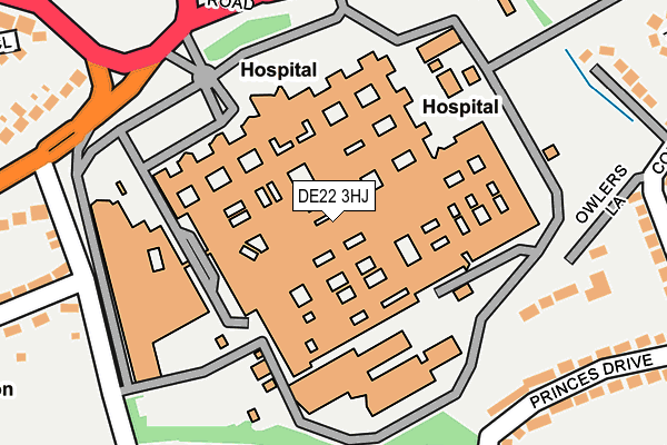
DE22 3HJ is located in the Littleover electoral ward, within the unitary authority of Derby and the English Parliamentary constituency of Derby North. The Sub Integrated Care Board (ICB) Location is NHS Derby and Derbyshire ICB - 15M and the police force is Derbyshire. This postcode has been in use since April 2010.


GetTheData
Source: OS OpenMap – Local (Ordnance Survey)
Source: OS VectorMap District (Ordnance Survey)
Licence: Open Government Licence (requires attribution)
| Easting | 432793 |
| Northing | 334879 |
| Latitude | 52.910345 |
| Longitude | -1.513825 |
GetTheData
Source: Open Postcode Geo
Licence: Open Government Licence
| Country | England |
| Postcode District | DE22 |
| ➜ DE22 open data dashboard ➜ See where DE22 is on a map ➜ Where is Derby? | |
GetTheData
Source: Land Registry Price Paid Data
Licence: Open Government Licence
Elevation or altitude of DE22 3HJ as distance above sea level:
| Metres | Feet | |
|---|---|---|
| Elevation | 90m | 295ft |
Elevation is measured from the approximate centre of the postcode, to the nearest point on an OS contour line from OS Terrain 50, which has contour spacing of ten vertical metres.
➜ How high above sea level am I? Find the elevation of your current position using your device's GPS.
GetTheData
Source: Open Postcode Elevation
Licence: Open Government Licence
| Ward | Littleover |
| Constituency | Derby North |
GetTheData
Source: ONS Postcode Database
Licence: Open Government Licence
| January 2024 | Anti-social behaviour | On or near Supermarket | 325m |
| January 2024 | Anti-social behaviour | On or near Supermarket | 325m |
| January 2024 | Anti-social behaviour | On or near Supermarket | 325m |
| ➜ Get more crime data in our Crime section | |||
GetTheData
Source: data.police.uk
Licence: Open Government Licence
| Education Block (Loop Road South) | California | 122m |
| Childrens Hospital (Loop Road South) | California | 151m |
| Royal Hospital Entrance (Loop Road North) | California | 168m |
| Maternity Hospital (Loop Road East) | California | 193m |
| Royal Derby Hospital (Uttoxeter New Road) | California | 197m |
| Peartree Station | 3.1km |
| Derby Station | 3.5km |
GetTheData
Source: NaPTAN
Licence: Open Government Licence
GetTheData
Source: ONS Postcode Database
Licence: Open Government Licence


➜ Get more ratings from the Food Standards Agency
GetTheData
Source: Food Standards Agency
Licence: FSA terms & conditions
| Last Collection | |||
|---|---|---|---|
| Location | Mon-Fri | Sat | Distance |
| City Hospital | 17:30 | 10:30 | 81m |
| City Hospital | 17:30 | 10:30 | 89m |
| Bretton Avenue | 17:30 | 12:00 | 389m |
GetTheData
Source: Dracos
Licence: Creative Commons Attribution-ShareAlike
| Facility | Distance |
|---|---|
| Wren Park Primary School Jackson Avenue, Mickleover, Derby Grass Pitches | 436m |
| Littleover Tennis Club Eastwood Drive, Littleover, Derby Outdoor Tennis Courts | 611m |
| Derby High School Hillsway, Littleover, Derby Grass Pitches, Sports Hall | 716m |
GetTheData
Source: Active Places
Licence: Open Government Licence
| School | Phase of Education | Distance |
|---|---|---|
| Wren Park Primary School Jackson Avenue, Mickleover, Derby, DE3 9AY | Primary | 435m |
| Derby High School Hillsway, Littleover, Derby, DE23 3DT | Not applicable | 716m |
| St Clare's School Rough Heanor Road, Mickleover, Derby, DE3 9AZ | Not applicable | 726m |
GetTheData
Source: Edubase
Licence: Open Government Licence
The below table lists the International Territorial Level (ITL) codes (formerly Nomenclature of Territorial Units for Statistics (NUTS) codes) and Local Administrative Units (LAU) codes for DE22 3HJ:
| ITL 1 Code | Name |
|---|---|
| TLF | East Midlands (England) |
| ITL 2 Code | Name |
| TLF1 | Derbyshire and Nottinghamshire |
| ITL 3 Code | Name |
| TLF11 | Derby |
| LAU 1 Code | Name |
| E06000015 | Derby |
GetTheData
Source: ONS Postcode Directory
Licence: Open Government Licence
The below table lists the Census Output Area (OA), Lower Layer Super Output Area (LSOA), and Middle Layer Super Output Area (MSOA) for DE22 3HJ:
| Code | Name | |
|---|---|---|
| OA | E00068382 | |
| LSOA | E01013542 | Derby 017C |
| MSOA | E02002812 | Derby 017 |
GetTheData
Source: ONS Postcode Directory
Licence: Open Government Licence
| DE23 6DE | Owlers Lane | 223m |
| DE23 6DW | Princes Drive | 255m |
| DE3 9AW | Kings Drive | 258m |
| DE23 6EZ | Springfield | 259m |
| DE23 6DY | Balmoral Close | 268m |
| DE23 6DX | Princes Drive | 279m |
| DE23 6EX | Kings Drive | 294m |
| DE23 6DZ | Constable Avenue | 297m |
| DE23 6DU | Queens Drive | 299m |
| DE23 6EW | Kings Drive | 309m |
GetTheData
Source: Open Postcode Geo; Land Registry Price Paid Data
Licence: Open Government Licence