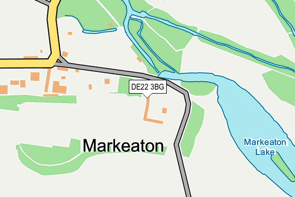
DE22 3BG is located in the Allestree electoral ward, within the unitary authority of Derby and the English Parliamentary constituency of Mid Derbyshire. The Sub Integrated Care Board (ICB) Location is NHS Derby and Derbyshire ICB - 15M and the police force is Derbyshire. This postcode has been in use since August 1992.


GetTheData
Source: OS OpenMap – Local (Ordnance Survey)
Source: OS VectorMap District (Ordnance Survey)
Licence: Open Government Licence (requires attribution)
| Easting | 433335 |
| Northing | 337641 |
| Latitude | 52.935157 |
| Longitude | -1.505479 |
GetTheData
Source: Open Postcode Geo
Licence: Open Government Licence
| Country | England |
| Postcode District | DE22 |
| ➜ DE22 open data dashboard ➜ See where DE22 is on a map ➜ Where is Derby? | |
GetTheData
Source: Land Registry Price Paid Data
Licence: Open Government Licence
Elevation or altitude of DE22 3BG as distance above sea level:
| Metres | Feet | |
|---|---|---|
| Elevation | 60m | 197ft |
Elevation is measured from the approximate centre of the postcode, to the nearest point on an OS contour line from OS Terrain 50, which has contour spacing of ten vertical metres.
➜ How high above sea level am I? Find the elevation of your current position using your device's GPS.
GetTheData
Source: Open Postcode Elevation
Licence: Open Government Licence
| Ward | Allestree |
| Constituency | Mid Derbyshire |
GetTheData
Source: ONS Postcode Database
Licence: Open Government Licence
| December 2023 | Violence and sexual offences | On or near Parking Area | 400m |
| October 2023 | Public order | On or near Park/Open Space | 274m |
| October 2023 | Shoplifting | On or near Park/Open Space | 274m |
| ➜ Get more crime data in our Crime section | |||
GetTheData
Source: data.police.uk
Licence: Open Government Licence
| University (Kedleston Road) | Allestree | 371m |
| Mundy Play Centre (Kedleston Road) | Allestree | 397m |
| Mundy Play Centre (Kedleston Road) | Allestree | 405m |
| University (Kedleston Road) | Allestree | 413m |
| Markeaton Lane (Kedleston Road) | Allestree | 505m |
| Derby Station | 3.5km |
| Peartree Station | 4.8km |
GetTheData
Source: NaPTAN
Licence: Open Government Licence
GetTheData
Source: ONS Postcode Database
Licence: Open Government Licence


➜ Get more ratings from the Food Standards Agency
GetTheData
Source: Food Standards Agency
Licence: FSA terms & conditions
| Last Collection | |||
|---|---|---|---|
| Location | Mon-Fri | Sat | Distance |
| Marketon Village | 17:30 | 11:00 | 219m |
| Maxwell Avenue | 17:30 | 12:00 | 417m |
| Toll Bar | 17:30 | 11:30 | 482m |
GetTheData
Source: Dracos
Licence: Creative Commons Attribution-ShareAlike
| Facility | Distance |
|---|---|
| Markeaton Park Markeaton Lane, Derby Grass Pitches, Outdoor Tennis Courts | 289m |
| University Of Derby Sports Centre Kedleston Road, Derby Sports Hall, Health and Fitness Gym, Grass Pitches, Studio, Outdoor Tennis Courts, Squash Courts, Artificial Grass Pitch | 666m |
| University Of Derby (Grass Pitches) Kedleston Road, Derby Grass Pitches | 681m |
GetTheData
Source: Active Places
Licence: Open Government Licence
| School | Phase of Education | Distance |
|---|---|---|
| University of Derby Kedleston Road, Derby, DE22 1GB | Not applicable | 695m |
| Royal School for the Deaf Derby Ashbourne Road, Derby, DE22 3BH | Not applicable | 759m |
| Bridge Street School Bridge Street, Derby, DE1 3LB | Not applicable | 833m |
GetTheData
Source: Edubase
Licence: Open Government Licence
The below table lists the International Territorial Level (ITL) codes (formerly Nomenclature of Territorial Units for Statistics (NUTS) codes) and Local Administrative Units (LAU) codes for DE22 3BG:
| ITL 1 Code | Name |
|---|---|
| TLF | East Midlands (England) |
| ITL 2 Code | Name |
| TLF1 | Derbyshire and Nottinghamshire |
| ITL 3 Code | Name |
| TLF11 | Derby |
| LAU 1 Code | Name |
| E06000015 | Derby |
GetTheData
Source: ONS Postcode Directory
Licence: Open Government Licence
The below table lists the Census Output Area (OA), Lower Layer Super Output Area (LSOA), and Middle Layer Super Output Area (MSOA) for DE22 3BG:
| Code | Name | |
|---|---|---|
| OA | E00067963 | |
| LSOA | E01013468 | Derby 002D |
| MSOA | E02002797 | Derby 002 |
GetTheData
Source: ONS Postcode Directory
Licence: Open Government Licence
| DE22 4NH | Markeaton Lane | 446m |
| DE22 1GA | Kedleston Old Road | 484m |
| DE22 2TE | Kedleston Road | 493m |
| DE22 1GQ | Maxwell Avenue | 530m |
| DE22 2QZ | Carsington Crescent | 562m |
| DE22 2QY | Carsington Crescent | 590m |
| DE22 1GS | Longford Street | 595m |
| DE22 1FZ | Broadway | 640m |
| DE22 2RL | Edale Close | 650m |
| DE22 1BQ | Broadway | 668m |
GetTheData
Source: Open Postcode Geo; Land Registry Price Paid Data
Licence: Open Government Licence