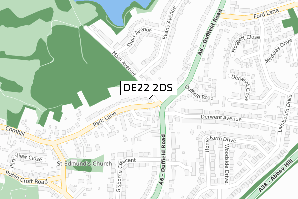
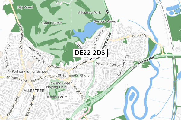
DE22 2DS is located in the Allestree electoral ward, within the unitary authority of Derby and the English Parliamentary constituency of Mid Derbyshire. The Sub Integrated Care Board (ICB) Location is NHS Derby and Derbyshire ICB - 15M and the police force is Derbyshire. This postcode has been in use since August 1992.


GetTheData
Source: OS Open Zoomstack (Ordnance Survey)
Licence: Open Government Licence (requires attribution)
Attribution: Contains OS data © Crown copyright and database right 2024
Source: Open Postcode Geo
Licence: Open Government Licence (requires attribution)
Attribution: Contains OS data © Crown copyright and database right 2024; Contains Royal Mail data © Royal Mail copyright and database right 2024; Source: Office for National Statistics licensed under the Open Government Licence v.3.0
| Easting | 435044 |
| Northing | 339922 |
| Latitude | 52.955553 |
| Longitude | -1.479808 |
GetTheData
Source: Open Postcode Geo
Licence: Open Government Licence
| Country | England |
| Postcode District | DE22 |
| ➜ DE22 open data dashboard ➜ See where DE22 is on a map ➜ Where is Derby? | |
GetTheData
Source: Land Registry Price Paid Data
Licence: Open Government Licence
Elevation or altitude of DE22 2DS as distance above sea level:
| Metres | Feet | |
|---|---|---|
| Elevation | 90m | 295ft |
Elevation is measured from the approximate centre of the postcode, to the nearest point on an OS contour line from OS Terrain 50, which has contour spacing of ten vertical metres.
➜ How high above sea level am I? Find the elevation of your current position using your device's GPS.
GetTheData
Source: Open Postcode Elevation
Licence: Open Government Licence
| Ward | Allestree |
| Constituency | Mid Derbyshire |
GetTheData
Source: ONS Postcode Database
Licence: Open Government Licence
| November 2023 | Vehicle crime | On or near Lambourn Court | 444m |
| August 2023 | Violence and sexual offences | On or near Lambourn Court | 444m |
| May 2023 | Public order | On or near Cornhill | 494m |
| ➜ Get more crime data in our Crime section | |||
GetTheData
Source: data.police.uk
Licence: Open Government Licence
| Park Lane (Duffield Road) | Allestree | 52m |
| Lime Croft (Park Lane) | Allestree | 61m |
| No1 Derwent Avenue (Derwent Avenue) | Allestree | 101m |
| Park Lane (Duffield Road) | Allestree | 146m |
| Lime Croft (Park Lane) | Allestree | 184m |
| Duffield Station | 3.7km |
| Derby Station | 4.5km |
| Spondon Station | 6.7km |
GetTheData
Source: NaPTAN
Licence: Open Government Licence
GetTheData
Source: ONS Postcode Database
Licence: Open Government Licence


➜ Get more ratings from the Food Standards Agency
GetTheData
Source: Food Standards Agency
Licence: FSA terms & conditions
| Last Collection | |||
|---|---|---|---|
| Location | Mon-Fri | Sat | Distance |
| Allestree Village | 17:30 | 11:00 | 90m |
| St Edmunds Close | 17:30 | 11:00 | 356m |
| Gemma Close | 17:30 | 11:00 | 375m |
GetTheData
Source: Dracos
Licence: Creative Commons Attribution-ShareAlike
| Facility | Distance |
|---|---|
| Allestree Recreation Ground Robincroft Road, Derby Grass Pitches | 618m |
| Allestree Park Golf Club (Closed) Allestree Park, Allestree, Derby Golf | 888m |
| Portway Junior School Robincroft Road, Allestree, Derby Grass Pitches | 890m |
GetTheData
Source: Active Places
Licence: Open Government Licence
| School | Phase of Education | Distance |
|---|---|---|
| Portway Infant School Woodlands Road, Allestree, Derby, DE22 2HE | Primary | 869m |
| Portway Junior School Robincroft Road, Allestree, Derby, DE22 2GL | Primary | 890m |
| Old Vicarage School 11 Church Lane, Darley Abbey, Derby, DE22 1EW | Not applicable | 904m |
GetTheData
Source: Edubase
Licence: Open Government Licence
The below table lists the International Territorial Level (ITL) codes (formerly Nomenclature of Territorial Units for Statistics (NUTS) codes) and Local Administrative Units (LAU) codes for DE22 2DS:
| ITL 1 Code | Name |
|---|---|
| TLF | East Midlands (England) |
| ITL 2 Code | Name |
| TLF1 | Derbyshire and Nottinghamshire |
| ITL 3 Code | Name |
| TLF11 | Derby |
| LAU 1 Code | Name |
| E06000015 | Derby |
GetTheData
Source: ONS Postcode Directory
Licence: Open Government Licence
The below table lists the Census Output Area (OA), Lower Layer Super Output Area (LSOA), and Middle Layer Super Output Area (MSOA) for DE22 2DS:
| Code | Name | |
|---|---|---|
| OA | E00067996 | |
| LSOA | E01013461 | Derby 001A |
| MSOA | E02002796 | Derby 001 |
GetTheData
Source: ONS Postcode Directory
Licence: Open Government Licence
| DE22 2DR | Park Lane | 41m |
| DE22 2DW | Poplar Nook | 90m |
| DE22 2DG | Duffield Road | 97m |
| DE22 2EF | Main Avenue | 109m |
| DE22 2DX | The Poplars | 117m |
| DE22 2EA | Church Walk | 134m |
| DE22 2DJ | Duffield Road | 141m |
| DE22 2EN | Evans Avenue | 149m |
| DE22 2DT | Park Lane | 152m |
| DE22 2EP | Evans Avenue | 154m |
GetTheData
Source: Open Postcode Geo; Land Registry Price Paid Data
Licence: Open Government Licence