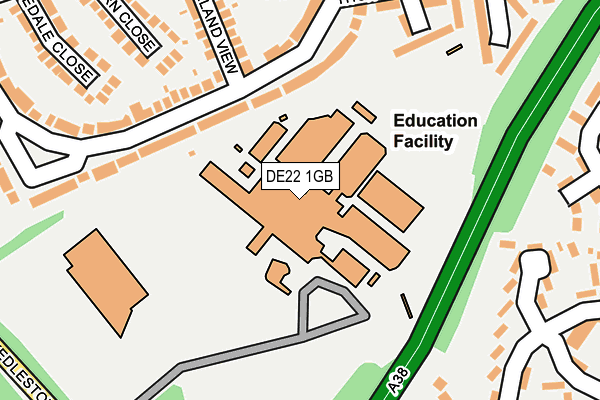
DE22 1GB is located in the Allestree electoral ward, within the unitary authority of Derby and the English Parliamentary constituency of Mid Derbyshire. The Sub Integrated Care Board (ICB) Location is NHS Derby and Derbyshire ICB - 15M and the police force is Derbyshire. This postcode has been in use since August 1992.


GetTheData
Source: OS OpenMap – Local (Ordnance Survey)
Source: OS VectorMap District (Ordnance Survey)
Licence: Open Government Licence (requires attribution)
| Easting | 433924 |
| Northing | 338014 |
| Latitude | 52.938473 |
| Longitude | -1.496678 |
GetTheData
Source: Open Postcode Geo
Licence: Open Government Licence
| Country | England |
| Postcode District | DE22 |
| ➜ DE22 open data dashboard ➜ See where DE22 is on a map ➜ Where is Derby? | |
GetTheData
Source: Land Registry Price Paid Data
Licence: Open Government Licence
Elevation or altitude of DE22 1GB as distance above sea level:
| Metres | Feet | |
|---|---|---|
| Elevation | 80m | 262ft |
Elevation is measured from the approximate centre of the postcode, to the nearest point on an OS contour line from OS Terrain 50, which has contour spacing of ten vertical metres.
➜ How high above sea level am I? Find the elevation of your current position using your device's GPS.
GetTheData
Source: Open Postcode Elevation
Licence: Open Government Licence
| Ward | Allestree |
| Constituency | Mid Derbyshire |
GetTheData
Source: ONS Postcode Database
Licence: Open Government Licence
| June 2022 | Violence and sexual offences | On or near Carsington Mews | 221m |
| June 2022 | Violence and sexual offences | On or near Edale Close | 303m |
| June 2022 | Violence and sexual offences | On or near Edale Close | 303m |
| ➜ Get more crime data in our Crime section | |||
GetTheData
Source: data.police.uk
Licence: Open Government Licence
| University Bus Park (University Grounds) | Allestree | 75m |
| University Bus Park (University Grounds) | Allestree | 84m |
| University Bus Park (University Grounds) | Allestree | 92m |
| University Bus Park (University Grounds) | Allestree | 101m |
| The Leylands (Broadway) | Darley Abbey | 303m |
| Derby Station | 3.3km |
| Peartree Station | 4.9km |
GetTheData
Source: NaPTAN
Licence: Open Government Licence
GetTheData
Source: ONS Postcode Database
Licence: Open Government Licence


➜ Get more ratings from the Food Standards Agency
GetTheData
Source: Food Standards Agency
Licence: FSA terms & conditions
| Last Collection | |||
|---|---|---|---|
| Location | Mon-Fri | Sat | Distance |
| Carsington Crescent | 17:30 | 11:30 | 140m |
| Maxwell Avenue | 17:30 | 12:00 | 324m |
| Broadway | 17:30 | 10:30 | 406m |
GetTheData
Source: Dracos
Licence: Creative Commons Attribution-ShareAlike
| Facility | Distance |
|---|---|
| University Of Derby Sports Centre Kedleston Road, Derby Sports Hall, Health and Fitness Gym, Grass Pitches, Studio, Outdoor Tennis Courts, Squash Courts, Artificial Grass Pitch | 31m |
| Lawn Primary School Norbury Close, Allestree, Derby Grass Pitches | 454m |
| Markeaton Primary School Bromley Street, Derby Grass Pitches, Outdoor Tennis Courts | 641m |
GetTheData
Source: Active Places
Licence: Open Government Licence
| School | Phase of Education | Distance |
|---|---|---|
| University of Derby Kedleston Road, Derby, DE22 1GB | Not applicable | 31m |
| Lawn Primary School Norbury Close, Allestree, Derby, DE22 2QR | Primary | 453m |
| Bridge Street School Bridge Street, Derby, DE1 3LB | Not applicable | 522m |
GetTheData
Source: Edubase
Licence: Open Government Licence
The below table lists the International Territorial Level (ITL) codes (formerly Nomenclature of Territorial Units for Statistics (NUTS) codes) and Local Administrative Units (LAU) codes for DE22 1GB:
| ITL 1 Code | Name |
|---|---|
| TLF | East Midlands (England) |
| ITL 2 Code | Name |
| TLF1 | Derbyshire and Nottinghamshire |
| ITL 3 Code | Name |
| TLF11 | Derby |
| LAU 1 Code | Name |
| E06000015 | Derby |
GetTheData
Source: ONS Postcode Directory
Licence: Open Government Licence
The below table lists the Census Output Area (OA), Lower Layer Super Output Area (LSOA), and Middle Layer Super Output Area (MSOA) for DE22 1GB:
| Code | Name | |
|---|---|---|
| OA | E00067963 | |
| LSOA | E01013468 | Derby 002D |
| MSOA | E02002797 | Derby 002 |
GetTheData
Source: ONS Postcode Directory
Licence: Open Government Licence
| DE22 2QW | Carsington Crescent | 193m |
| DE22 2QZ | Carsington Crescent | 207m |
| DE22 2XB | Carsington Mews | 211m |
| DE22 2RD | Hulland View | 222m |
| DE22 2QY | Carsington Crescent | 228m |
| DE22 2QX | Carsington Crescent | 242m |
| DE22 1BU | Broadway Park Close | 254m |
| DE22 2XH | Wessington Mews | 259m |
| DE22 2RB | Jacksdale Close | 260m |
| DE22 1BA | Leylands | 260m |
GetTheData
Source: Open Postcode Geo; Land Registry Price Paid Data
Licence: Open Government Licence