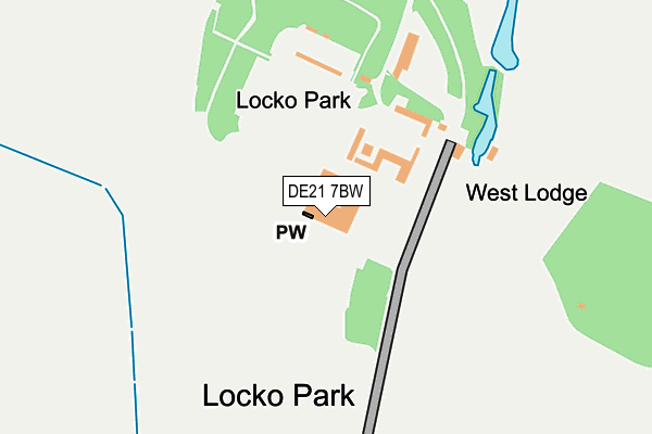
DE21 7BW is located in the West Hallam & Dale Abbey electoral ward, within the local authority district of Erewash and the English Parliamentary constituency of Mid Derbyshire. The Sub Integrated Care Board (ICB) Location is NHS Derby and Derbyshire ICB - 15M and the police force is Derbyshire. This postcode has been in use since August 1992.


GetTheData
Source: OS OpenMap – Local (Ordnance Survey)
Source: OS VectorMap District (Ordnance Survey)
Licence: Open Government Licence (requires attribution)
| Easting | 440952 |
| Northing | 338641 |
| Latitude | 52.943603 |
| Longitude | -1.392037 |
GetTheData
Source: Open Postcode Geo
Licence: Open Government Licence
| Country | England |
| Postcode District | DE21 |
| ➜ DE21 open data dashboard ➜ See where DE21 is on a map | |
GetTheData
Source: Land Registry Price Paid Data
Licence: Open Government Licence
Elevation or altitude of DE21 7BW as distance above sea level:
| Metres | Feet | |
|---|---|---|
| Elevation | 90m | 295ft |
Elevation is measured from the approximate centre of the postcode, to the nearest point on an OS contour line from OS Terrain 50, which has contour spacing of ten vertical metres.
➜ How high above sea level am I? Find the elevation of your current position using your device's GPS.
GetTheData
Source: Open Postcode Elevation
Licence: Open Government Licence
| Ward | West Hallam & Dale Abbey |
| Constituency | Mid Derbyshire |
GetTheData
Source: ONS Postcode Database
Licence: Open Government Licence
| The Footrills (Derby Road) | Stanley | 972m |
| The Footrills (Derby Road) | Stanley | 977m |
| North Lodge (Derby Road) | Morley | 1,011m |
| North Lodge (Derby Road) | Morley | 1,016m |
| Manor Lodge (Derby Road) | Stanley | 1,042m |
| Spondon Station | 3.7km |
| Derby Station | 5.7km |
GetTheData
Source: NaPTAN
Licence: Open Government Licence
➜ Broadband speed and availability dashboard for DE21 7BW
| Percentage of properties with Next Generation Access | 100.0% |
| Percentage of properties with Superfast Broadband | 0.0% |
| Percentage of properties with Ultrafast Broadband | 0.0% |
| Percentage of properties with Full Fibre Broadband | 0.0% |
Superfast Broadband is between 30Mbps and 300Mbps
Ultrafast Broadband is > 300Mbps
| Median download speed | 1.6Mbps |
| Average download speed | 7.0Mbps |
| Maximum download speed | 19.62Mbps |
| Median upload speed | 0.7Mbps |
| Average upload speed | 0.8Mbps |
| Maximum upload speed | 1.42Mbps |
| Percentage of properties unable to receive 2Mbps | 7.7% |
| Percentage of properties unable to receive 5Mbps | 7.7% |
| Percentage of properties unable to receive 10Mbps | 7.7% |
| Percentage of properties unable to receive 30Mbps | 100.0% |
➜ Broadband speed and availability dashboard for DE21 7BW
GetTheData
Source: Ofcom
Licence: Ofcom Terms of Use (requires attribution)
GetTheData
Source: ONS Postcode Database
Licence: Open Government Licence


➜ Get more ratings from the Food Standards Agency
GetTheData
Source: Food Standards Agency
Licence: FSA terms & conditions
| Last Collection | |||
|---|---|---|---|
| Location | Mon-Fri | Sat | Distance |
| Morley Road | 17:30 | 11:30 | 1,646m |
| Stanley | 17:30 | 08:00 | 1,687m |
| Chaffinch Close | 17:30 | 11:00 | 1,763m |
GetTheData
Source: Dracos
Licence: Creative Commons Attribution-ShareAlike
| Facility | Distance |
|---|---|
| Derby County Fc (Moor Farm Training Centre) Morley Road, Oakwood, Derby Health and Fitness Gym, Sports Hall, Grass Pitches, Artificial Grass Pitch | 1.6km |
| Spondon Cricket Club Locko Road, Spondon, Derby Grass Pitches | 1.9km |
| Dale Road Park Dale Road, Spondon, Derby Grass Pitches | 2.3km |
GetTheData
Source: Active Places
Licence: Open Government Licence
| School | Phase of Education | Distance |
|---|---|---|
| St Andrew's CofE Primary School Station Road, Stanley, Ilkeston, DE7 6FB | Primary | 1.9km |
| Lees Brook Academy Morley Road, Chaddesden, Derby, DE21 4QX | Secondary | 2.3km |
| Borrow Wood Primary School Arundel Drive, Spondon, Derby, DE21 7QW | Primary | 2.5km |
GetTheData
Source: Edubase
Licence: Open Government Licence
The below table lists the International Territorial Level (ITL) codes (formerly Nomenclature of Territorial Units for Statistics (NUTS) codes) and Local Administrative Units (LAU) codes for DE21 7BW:
| ITL 1 Code | Name |
|---|---|
| TLF | East Midlands (England) |
| ITL 2 Code | Name |
| TLF1 | Derbyshire and Nottinghamshire |
| ITL 3 Code | Name |
| TLF13 | South and West Derbyshire |
| LAU 1 Code | Name |
| E07000036 | Erewash |
GetTheData
Source: ONS Postcode Directory
Licence: Open Government Licence
The below table lists the Census Output Area (OA), Lower Layer Super Output Area (LSOA), and Middle Layer Super Output Area (MSOA) for DE21 7BW:
| Code | Name | |
|---|---|---|
| OA | E00099684 | |
| LSOA | E01019704 | Erewash 005D |
| MSOA | E02004082 | Erewash 005 |
GetTheData
Source: ONS Postcode Directory
Licence: Open Government Licence
| DE21 4RA | Morley Road | 1456m |
| DE21 2XX | Baron Close | 1465m |
| DE21 2XT | Coronet Court | 1499m |
| DE21 2XW | Monarch Drive | 1503m |
| DE7 6EX | Derby Road | 1522m |
| DE21 2XU | Sovereign Way | 1561m |
| DE21 2XY | Royal Grove | 1578m |
| DE21 4TD | Morley Road | 1586m |
| DE7 4PQ | Spondon Road | 1587m |
| DE21 2XJ | Dahlia Drive | 1604m |
GetTheData
Source: Open Postcode Geo; Land Registry Price Paid Data
Licence: Open Government Licence