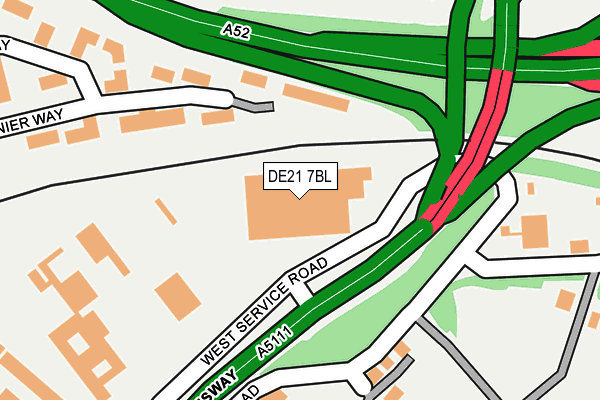
DE21 7BL is located in the Spondon electoral ward, within the unitary authority of Derby and the English Parliamentary constituency of Mid Derbyshire. The Sub Integrated Care Board (ICB) Location is NHS Derby and Derbyshire ICB - 15M and the police force is Derbyshire. This postcode has been in use since January 2004.


GetTheData
Source: OS OpenMap – Local (Ordnance Survey)
Source: OS VectorMap District (Ordnance Survey)
Licence: Open Government Licence (requires attribution)
| Easting | 438701 |
| Northing | 335314 |
| Latitude | 52.913882 |
| Longitude | -1.425924 |
GetTheData
Source: Open Postcode Geo
Licence: Open Government Licence
| Country | England |
| Postcode District | DE21 |
➜ See where DE21 is on a map ➜ Where is Derby? | |
GetTheData
Source: Land Registry Price Paid Data
Licence: Open Government Licence
Elevation or altitude of DE21 7BL as distance above sea level:
| Metres | Feet | |
|---|---|---|
| Elevation | 50m | 164ft |
Elevation is measured from the approximate centre of the postcode, to the nearest point on an OS contour line from OS Terrain 50, which has contour spacing of ten vertical metres.
➜ How high above sea level am I? Find the elevation of your current position using your device's GPS.
GetTheData
Source: Open Postcode Elevation
Licence: Open Government Licence
| Ward | Spondon |
| Constituency | Mid Derbyshire |
GetTheData
Source: ONS Postcode Database
Licence: Open Government Licence
| Charlton House (East Service Road) | Raynesway | 226m |
| Severn Trent (West Service Road) | Raynesway | 237m |
| The Wyvern (Stanier Way) | Wyvern Park | 291m |
| Stephensons Way | Wyvern Park | 309m |
| Waterford Drive | Chaddesden | 335m |
| Spondon Station | 1km |
| Derby Station | 2.5km |
| Peartree Station | 3.7km |
GetTheData
Source: NaPTAN
Licence: Open Government Licence
GetTheData
Source: ONS Postcode Database
Licence: Open Government Licence


➜ Get more ratings from the Food Standards Agency
GetTheData
Source: Food Standards Agency
Licence: FSA terms & conditions
| Last Collection | |||
|---|---|---|---|
| Location | Mon-Fri | Sat | Distance |
| Cavan Drive | 17:30 | 10:30 | 427m |
| Wyvern Way | 17:30 | 11:00 | 575m |
| Cherry Tree Hill Post Office | 17:30 | 12:00 | 787m |
GetTheData
Source: Dracos
Licence: Creative Commons Attribution-ShareAlike
| Risk of DE21 7BL flooding from rivers and sea | Medium |
| ➜ DE21 7BL flood map | |
GetTheData
Source: Open Flood Risk by Postcode
Licence: Open Government Licence
The below table lists the International Territorial Level (ITL) codes (formerly Nomenclature of Territorial Units for Statistics (NUTS) codes) and Local Administrative Units (LAU) codes for DE21 7BL:
| ITL 1 Code | Name |
|---|---|
| TLF | East Midlands (England) |
| ITL 2 Code | Name |
| TLF1 | Derbyshire and Nottinghamshire |
| ITL 3 Code | Name |
| TLF11 | Derby |
| LAU 1 Code | Name |
| E06000015 | Derby |
GetTheData
Source: ONS Postcode Directory
Licence: Open Government Licence
The below table lists the Census Output Area (OA), Lower Layer Super Output Area (LSOA), and Middle Layer Super Output Area (MSOA) for DE21 7BL:
| Code | Name | |
|---|---|---|
| OA | E00171226 | |
| LSOA | E01013595 | Derby 014B |
| MSOA | E02002809 | Derby 014 |
GetTheData
Source: ONS Postcode Directory
Licence: Open Government Licence
| DE21 6BF | Wyvern Business Park | 170m |
| DE21 6TR | Galway Avenue | 242m |
| DE21 7RW | East Service Road | 245m |
| DE21 6LY | Stephensons Way | 284m |
| DE21 6TG | Waterford Drive | 317m |
| DE21 6TP | Limerick Road | 339m |
| DE21 6UA | Meath Avenue | 352m |
| DE21 6TH | Waterford Drive | 378m |
| DE21 6TF | Waterford Drive | 385m |
| DE21 6TQ | Shannon Square | 423m |
GetTheData
Source: Open Postcode Geo; Land Registry Price Paid Data
Licence: Open Government Licence