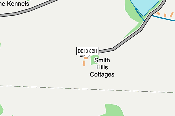
DE13 8BH lies on Smiths Hills in Dunstall, Burton-on-trent. DE13 8BH is located in the Bagots & Needwood electoral ward, within the local authority district of East Staffordshire and the English Parliamentary constituency of Lichfield. The Sub Integrated Care Board (ICB) Location is NHS Staffordshire and Stoke-on-Trent ICB - 05D and the police force is Staffordshire. This postcode has been in use since January 1980.


GetTheData
Source: OS OpenMap – Local (Ordnance Survey)
Source: OS VectorMap District (Ordnance Survey)
Licence: Open Government Licence (requires attribution)
| Easting | 418357 |
| Northing | 319957 |
| Latitude | 52.776891 |
| Longitude | -1.729314 |
GetTheData
Source: Open Postcode Geo
Licence: Open Government Licence
| Street | Smiths Hills |
| Locality | Dunstall |
| Town/City | Burton-on-trent |
| Country | England |
| Postcode District | DE13 |
| ➜ DE13 open data dashboard ➜ See where DE13 is on a map | |
GetTheData
Source: Land Registry Price Paid Data
Licence: Open Government Licence
Elevation or altitude of DE13 8BH as distance above sea level:
| Metres | Feet | |
|---|---|---|
| Elevation | 70m | 230ft |
Elevation is measured from the approximate centre of the postcode, to the nearest point on an OS contour line from OS Terrain 50, which has contour spacing of ten vertical metres.
➜ How high above sea level am I? Find the elevation of your current position using your device's GPS.
GetTheData
Source: Open Postcode Elevation
Licence: Open Government Licence
| Ward | Bagots & Needwood |
| Constituency | Lichfield |
GetTheData
Source: ONS Postcode Database
Licence: Open Government Licence
| Forest Road (Barton Gate Road) | Barton Gate | 1,162m |
| Forest Road (Barton Gate Rd) | Barton Gate | 1,169m |
| Park Road (Main St) | Barton Under Needwood | 1,221m |
| Park Road (Main St) | Barton Under Needwood | 1,222m |
| No 17 (Wales Lane) | Barton Under Needwood | 1,346m |
GetTheData
Source: NaPTAN
Licence: Open Government Licence
➜ Broadband speed and availability dashboard for DE13 8BH
| Percentage of properties with Next Generation Access | 100.0% |
| Percentage of properties with Superfast Broadband | 100.0% |
| Percentage of properties with Ultrafast Broadband | 100.0% |
| Percentage of properties with Full Fibre Broadband | 100.0% |
Superfast Broadband is between 30Mbps and 300Mbps
Ultrafast Broadband is > 300Mbps
| Median download speed | 1.3Mbps |
| Average download speed | 1.5Mbps |
| Maximum download speed | 3.17Mbps |
| Median upload speed | 0.4Mbps |
| Average upload speed | 0.5Mbps |
| Maximum upload speed | 1.03Mbps |
| Percentage of properties unable to receive 2Mbps | 0.0% |
| Percentage of properties unable to receive 5Mbps | 0.0% |
| Percentage of properties unable to receive 10Mbps | 0.0% |
| Percentage of properties unable to receive 30Mbps | 0.0% |
➜ Broadband speed and availability dashboard for DE13 8BH
GetTheData
Source: Ofcom
Licence: Ofcom Terms of Use (requires attribution)
GetTheData
Source: ONS Postcode Database
Licence: Open Government Licence


➜ Get more ratings from the Food Standards Agency
GetTheData
Source: Food Standards Agency
Licence: FSA terms & conditions
| Last Collection | |||
|---|---|---|---|
| Location | Mon-Fri | Sat | Distance |
| Dunstall | 16:00 | 08:30 | 721m |
| Dunstall Turns | 16:00 | 08:00 | 1,154m |
| Barton Gate | 16:45 | 08:45 | 1,203m |
GetTheData
Source: Dracos
Licence: Creative Commons Attribution-ShareAlike
| Facility | Distance |
|---|---|
| Dunstall Cricket Club View Lane, Dunstall Grass Pitches | 877m |
| John Taylor High School Dunstall Road, Barton Under Needwood, Burton-on-trent Sports Hall, Grass Pitches | 1.5km |
| Holland Sports Club Potters Way, Barton Under Needwood, Burton-on-trent Grass Pitches, Outdoor Tennis Courts | 1.9km |
GetTheData
Source: Active Places
Licence: Open Government Licence
| School | Phase of Education | Distance |
|---|---|---|
| John Taylor High School Dunstall Road, Barton-under-Needwood, Burton-on-Trent, DE13 8AZ | Secondary | 1.5km |
| Thomas Russell Infants School Station Road, Barton-Under-Needwood, Burton-on-Trent, DE13 8DS | Primary | 1.8km |
| Thomas Russell Junior School Gilmour Lane, Barton-Under-Needwood, Burton-on-Trent, DE13 8EU | Primary | 2km |
GetTheData
Source: Edubase
Licence: Open Government Licence
The below table lists the International Territorial Level (ITL) codes (formerly Nomenclature of Territorial Units for Statistics (NUTS) codes) and Local Administrative Units (LAU) codes for DE13 8BH:
| ITL 1 Code | Name |
|---|---|
| TLG | West Midlands (England) |
| ITL 2 Code | Name |
| TLG2 | Shropshire and Staffordshire |
| ITL 3 Code | Name |
| TLG24 | Staffordshire CC |
| LAU 1 Code | Name |
| E07000193 | East Staffordshire |
GetTheData
Source: ONS Postcode Directory
Licence: Open Government Licence
The below table lists the Census Output Area (OA), Lower Layer Super Output Area (LSOA), and Middle Layer Super Output Area (MSOA) for DE13 8BH:
| Code | Name | |
|---|---|---|
| OA | E00168368 | |
| LSOA | E01029440 | East Staffordshire 015B |
| MSOA | E02006145 | East Staffordshire 015 |
GetTheData
Source: ONS Postcode Directory
Licence: Open Government Licence
| DE13 8BE | 681m | |
| DE13 8AP | Barton Gate | 871m |
| DE13 8BP | Barton Gate | 1054m |
| DE13 8BL | Forest Row | 1058m |
| DE13 8AY | Council Houses | 1089m |
| DE13 8AG | Barton Gate | 1097m |
| DE13 8AQ | Barton Gate | 1196m |
| DE13 8AB | Main Street | 1232m |
| DE13 8AF | Crowberry Lane | 1281m |
| DE13 8BJ | Dunstall Cross | 1302m |
GetTheData
Source: Open Postcode Geo; Land Registry Price Paid Data
Licence: Open Government Licence