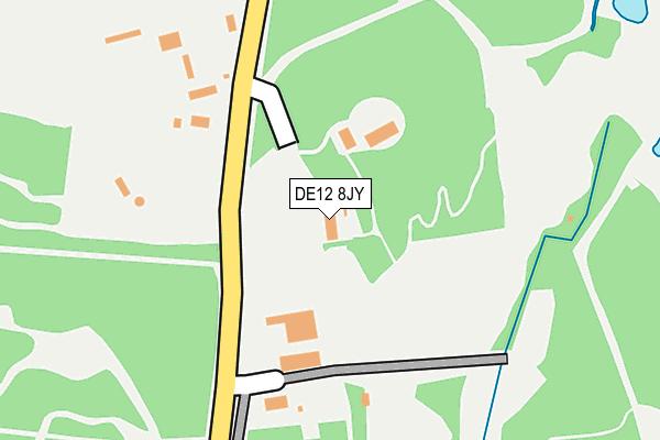
DE12 8JY is located in the Linton electoral ward, within the local authority district of South Derbyshire and the English Parliamentary constituency of South Derbyshire. The Sub Integrated Care Board (ICB) Location is NHS Derby and Derbyshire ICB - 15M and the police force is Derbyshire. This postcode has been in use since July 2010.


GetTheData
Source: OS OpenMap – Local (Ordnance Survey)
Source: OS VectorMap District (Ordnance Survey)
Licence: Open Government Licence (requires attribution)
| Easting | 424335 |
| Northing | 317621 |
| Latitude | 52.755656 |
| Longitude | -1.640870 |
GetTheData
Source: Open Postcode Geo
Licence: Open Government Licence
| Country | England |
| Postcode District | DE12 |
| ➜ DE12 open data dashboard ➜ See where DE12 is on a map | |
GetTheData
Source: Land Registry Price Paid Data
Licence: Open Government Licence
Elevation or altitude of DE12 8JY as distance above sea level:
| Metres | Feet | |
|---|---|---|
| Elevation | 70m | 230ft |
Elevation is measured from the approximate centre of the postcode, to the nearest point on an OS contour line from OS Terrain 50, which has contour spacing of ten vertical metres.
➜ How high above sea level am I? Find the elevation of your current position using your device's GPS.
GetTheData
Source: Open Postcode Elevation
Licence: Open Government Licence
| Ward | Linton |
| Constituency | South Derbyshire |
GetTheData
Source: ONS Postcode Database
Licence: Open Government Licence
| May 2022 | Violence and sexual offences | On or near Parking Area | 131m |
| May 2022 | Violence and sexual offences | On or near Parking Area | 131m |
| May 2022 | Criminal damage and arson | On or near Parking Area | 131m |
| ➜ Get more crime data in our Crime section | |||
GetTheData
Source: data.police.uk
Licence: Open Government Licence
| Forestry Centre (Burton Road) | Rosliston | 134m |
| Burton Road | Rosliston | 812m |
| Burton Road | Rosliston | 857m |
| School (Main Street) | Rosliston | 868m |
| School (Main Street) | Rosliston | 873m |
GetTheData
Source: NaPTAN
Licence: Open Government Licence
GetTheData
Source: ONS Postcode Database
Licence: Open Government Licence


➜ Get more ratings from the Food Standards Agency
GetTheData
Source: Food Standards Agency
Licence: FSA terms & conditions
| Last Collection | |||
|---|---|---|---|
| Location | Mon-Fri | Sat | Distance |
| Roliston Post Office | 16:00 | 12:00 | 880m |
| Cauldwell | 16:00 | 10:45 | 1,221m |
| Linton Road | 16:00 | 11:45 | 1,267m |
GetTheData
Source: Dracos
Licence: Creative Commons Attribution-ShareAlike
| Facility | Distance |
|---|---|
| Rosliston C Of E Primary School Main Street, Rosliston, Swadlincote Grass Pitches | 882m |
| Rosliston Fields Strawberry Lane, Rosliston, Swadlincote Grass Pitches | 1.4km |
| Powergen (Closed) Drakelow, Burton-on-trent Grass Pitches | 2.1km |
GetTheData
Source: Active Places
Licence: Open Government Licence
| School | Phase of Education | Distance |
|---|---|---|
| Rosliston CofE Primary School Main Street, Rosliston, Swadlincote, DE12 8JW | Primary | 876m |
| Pegasus School Main Street, Cauldwell, Swadlincote, DE12 6RS | Not applicable | 1.3km |
| Coton-in-the-Elms Cof E Primary School Elmslea Avenue, Coton-in-the-Elms, Swadlincote, DE12 8HE | Primary | 2.3km |
GetTheData
Source: Edubase
Licence: Open Government Licence
The below table lists the International Territorial Level (ITL) codes (formerly Nomenclature of Territorial Units for Statistics (NUTS) codes) and Local Administrative Units (LAU) codes for DE12 8JY:
| ITL 1 Code | Name |
|---|---|
| TLF | East Midlands (England) |
| ITL 2 Code | Name |
| TLF1 | Derbyshire and Nottinghamshire |
| ITL 3 Code | Name |
| TLF13 | South and West Derbyshire |
| LAU 1 Code | Name |
| E07000039 | South Derbyshire |
GetTheData
Source: ONS Postcode Directory
Licence: Open Government Licence
The below table lists the Census Output Area (OA), Lower Layer Super Output Area (LSOA), and Middle Layer Super Output Area (MSOA) for DE12 8JY:
| Code | Name | |
|---|---|---|
| OA | E00100458 | |
| LSOA | E01019850 | South Derbyshire 011A |
| MSOA | E02004128 | South Derbyshire 011 |
GetTheData
Source: ONS Postcode Directory
Licence: Open Government Licence
| DE12 8JX | Burton Road | 110m |
| DE12 8HY | The Chase | 749m |
| DE12 8JU | Burton Road | 773m |
| DE12 8JR | Holdon Croft | 848m |
| DE12 8JW | Main Street | 930m |
| DE12 8JQ | The Glebe | 944m |
| DE12 8JF | Yew Tree Road | 965m |
| DE12 8JP | Catton Lane | 971m |
| DE12 8LB | Vicarage Walk | 974m |
| DE12 8JG | Yew Tree Gardens | 1025m |
GetTheData
Source: Open Postcode Geo; Land Registry Price Paid Data
Licence: Open Government Licence