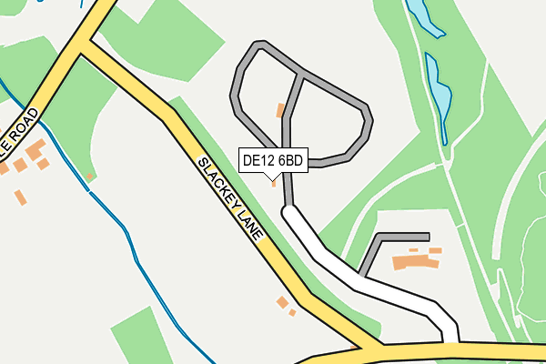
DE12 6BD is located in the Ashby Woulds electoral ward, within the local authority district of North West Leicestershire and the English Parliamentary constituency of North West Leicestershire. The Sub Integrated Care Board (ICB) Location is NHS Leicester, Leicestershire and Rutland ICB - 04V and the police force is Leicestershire. This postcode has been in use since June 1996.


GetTheData
Source: OS OpenMap – Local (Ordnance Survey)
Source: OS VectorMap District (Ordnance Survey)
Licence: Open Government Licence (requires attribution)
| Easting | 430564 |
| Northing | 315697 |
| Latitude | 52.738063 |
| Longitude | -1.548751 |
GetTheData
Source: Open Postcode Geo
Licence: Open Government Licence
| Country | England |
| Postcode District | DE12 |
| ➜ DE12 open data dashboard ➜ See where DE12 is on a map ➜ Where is Moira? | |
GetTheData
Source: Land Registry Price Paid Data
Licence: Open Government Licence
Elevation or altitude of DE12 6BD as distance above sea level:
| Metres | Feet | |
|---|---|---|
| Elevation | 90m | 295ft |
Elevation is measured from the approximate centre of the postcode, to the nearest point on an OS contour line from OS Terrain 50, which has contour spacing of ten vertical metres.
➜ How high above sea level am I? Find the elevation of your current position using your device's GPS.
GetTheData
Source: Open Postcode Elevation
Licence: Open Government Licence
| Ward | Ashby Woulds |
| Constituency | North West Leicestershire |
GetTheData
Source: ONS Postcode Database
Licence: Open Government Licence
| June 2022 | Burglary | On or near Bath Lane | 325m |
| March 2022 | Vehicle crime | On or near Slackey Lane | 212m |
| January 2022 | Anti-social behaviour | On or near Woodville Road | 440m |
| ➜ Get more crime data in our Crime section | |||
GetTheData
Source: data.police.uk
Licence: Open Government Licence
| Bath Yard (Bath Lane) | Moira | 380m |
| Bath Yard (Bath Lane) | Moira | 382m |
| Rosedene View (Woodville Road) | Overseal | 470m |
| Rosedene View (Woodville Road) | Overseal | 470m |
| The Navigation (Spring Cottage Road) | Moira | 514m |
GetTheData
Source: NaPTAN
Licence: Open Government Licence
GetTheData
Source: ONS Postcode Database
Licence: Open Government Licence


➜ Get more ratings from the Food Standards Agency
GetTheData
Source: Food Standards Agency
Licence: FSA terms & conditions
| Last Collection | |||
|---|---|---|---|
| Location | Mon-Fri | Sat | Distance |
| Spring Cottage | 16:00 | 09:30 | 558m |
| Gorsey Lees | 16:00 | 11:15 | 581m |
| Short Heath | 16:00 | 11:15 | 680m |
GetTheData
Source: Dracos
Licence: Creative Commons Attribution-ShareAlike
| Facility | Distance |
|---|---|
| Moira Miners Welfare Bath Lane, Moira, Swadlincote Grass Pitches | 405m |
| Spring Cottage Recreation Ground Spring Cottage Road, Overseal, Swadlincote Grass Pitches | 536m |
| Overseal Primary School Woodville Road, Overseal, Swadlincote Grass Pitches | 631m |
GetTheData
Source: Active Places
Licence: Open Government Licence
| School | Phase of Education | Distance |
|---|---|---|
| Overseal Primary School Woodville Road, Overseal, Swadlincote, DE12 6LU | Primary | 622m |
| Donisthorpe Primary School Ashby Road, Donisthorpe, Swadlincote, DE12 7QF | Primary | 2.3km |
| Albert Village Primary School Occupation Road, Albert Village, Swadlincote, DE11 8HA | Primary | 2.3km |
GetTheData
Source: Edubase
Licence: Open Government Licence
The below table lists the International Territorial Level (ITL) codes (formerly Nomenclature of Territorial Units for Statistics (NUTS) codes) and Local Administrative Units (LAU) codes for DE12 6BD:
| ITL 1 Code | Name |
|---|---|
| TLF | East Midlands (England) |
| ITL 2 Code | Name |
| TLF2 | Leicestershire, Rutland and Northamptonshire |
| ITL 3 Code | Name |
| TLF22 | Leicestershire CC and Rutland |
| LAU 1 Code | Name |
| E07000134 | North West Leicestershire |
GetTheData
Source: ONS Postcode Directory
Licence: Open Government Licence
The below table lists the Census Output Area (OA), Lower Layer Super Output Area (LSOA), and Middle Layer Super Output Area (MSOA) for DE12 6BD:
| Code | Name | |
|---|---|---|
| OA | E00131694 | |
| LSOA | E01025951 | North West Leicestershire 008B |
| MSOA | E02005404 | North West Leicestershire 008 |
GetTheData
Source: ONS Postcode Directory
Licence: Open Government Licence
| DE12 6BS | Roman Way | 459m |
| DE12 6JD | Moira Road | 460m |
| DE12 6ND | Spring Cottage Road | 495m |
| DE12 6LX | Woodville Road | 512m |
| DE12 6BP | Bath Lane | 517m |
| DE12 6LZ | Rosedene View | 557m |
| DE12 6JE | Gorsey Leys | 571m |
| DE12 6LY | Harley Court | 575m |
| DE12 6BL | 647m | |
| DE12 6AP | Shortheath Road | 670m |
GetTheData
Source: Open Postcode Geo; Land Registry Price Paid Data
Licence: Open Government Licence