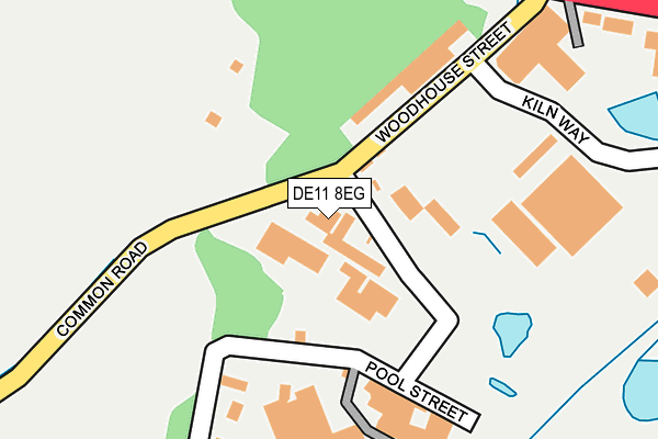
DE11 8EG is located in the Church Gresley electoral ward, within the local authority district of South Derbyshire and the English Parliamentary constituency of South Derbyshire. The Sub Integrated Care Board (ICB) Location is NHS Derby and Derbyshire ICB - 15M and the police force is Derbyshire. This postcode has been in use since January 1980.


GetTheData
Source: OS OpenMap – Local (Ordnance Survey)
Source: OS VectorMap District (Ordnance Survey)
Licence: Open Government Licence (requires attribution)
| Easting | 430561 |
| Northing | 318988 |
| Latitude | 52.767647 |
| Longitude | -1.548489 |
GetTheData
Source: Open Postcode Geo
Licence: Open Government Licence
| Country | England |
| Postcode District | DE11 |
| ➜ DE11 open data dashboard ➜ See where DE11 is on a map ➜ Where is Swadlincote? | |
GetTheData
Source: Land Registry Price Paid Data
Licence: Open Government Licence
Elevation or altitude of DE11 8EG as distance above sea level:
| Metres | Feet | |
|---|---|---|
| Elevation | 130m | 427ft |
Elevation is measured from the approximate centre of the postcode, to the nearest point on an OS contour line from OS Terrain 50, which has contour spacing of ten vertical metres.
➜ How high above sea level am I? Find the elevation of your current position using your device's GPS.
GetTheData
Source: Open Postcode Elevation
Licence: Open Government Licence
| Ward | Church Gresley |
| Constituency | South Derbyshire |
GetTheData
Source: ONS Postcode Database
Licence: Open Government Licence
| June 2022 | Violence and sexual offences | On or near Coppice Side | 444m |
| June 2022 | Shoplifting | On or near Bernard Street | 464m |
| June 2022 | Robbery | On or near Parking Area | 466m |
| ➜ Get more crime data in our Crime section | |||
GetTheData
Source: data.police.uk
Licence: Open Government Licence
| Woodhouse Street (Derby Road) | Woodville | 276m |
| Ski Centre (Derby Road) | Swadlincote | 292m |
| Woodhouse Street (Swadlincote Road) | Woodville | 326m |
| Barley Mow (Coppice Side) | Church Gresley | 407m |
| Hastings Road (Coppice Side) | Swadlincote | 422m |
GetTheData
Source: NaPTAN
Licence: Open Government Licence
GetTheData
Source: ONS Postcode Database
Licence: Open Government Licence

➜ Get more ratings from the Food Standards Agency
GetTheData
Source: Food Standards Agency
Licence: FSA terms & conditions
| Last Collection | |||
|---|---|---|---|
| Location | Mon-Fri | Sat | Distance |
| Swadlincote Road | 16:00 | 11:30 | 330m |
| Morrisons | 16:00 | 12:15 | 727m |
| Hastings Road | 17:30 | 11:15 | 746m |
GetTheData
Source: Dracos
Licence: Creative Commons Attribution-ShareAlike
| Facility | Distance |
|---|---|
| Woodhouse Recreation Ground Common Road, Church Gresley, Swadlincote Grass Pitches | 138m |
| Swadlincote Snowsports Centre Sir Herbert Wragg Way, Swadlincote Ski Slopes | 316m |
| Snap Fitness (Swadlincote) Coppice Side, Coppice Side, Swadlincote Health and Fitness Gym | 663m |
GetTheData
Source: Active Places
Licence: Open Government Licence
| School | Phase of Education | Distance |
|---|---|---|
| Belmont Primary School Belmont Street, Swadlincote, DE11 8JZ | Primary | 974m |
| Albert Village Primary School Occupation Road, Albert Village, Swadlincote, DE11 8HA | Primary | 983m |
| St George's CofE Primary School Church Street, Church Gresley, Swadlincote, DE11 9NP | Primary | 1.1km |
GetTheData
Source: Edubase
Licence: Open Government Licence
The below table lists the International Territorial Level (ITL) codes (formerly Nomenclature of Territorial Units for Statistics (NUTS) codes) and Local Administrative Units (LAU) codes for DE11 8EG:
| ITL 1 Code | Name |
|---|---|
| TLF | East Midlands (England) |
| ITL 2 Code | Name |
| TLF1 | Derbyshire and Nottinghamshire |
| ITL 3 Code | Name |
| TLF13 | South and West Derbyshire |
| LAU 1 Code | Name |
| E07000039 | South Derbyshire |
GetTheData
Source: ONS Postcode Directory
Licence: Open Government Licence
The below table lists the Census Output Area (OA), Lower Layer Super Output Area (LSOA), and Middle Layer Super Output Area (MSOA) for DE11 8EG:
| Code | Name | |
|---|---|---|
| OA | E00100379 | |
| LSOA | E01019837 | South Derbyshire 012A |
| MSOA | E02006919 | South Derbyshire 012 |
GetTheData
Source: ONS Postcode Directory
Licence: Open Government Licence
| DE11 8ED | Woodhouse Street | 249m |
| DE11 8EB | Derby Road | 259m |
| DE11 8DA | Swadlincote Road | 352m |
| DE11 8BT | Manor Coach Court | 358m |
| DE11 8BZ | Bernard Street | 422m |
| DE11 9AE | Coppice Side | 429m |
| DE11 9AA | Coppice Side | 466m |
| DE11 8DB | Swadlincote Road | 476m |
| DE11 8FJ | Crown Rise | 482m |
| DE11 9AB | Heritage Close | 485m |
GetTheData
Source: Open Postcode Geo; Land Registry Price Paid Data
Licence: Open Government Licence