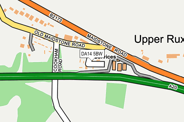
DA14 5BW is located in the St Paul's Cray electoral ward, within the London borough of Bromley and the English Parliamentary constituency of Orpington. The Sub Integrated Care Board (ICB) Location is NHS South East London ICB - 72Q and the police force is Metropolitan Police. This postcode has been in use since February 2008.


GetTheData
Source: OS OpenMap – Local (Ordnance Survey)
Source: OS VectorMap District (Ordnance Survey)
Licence: Open Government Licence (requires attribution)
| Easting | 549119 |
| Northing | 170049 |
| Latitude | 51.409862 |
| Longitude | 0.142726 |
GetTheData
Source: Open Postcode Geo
Licence: Open Government Licence
| Country | England |
| Postcode District | DA14 |
| ➜ DA14 open data dashboard ➜ See where DA14 is on a map ➜ Where is Upper Ruxley? | |
GetTheData
Source: Land Registry Price Paid Data
Licence: Open Government Licence
Elevation or altitude of DA14 5BW as distance above sea level:
| Metres | Feet | |
|---|---|---|
| Elevation | 50m | 164ft |
Elevation is measured from the approximate centre of the postcode, to the nearest point on an OS contour line from OS Terrain 50, which has contour spacing of ten vertical metres.
➜ How high above sea level am I? Find the elevation of your current position using your device's GPS.
GetTheData
Source: Open Postcode Elevation
Licence: Open Government Licence
| Ward | St Paul's Cray |
| Constituency | Orpington |
GetTheData
Source: ONS Postcode Database
Licence: Open Government Licence
| January 2024 | Robbery | On or near Petrol Station | 93m |
| January 2024 | Vehicle crime | On or near Petrol Station | 93m |
| December 2023 | Criminal damage and arson | On or near Petrol Station | 93m |
| ➜ Get more crime data in our Crime section | |||
GetTheData
Source: data.police.uk
Licence: Open Government Licence
| Old Maidstone Road (Maidstone Road) | Ruxley | 149m |
| Old Maidstone Road (Maidstone Road) | Ruxley | 174m |
| Hillside Nursery | Ruxley | 302m |
| Hillside Nursery | Ruxley | 375m |
| Glebe Cottages (Maidstone Road) | Ruxley | 715m |
| Swanley Station | 2.6km |
| St Mary Cray Station | 3km |
| Albany Park Station | 3.1km |
GetTheData
Source: NaPTAN
Licence: Open Government Licence
| Percentage of properties with Next Generation Access | 100.0% |
| Percentage of properties with Superfast Broadband | 0.0% |
| Percentage of properties with Ultrafast Broadband | 0.0% |
| Percentage of properties with Full Fibre Broadband | 0.0% |
Superfast Broadband is between 30Mbps and 300Mbps
Ultrafast Broadband is > 300Mbps
| Percentage of properties unable to receive 2Mbps | 0.0% |
| Percentage of properties unable to receive 5Mbps | 0.0% |
| Percentage of properties unable to receive 10Mbps | 0.0% |
| Percentage of properties unable to receive 30Mbps | 100.0% |
GetTheData
Source: Ofcom
Licence: Ofcom Terms of Use (requires attribution)
GetTheData
Source: ONS Postcode Database
Licence: Open Government Licence


➜ Get more ratings from the Food Standards Agency
GetTheData
Source: Food Standards Agency
Licence: FSA terms & conditions
| Last Collection | |||
|---|---|---|---|
| Location | Mon-Fri | Sat | Distance |
| Upper Ruxley | 17:30 | 11:30 | 378m |
| Hockenden Lane | 18:00 | 09:00 | 1,006m |
| Honeydene | 17:30 | 11:30 | 1,233m |
GetTheData
Source: Dracos
Licence: Creative Commons Attribution-ShareAlike
| Facility | Distance |
|---|---|
| Bromley Ski Centre (Closed) Sandy Lane, St. Pauls Cray, Orpington Ski Slopes | 1.2km |
| Birchwood Park Golf Club Stonehill Green, Dartford Health and Fitness Gym, Golf, Studio, Swimming Pool | 1.2km |
| North Cray Primary School (Closed) Bedens Road, Sidcup Grass Pitches | 1.3km |
GetTheData
Source: Active Places
Licence: Open Government Licence
| School | Phase of Education | Distance |
|---|---|---|
| The Annex School House Pembroke House, Leydenhatch Lane, Hextable, Swanley, BR8 7PS | Not applicable | 1.7km |
| Riverside School Main Road, St Paul's Cray, Orpington, BR5 3HS | Not applicable | 1.9km |
| Hope Community School 167 Rectory Lane, Sidcup, DA14 5BU | Primary | 1.9km |
GetTheData
Source: Edubase
Licence: Open Government Licence
The below table lists the International Territorial Level (ITL) codes (formerly Nomenclature of Territorial Units for Statistics (NUTS) codes) and Local Administrative Units (LAU) codes for DA14 5BW:
| ITL 1 Code | Name |
|---|---|
| TLI | London |
| ITL 2 Code | Name |
| TLI6 | Outer London - South |
| ITL 3 Code | Name |
| TLI61 | Bromley |
| LAU 1 Code | Name |
| E09000006 | Bromley |
GetTheData
Source: ONS Postcode Directory
Licence: Open Government Licence
The below table lists the Census Output Area (OA), Lower Layer Super Output Area (LSOA), and Middle Layer Super Output Area (MSOA) for DA14 5BW:
| Code | Name | |
|---|---|---|
| OA | E00003520 | |
| LSOA | E01000720 | Bromley 019B |
| MSOA | E02000145 | Bromley 019 |
GetTheData
Source: ONS Postcode Directory
Licence: Open Government Licence
| DA14 5AZ | Old Maidstone Road | 158m |
| DA14 5BD | Maidstone Road | 166m |
| DA14 5AP | Maidstone Road | 172m |
| DA14 5BB | Maidstone Road | 223m |
| DA14 5BA | Old Maidstone Road | 282m |
| DA14 5AR | Old London Road | 345m |
| DA14 5AT | 627m | |
| DA14 5BG | Maidstone Road | 685m |
| DA14 5AW | Glebe Cottages | 713m |
| BR8 7QN | Vinsons Cottages | 1004m |
GetTheData
Source: Open Postcode Geo; Land Registry Price Paid Data
Licence: Open Government Licence