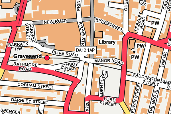
DA12 1AP lies on Railway Place in Gravesend. DA12 1AP is located in the Town electoral ward, within the local authority district of Gravesham and the English Parliamentary constituency of Gravesham. The Sub Integrated Care Board (ICB) Location is NHS Kent and Medway ICB - 91Q and the police force is Kent. This postcode has been in use since January 1980.


GetTheData
Source: OS OpenMap – Local (Ordnance Survey)
Source: OS VectorMap District (Ordnance Survey)
Licence: Open Government Licence (requires attribution)
| Easting | 564737 |
| Northing | 174030 |
| Latitude | 51.441310 |
| Longitude | 0.368973 |
GetTheData
Source: Open Postcode Geo
Licence: Open Government Licence
| Street | Railway Place |
| Town/City | Gravesend |
| Country | England |
| Postcode District | DA12 |
| ➜ DA12 open data dashboard ➜ See where DA12 is on a map ➜ Where is Gravesend? | |
GetTheData
Source: Land Registry Price Paid Data
Licence: Open Government Licence
Elevation or altitude of DA12 1AP as distance above sea level:
| Metres | Feet | |
|---|---|---|
| Elevation | 20m | 66ft |
Elevation is measured from the approximate centre of the postcode, to the nearest point on an OS contour line from OS Terrain 50, which has contour spacing of ten vertical metres.
➜ How high above sea level am I? Find the elevation of your current position using your device's GPS.
GetTheData
Source: Open Postcode Elevation
Licence: Open Government Licence
| Ward | Town |
| Constituency | Gravesham |
GetTheData
Source: ONS Postcode Database
Licence: Open Government Licence
| January 2024 | Anti-social behaviour | On or near West Crescent Road | 305m |
| January 2024 | Burglary | On or near West Crescent Road | 305m |
| January 2024 | Anti-social behaviour | On or near White Hart Yard | 333m |
| ➜ Railway Place crime map and outcomes | |||
GetTheData
Source: data.police.uk
Licence: Open Government Licence
| Stone Street | Gravesend | 59m |
| Gravesend Railway Station (Clive Road) | Gravesend | 98m |
| Gravesend Railway Station (Clive Road) | Gravesend | 117m |
| Gravesend Railway Station (Clive Road) | Gravesend | 134m |
| King Street | Gravesend | 136m |
| Gravesend Station | 0.2km |
| Tilbury Town Station | 2.6km |
| Northfleet Station | 3.1km |
GetTheData
Source: NaPTAN
Licence: Open Government Licence
| Percentage of properties with Next Generation Access | 100.0% |
| Percentage of properties with Superfast Broadband | 100.0% |
| Percentage of properties with Ultrafast Broadband | 100.0% |
| Percentage of properties with Full Fibre Broadband | 0.0% |
Superfast Broadband is between 30Mbps and 300Mbps
Ultrafast Broadband is > 300Mbps
| Percentage of properties unable to receive 2Mbps | 0.0% |
| Percentage of properties unable to receive 5Mbps | 0.0% |
| Percentage of properties unable to receive 10Mbps | 0.0% |
| Percentage of properties unable to receive 30Mbps | 0.0% |
GetTheData
Source: Ofcom
Licence: Ofcom Terms of Use (requires attribution)
GetTheData
Source: ONS Postcode Database
Licence: Open Government Licence


➜ Get more ratings from the Food Standards Agency
GetTheData
Source: Food Standards Agency
Licence: FSA terms & conditions
| Last Collection | |||
|---|---|---|---|
| Location | Mon-Fri | Sat | Distance |
| Woodville Gardens | 18:30 | 11:00 | 43m |
| New Road Old Post Office | 18:30 | 11:00 | 130m |
| New Road Post Office | 18:30 | 12:00 | 130m |
GetTheData
Source: Dracos
Licence: Creative Commons Attribution-ShareAlike
| Facility | Distance |
|---|---|
| Puregym (Gravesend) New Road, New Road, Gravesend Health and Fitness Gym | 180m |
| Nrg Gym (Gravesend) Garrick Street, Gravesend Health and Fitness Gym | 219m |
| Shapers (Gravesend) Milton Road, Gravesend Health and Fitness Gym | 251m |
GetTheData
Source: Active Places
Licence: Open Government Licence
| School | Phase of Education | Distance |
|---|---|---|
| Pier View Academy 42-44 Harmer Street, Gravesend, DA12 2AX | Not applicable | 323m |
| Bronte School 7 Pelham Road, Gravesend, DA11 0HN | Not applicable | 413m |
| Wrotham Road Primary School Wrotham Road, Gravesend, DA11 0QF | Primary | 482m |
GetTheData
Source: Edubase
Licence: Open Government Licence
The below table lists the International Territorial Level (ITL) codes (formerly Nomenclature of Territorial Units for Statistics (NUTS) codes) and Local Administrative Units (LAU) codes for DA12 1AP:
| ITL 1 Code | Name |
|---|---|
| TLJ | South East (England) |
| ITL 2 Code | Name |
| TLJ4 | Kent |
| ITL 3 Code | Name |
| TLJ43 | Kent Thames Gateway |
| LAU 1 Code | Name |
| E07000109 | Gravesham |
GetTheData
Source: ONS Postcode Directory
Licence: Open Government Licence
The below table lists the Census Output Area (OA), Lower Layer Super Output Area (LSOA), and Middle Layer Super Output Area (MSOA) for DA12 1AP:
| Code | Name | |
|---|---|---|
| OA | E00123315 | |
| LSOA | E01032799 | Gravesham 002F |
| MSOA | E02005056 | Gravesham 002 |
GetTheData
Source: ONS Postcode Directory
Licence: Open Government Licence
| DA12 1AH | Windmill Street | 55m |
| DA11 0NH | Stone Street | 57m |
| DA12 1AD | Windmill Street | 57m |
| DA11 0NP | Stone Street | 59m |
| DA12 1AA | Manor Road | 87m |
| DA12 1AS | Windmill Street | 103m |
| DA12 1EW | Parrock Street | 124m |
| DA12 2DU | King Street | 134m |
| DA11 0AF | New Road | 135m |
| DA11 0HP | Rathmore Road | 136m |
GetTheData
Source: Open Postcode Geo; Land Registry Price Paid Data
Licence: Open Government Licence