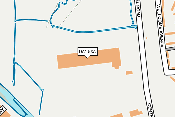
DA1 5XA is located in the Town electoral ward, within the local authority district of Dartford and the English Parliamentary constituency of Dartford. The Sub Integrated Care Board (ICB) Location is NHS Kent and Medway ICB - 91Q and the police force is Kent. This postcode has been in use since October 2016.


GetTheData
Source: OS OpenMap – Local (Ordnance Survey)
Source: OS VectorMap District (Ordnance Survey)
Licence: Open Government Licence (requires attribution)
| Easting | 554247 |
| Northing | 175139 |
| Latitude | 51.454225 |
| Longitude | 0.218643 |
GetTheData
Source: Open Postcode Geo
Licence: Open Government Licence
| Country | England |
| Postcode District | DA1 |
➜ See where DA1 is on a map ➜ Where is Dartford? | |
GetTheData
Source: Land Registry Price Paid Data
Licence: Open Government Licence
Elevation or altitude of DA1 5XA as distance above sea level:
| Metres | Feet | |
|---|---|---|
| Elevation | 10m | 33ft |
Elevation is measured from the approximate centre of the postcode, to the nearest point on an OS contour line from OS Terrain 50, which has contour spacing of ten vertical metres.
➜ How high above sea level am I? Find the elevation of your current position using your device's GPS.
GetTheData
Source: Open Postcode Elevation
Licence: Open Government Licence
| Ward | Town |
| Constituency | Dartford |
GetTheData
Source: ONS Postcode Database
Licence: Open Government Licence
| Wellcome Avenue (Trevithick Drive) | Temple Hill | 336m |
| Wellcome Avenue (Trevithick Drive) | Temple Hill | 422m |
| Hall Road (Trevithick Drive) | Temple Hill | 496m |
| Salmon Road (Joyce Green Lane) | Temple Hill | 534m |
| Joyce Green Lane South End (Trevithick Drive) | Temple Hill | 537m |
| Dartford Station | 0.8km |
| Slade Green Station | 2.5km |
| Crayford Station | 2.8km |
GetTheData
Source: NaPTAN
Licence: Open Government Licence
GetTheData
Source: ONS Postcode Database
Licence: Open Government Licence


➜ Get more ratings from the Food Standards Agency
GetTheData
Source: Food Standards Agency
Licence: FSA terms & conditions
| Last Collection | |||
|---|---|---|---|
| Location | Mon-Fri | Sat | Distance |
| Bean Road | 17:30 | 11:15 | 329m |
| Joyce Green Lane | 17:30 | 11:00 | 620m |
| Temple Hill Post Office | 17:30 | 12:00 | 739m |
GetTheData
Source: Dracos
Licence: Creative Commons Attribution-ShareAlike
| Risk of DA1 5XA flooding from rivers and sea | Very Low |
| ➜ DA1 5XA flood map | |
GetTheData
Source: Open Flood Risk by Postcode
Licence: Open Government Licence
The below table lists the International Territorial Level (ITL) codes (formerly Nomenclature of Territorial Units for Statistics (NUTS) codes) and Local Administrative Units (LAU) codes for DA1 5XA:
| ITL 1 Code | Name |
|---|---|
| TLJ | South East (England) |
| ITL 2 Code | Name |
| TLJ4 | Kent |
| ITL 3 Code | Name |
| TLJ43 | Kent Thames Gateway |
| LAU 1 Code | Name |
| E07000107 | Dartford |
GetTheData
Source: ONS Postcode Directory
Licence: Open Government Licence
The below table lists the Census Output Area (OA), Lower Layer Super Output Area (LSOA), and Middle Layer Super Output Area (MSOA) for DA1 5XA:
| Code | Name | |
|---|---|---|
| OA | E00122591 | |
| LSOA | E01024148 | Dartford 001A |
| MSOA | E02005028 | Dartford 001 |
GetTheData
Source: ONS Postcode Directory
Licence: Open Government Licence
| DA1 5BS | Riverside Industrial Estate | 223m |
| DA1 5JJ | Farthing Close | 286m |
| DA1 5JW | Wellcome Avenue | 302m |
| DA1 5JN | Wellcome Avenue | 306m |
| DA1 5LL | Trevithick Drive | 358m |
| DA1 2TJ | Kenwyn Road | 359m |
| DA1 2TH | Kenwyn Road | 369m |
| DA1 2FA | Creek Mill Way | 376m |
| DA1 5LN | Trevithick Drive | 380m |
| DA1 2FB | Creek Mill Way | 381m |
GetTheData
Source: Open Postcode Geo; Land Registry Price Paid Data
Licence: Open Government Licence