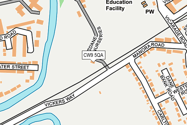
CW9 5QA is located in the Northwich Witton electoral ward, within the unitary authority of Cheshire West and Chester and the English Parliamentary constituency of Weaver Vale. The Sub Integrated Care Board (ICB) Location is NHS Cheshire and Merseyside ICB - 27D and the police force is Cheshire. This postcode has been in use since January 1980.


GetTheData
Source: OS OpenMap – Local (Ordnance Survey)
Source: OS VectorMap District (Ordnance Survey)
Licence: Open Government Licence (requires attribution)
| Easting | 366280 |
| Northing | 373498 |
| Latitude | 53.257423 |
| Longitude | -2.506912 |
GetTheData
Source: Open Postcode Geo
Licence: Open Government Licence
| Country | England |
| Postcode District | CW9 |
➜ See where CW9 is on a map ➜ Where is Northwich? | |
GetTheData
Source: Land Registry Price Paid Data
Licence: Open Government Licence
Elevation or altitude of CW9 5QA as distance above sea level:
| Metres | Feet | |
|---|---|---|
| Elevation | 20m | 66ft |
Elevation is measured from the approximate centre of the postcode, to the nearest point on an OS contour line from OS Terrain 50, which has contour spacing of ten vertical metres.
➜ How high above sea level am I? Find the elevation of your current position using your device's GPS.
GetTheData
Source: Open Postcode Elevation
Licence: Open Government Licence
| Ward | Northwich Witton |
| Constituency | Weaver Vale |
GetTheData
Source: ONS Postcode Database
Licence: Open Government Licence
| Memorial Hall Alighting Only (Chester Way) | Northwich | 461m |
| Railway Arch (London Road) | Northwich | 470m |
| Police Station (Chester Way) | Northwich | 474m |
| Railway Arch (London Road) | Northwich | 483m |
| Waitrose (Dane Street) | Northwich | 488m |
| Northwich Station | 0.8km |
| Greenbank Station | 1.9km |
| Lostock Gralam Station | 3km |
GetTheData
Source: NaPTAN
Licence: Open Government Licence
GetTheData
Source: ONS Postcode Database
Licence: Open Government Licence

➜ Get more ratings from the Food Standards Agency
GetTheData
Source: Food Standards Agency
Licence: FSA terms & conditions
| Last Collection | |||
|---|---|---|---|
| Location | Mon-Fri | Sat | Distance |
| London Road | 17:30 | 11:00 | 108m |
| Hartford Road | 17:30 | 08:00 | 677m |
| Winnington Hill | 17:45 | 11:00 | 688m |
GetTheData
Source: Dracos
Licence: Creative Commons Attribution-ShareAlike
| Risk of CW9 5QA flooding from rivers and sea | Low |
| ➜ CW9 5QA flood map | |
GetTheData
Source: Open Flood Risk by Postcode
Licence: Open Government Licence
The below table lists the International Territorial Level (ITL) codes (formerly Nomenclature of Territorial Units for Statistics (NUTS) codes) and Local Administrative Units (LAU) codes for CW9 5QA:
| ITL 1 Code | Name |
|---|---|
| TLD | North West (England) |
| ITL 2 Code | Name |
| TLD6 | Cheshire |
| ITL 3 Code | Name |
| TLD63 | Cheshire West and Chester |
| LAU 1 Code | Name |
| E06000050 | Cheshire West and Chester |
GetTheData
Source: ONS Postcode Directory
Licence: Open Government Licence
The below table lists the Census Output Area (OA), Lower Layer Super Output Area (LSOA), and Middle Layer Super Output Area (MSOA) for CW9 5QA:
| Code | Name | |
|---|---|---|
| OA | E00094478 | |
| LSOA | E01018717 | Cheshire West and Chester 021D |
| MSOA | E02003882 | Cheshire West and Chester 021 |
GetTheData
Source: ONS Postcode Directory
Licence: Open Government Licence
| CW9 5PG | Carlton Road | 165m |
| CW9 5QB | Whalley Road | 222m |
| CW9 5PJ | Dane Bank Road | 228m |
| CW9 5HU | Drillfield Road | 229m |
| CW9 5PF | Manora Road | 234m |
| CW9 5QE | Priory Street | 246m |
| CW9 5HT | Drillfield Road | 256m |
| CW9 5HP | Water Street | 261m |
| CW9 5QF | School Way | 268m |
| CW9 5JA | Chester Way | 285m |
GetTheData
Source: Open Postcode Geo; Land Registry Price Paid Data
Licence: Open Government Licence