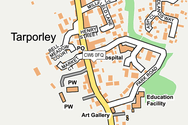
CW6 0FQ is located in the Tarporley electoral ward, within the unitary authority of Cheshire West and Chester and the English Parliamentary constituency of Eddisbury. The Sub Integrated Care Board (ICB) Location is NHS Cheshire and Merseyside ICB - 27D and the police force is Cheshire. This postcode has been in use since June 2000.


GetTheData
Source: OS OpenMap – Local (Ordnance Survey)
Source: OS VectorMap District (Ordnance Survey)
Licence: Open Government Licence (requires attribution)
| Easting | 355415 |
| Northing | 362612 |
| Latitude | 53.158773 |
| Longitude | -2.668241 |
GetTheData
Source: Open Postcode Geo
Licence: Open Government Licence
| Country | England |
| Postcode District | CW6 |
| ➜ CW6 open data dashboard ➜ See where CW6 is on a map ➜ Where is Tarporley? | |
GetTheData
Source: Land Registry Price Paid Data
Licence: Open Government Licence
Elevation or altitude of CW6 0FQ as distance above sea level:
| Metres | Feet | |
|---|---|---|
| Elevation | 90m | 295ft |
Elevation is measured from the approximate centre of the postcode, to the nearest point on an OS contour line from OS Terrain 50, which has contour spacing of ten vertical metres.
➜ How high above sea level am I? Find the elevation of your current position using your device's GPS.
GetTheData
Source: Open Postcode Elevation
Licence: Open Government Licence
| Ward | Tarporley |
| Constituency | Eddisbury |
GetTheData
Source: ONS Postcode Database
Licence: Open Government Licence
| June 2022 | Criminal damage and arson | On or near Parking Area | 267m |
| June 2022 | Other theft | On or near Petrol Station | 411m |
| May 2022 | Public order | On or near Supermarket | 133m |
| ➜ Get more crime data in our Crime section | |||
GetTheData
Source: data.police.uk
Licence: Open Government Licence
| Shops (High Street) | Tarporley | 9m |
| Rising Sun Ph (High Street) | Tarporley | 128m |
| Community Centre (High Street) | Tarporley | 321m |
| Community Centre (High Street) | Tarporley | 363m |
| Utkinton Road (High Street) | Tarporley | 364m |
GetTheData
Source: NaPTAN
Licence: Open Government Licence
GetTheData
Source: ONS Postcode Database
Licence: Open Government Licence


➜ Get more ratings from the Food Standards Agency
GetTheData
Source: Food Standards Agency
Licence: FSA terms & conditions
| Last Collection | |||
|---|---|---|---|
| Location | Mon-Fri | Sat | Distance |
| Portal | 16:00 | 09:30 | 993m |
| Bunbury Locks | 16:00 | 07:00 | 4,257m |
| Hilbre Bank | 16:00 | 10:30 | 4,351m |
GetTheData
Source: Dracos
Licence: Creative Commons Attribution-ShareAlike
| Facility | Distance |
|---|---|
| Tarporley Tennis Club High Street, Tarporley Outdoor Tennis Courts | 69m |
| Tarporley Ce Primary School Park Road, Tarporley Grass Pitches | 194m |
| Tarporley & District Community Centre High Street, Tarporley Grass Pitches, Sports Hall | 380m |
GetTheData
Source: Active Places
Licence: Open Government Licence
| School | Phase of Education | Distance |
|---|---|---|
| Tarporley CofE Primary School Park Road, Tarporley, CW6 0AN | Primary | 190m |
| Tarporley High School and Sixth Form College Eaton Road, Tarporley, CW6 0BL | Secondary | 618m |
| Eaton Primary School Lower Lane, Eaton, Tarporley, CW6 9AN | Primary | 2.3km |
GetTheData
Source: Edubase
Licence: Open Government Licence
The below table lists the International Territorial Level (ITL) codes (formerly Nomenclature of Territorial Units for Statistics (NUTS) codes) and Local Administrative Units (LAU) codes for CW6 0FQ:
| ITL 1 Code | Name |
|---|---|
| TLD | North West (England) |
| ITL 2 Code | Name |
| TLD6 | Cheshire |
| ITL 3 Code | Name |
| TLD63 | Cheshire West and Chester |
| LAU 1 Code | Name |
| E06000050 | Cheshire West and Chester |
GetTheData
Source: ONS Postcode Directory
Licence: Open Government Licence
The below table lists the Census Output Area (OA), Lower Layer Super Output Area (LSOA), and Middle Layer Super Output Area (MSOA) for CW6 0FQ:
| Code | Name | |
|---|---|---|
| OA | E00094523 | |
| LSOA | E01018724 | Cheshire West and Chester 045C |
| MSOA | E02003891 | Cheshire West and Chester 045 |
GetTheData
Source: ONS Postcode Directory
Licence: Open Government Licence
| CW6 0AB | High Street | 44m |
| CW6 0AH | Market Court | 71m |
| CW6 0AJ | Church Walk | 83m |
| CW6 0AN | Park Road | 90m |
| CW6 0DT | Bell Meadow Court | 107m |
| CW6 0DS | Henry Street | 110m |
| CW6 0AL | Rathbone Park | 124m |
| CW6 0UW | Chestnut Terrace | 134m |
| CW6 0UN | Chestnut Court | 137m |
| CW6 0DP | High Street | 156m |
GetTheData
Source: Open Postcode Geo; Land Registry Price Paid Data
Licence: Open Government Licence