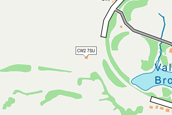
CW2 7SU is located in the Crewe West electoral ward, within the unitary authority of Cheshire East and the English Parliamentary constituency of Crewe and Nantwich. The Sub Integrated Care Board (ICB) Location is NHS Cheshire and Merseyside ICB - 27D and the police force is Cheshire. This postcode has been in use since July 1986.


GetTheData
Source: OS OpenMap – Local (Ordnance Survey)
Source: OS VectorMap District (Ordnance Survey)
Licence: Open Government Licence (requires attribution)
| Easting | 368416 |
| Northing | 355586 |
| Latitude | 53.096536 |
| Longitude | -2.473121 |
GetTheData
Source: Open Postcode Geo
Licence: Open Government Licence
| Country | England |
| Postcode District | CW2 |
| ➜ CW2 open data dashboard ➜ See where CW2 is on a map ➜ Where is Crewe? | |
GetTheData
Source: Land Registry Price Paid Data
Licence: Open Government Licence
Elevation or altitude of CW2 7SU as distance above sea level:
| Metres | Feet | |
|---|---|---|
| Elevation | 40m | 131ft |
Elevation is measured from the approximate centre of the postcode, to the nearest point on an OS contour line from OS Terrain 50, which has contour spacing of ten vertical metres.
➜ How high above sea level am I? Find the elevation of your current position using your device's GPS.
GetTheData
Source: Open Postcode Elevation
Licence: Open Government Licence
| Ward | Crewe West |
| Constituency | Crewe And Nantwich |
GetTheData
Source: ONS Postcode Database
Licence: Open Government Licence
| January 2024 | Violence and sexual offences | On or near Sandon Park Gardens | 493m |
| August 2023 | Anti-social behaviour | On or near Park/Open Space | 307m |
| July 2023 | Violence and sexual offences | On or near Park/Open Space | 307m |
| ➜ Get more crime data in our Crime section | |||
GetTheData
Source: data.police.uk
Licence: Open Government Licence
| White Avenue (Victoria Avenue) | Crewe | 341m |
| White Avenue (Victoria Avenue) | Crewe | 357m |
| Queens Park Gates (Victoria Avenue) | Crewe | 424m |
| Queens Park Gates (Victoria Avenue) | Crewe | 432m |
| Victoria Avenue (West Street) | Crewe | 442m |
| Crewe Station | 2.8km |
| Nantwich Station | 4.8km |
GetTheData
Source: NaPTAN
Licence: Open Government Licence
GetTheData
Source: ONS Postcode Database
Licence: Open Government Licence


➜ Get more ratings from the Food Standards Agency
GetTheData
Source: Food Standards Agency
Licence: FSA terms & conditions
| Last Collection | |||
|---|---|---|---|
| Location | Mon-Fri | Sat | Distance |
| Marshfield Bank | 17:30 | 12:15 | 406m |
| Alton Street West | 17:15 | 12:30 | 643m |
| Aldersey Road | 17:15 | 12:30 | 670m |
GetTheData
Source: Dracos
Licence: Creative Commons Attribution-ShareAlike
| Facility | Distance |
|---|---|
| Queens Park Golf Club Queens Park Drive, Crewe Golf | 0m |
| Simply Gym (Crewe) West Street, Crewe Health and Fitness Gym, Studio | 335m |
| King George V Playing Fields (Crewe) West Street, Crewe Grass Pitches | 357m |
GetTheData
Source: Active Places
Licence: Open Government Licence
| School | Phase of Education | Distance |
|---|---|---|
| The Axis Academy Lodgefields Drive, Crewe, CW2 8TU | Not applicable | 347m |
| Wistaston Academy Moreton Road, Crewe, CW2 8QS | Primary | 781m |
| The Oaks Academy Buchan Grove, Crewe, CW2 7NQ | Secondary | 1.2km |
GetTheData
Source: Edubase
Licence: Open Government Licence
The below table lists the International Territorial Level (ITL) codes (formerly Nomenclature of Territorial Units for Statistics (NUTS) codes) and Local Administrative Units (LAU) codes for CW2 7SU:
| ITL 1 Code | Name |
|---|---|
| TLD | North West (England) |
| ITL 2 Code | Name |
| TLD6 | Cheshire |
| ITL 3 Code | Name |
| TLD62 | Cheshire East |
| LAU 1 Code | Name |
| E06000049 | Cheshire East |
GetTheData
Source: ONS Postcode Directory
Licence: Open Government Licence
The below table lists the Census Output Area (OA), Lower Layer Super Output Area (LSOA), and Middle Layer Super Output Area (MSOA) for CW2 7SU:
| Code | Name | |
|---|---|---|
| OA | E00093271 | |
| LSOA | E01018483 | Cheshire East 037B |
| MSOA | E02003828 | Cheshire East 037 |
GetTheData
Source: ONS Postcode Directory
Licence: Open Government Licence
| CW2 7SW | Queens Park Gardens | 294m |
| CW2 7SN | Queens Park Drive | 316m |
| CW2 7SB | Queens Park Drive | 321m |
| CW2 8TY | Oakwood Crescent | 352m |
| CW2 8PB | Gawsworth Avenue | 364m |
| CW2 7SQ | Victoria Avenue | 373m |
| CW2 8SJ | West Street | 378m |
| CW2 8TX | Mossdale Close | 379m |
| CW2 8TU | Lodgefields Drive | 391m |
| CW2 8NZ | Old Gorse Close | 411m |
GetTheData
Source: Open Postcode Geo; Land Registry Price Paid Data
Licence: Open Government Licence