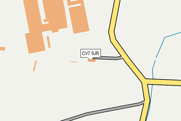
CV7 9JR is located in the Revel and Binley Woods electoral ward, within the local authority district of Rugby and the English Parliamentary constituency of Rugby. The Sub Integrated Care Board (ICB) Location is NHS Coventry and Warwickshire ICB - B2M3M and the police force is Warwickshire. This postcode has been in use since December 1996.


GetTheData
Source: OS OpenMap – Local (Ordnance Survey)
Source: OS VectorMap District (Ordnance Survey)
Licence: Open Government Licence (requires attribution)
| Easting | 440692 |
| Northing | 280840 |
| Latitude | 52.424040 |
| Longitude | -1.403030 |
GetTheData
Source: Open Postcode Geo
Licence: Open Government Licence
| Country | England |
| Postcode District | CV7 |
| ➜ CV7 open data dashboard ➜ See where CV7 is on a map | |
GetTheData
Source: Land Registry Price Paid Data
Licence: Open Government Licence
Elevation or altitude of CV7 9JR as distance above sea level:
| Metres | Feet | |
|---|---|---|
| Elevation | 80m | 262ft |
Elevation is measured from the approximate centre of the postcode, to the nearest point on an OS contour line from OS Terrain 50, which has contour spacing of ten vertical metres.
➜ How high above sea level am I? Find the elevation of your current position using your device's GPS.
GetTheData
Source: Open Postcode Elevation
Licence: Open Government Licence
| Ward | Revel And Binley Woods |
| Constituency | Rugby |
GetTheData
Source: ONS Postcode Database
Licence: Open Government Licence
| Bus Park (Brinklow Road) | Coombe Abbey | 1,244m |
| Ansty Park | Walsgrave | 1,579m |
GetTheData
Source: NaPTAN
Licence: Open Government Licence
GetTheData
Source: ONS Postcode Database
Licence: Open Government Licence


➜ Get more ratings from the Food Standards Agency
GetTheData
Source: Food Standards Agency
Licence: FSA terms & conditions
| Last Collection | |||
|---|---|---|---|
| Location | Mon-Fri | Sat | Distance |
| Brade Drive | 17:00 | 09:45 | 2,259m |
| Walsgrave Hospital Main | 17:30 | 10:15 | 2,364m |
| Athol Road | 17:00 | 09:45 | 2,488m |
GetTheData
Source: Dracos
Licence: Creative Commons Attribution-ShareAlike
| Facility | Distance |
|---|---|
| Spirit Health Club (Coventry) (Closed) Hinckley Road, Walsgrave On Sowe, Coventry Swimming Pool, Health and Fitness Gym | 2.3km |
| Walsgrave Hospital Sports Fields (Closed) Clifford Bridge Road, Walsgrave, Coventry Grass Pitches | 2.3km |
| Doubletree By Hilton Paradise Way, Coventry Walsgrave Triangle, Coventry Health and Fitness Gym, Swimming Pool | 2.5km |
GetTheData
Source: Active Places
Licence: Open Government Licence
| School | Phase of Education | Distance |
|---|---|---|
| Seva School Link House, Eden Road, Walsgrave Triangle, Coventry, CV2 2TB | All-through | 2.5km |
| Pearl Hyde Community Primary School Dorchester Way, Clifford Park, Coventry, CV2 2NB | Primary | 2.6km |
| Walsgrave Church of England Academy School House Lane, Coventry, CV2 2BA | Primary | 2.6km |
GetTheData
Source: Edubase
Licence: Open Government Licence
The below table lists the International Territorial Level (ITL) codes (formerly Nomenclature of Territorial Units for Statistics (NUTS) codes) and Local Administrative Units (LAU) codes for CV7 9JR:
| ITL 1 Code | Name |
|---|---|
| TLG | West Midlands (England) |
| ITL 2 Code | Name |
| TLG1 | Herefordshire, Worcestershire and Warwickshire |
| ITL 3 Code | Name |
| TLG13 | Warwickshire CC |
| LAU 1 Code | Name |
| E07000220 | Rugby |
GetTheData
Source: ONS Postcode Directory
Licence: Open Government Licence
The below table lists the Census Output Area (OA), Lower Layer Super Output Area (LSOA), and Middle Layer Super Output Area (MSOA) for CV7 9JR:
| Code | Name | |
|---|---|---|
| OA | E00158822 | |
| LSOA | E01031159 | Rugby 001C |
| MSOA | E02006492 | Rugby 001 |
GetTheData
Source: ONS Postcode Directory
Licence: Open Government Licence
| CV2 2DR | Peter Hall Lane | 333m |
| CV7 9JP | Coombe Fields Road | 1103m |
| CV3 2AB | Brinklow Road | 1393m |
| CV2 2DU | Smeaton Lane | 1549m |
| CV7 9JL | Brinklow Road | 1878m |
| CV23 0NQ | Walkers Terrace | 1943m |
| CV2 2BQ | Barrow Close | 2086m |
| CV2 2BJ | Fitzroy Close | 2116m |
| CV2 2BP | Barrow Close | 2125m |
| CV2 2DQ | Osprey Close | 2125m |
GetTheData
Source: Open Postcode Geo; Land Registry Price Paid Data
Licence: Open Government Licence