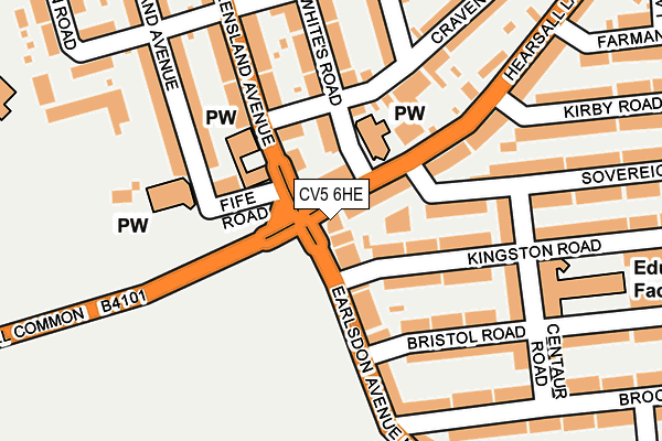
CV5 6HE is located in the Whoberley electoral ward, within the metropolitan district of Coventry and the English Parliamentary constituency of Coventry North West. The Sub Integrated Care Board (ICB) Location is NHS Coventry and Warwickshire ICB - B2M3M and the police force is West Midlands. This postcode has been in use since June 2000.


GetTheData
Source: OS OpenMap – Local (Ordnance Survey)
Source: OS VectorMap District (Ordnance Survey)
Licence: Open Government Licence (requires attribution)
| Easting | 431737 |
| Northing | 278637 |
| Latitude | 52.404827 |
| Longitude | -1.534920 |
GetTheData
Source: Open Postcode Geo
Licence: Open Government Licence
| Country | England |
| Postcode District | CV5 |
| ➜ CV5 open data dashboard ➜ See where CV5 is on a map ➜ Where is Coventry? | |
GetTheData
Source: Land Registry Price Paid Data
Licence: Open Government Licence
Elevation or altitude of CV5 6HE as distance above sea level:
| Metres | Feet | |
|---|---|---|
| Elevation | 100m | 328ft |
Elevation is measured from the approximate centre of the postcode, to the nearest point on an OS contour line from OS Terrain 50, which has contour spacing of ten vertical metres.
➜ How high above sea level am I? Find the elevation of your current position using your device's GPS.
GetTheData
Source: Open Postcode Elevation
Licence: Open Government Licence
| Ward | Whoberley |
| Constituency | Coventry North West |
GetTheData
Source: ONS Postcode Database
Licence: Open Government Licence
| October 2023 | Vehicle crime | On or near Maudslay Road | 500m |
| October 2023 | Vehicle crime | On or near Maudslay Road | 500m |
| October 2023 | Vehicle crime | On or near Maudslay Road | 500m |
| ➜ Get more crime data in our Crime section | |||
GetTheData
Source: data.police.uk
Licence: Open Government Licence
| Hearsall Common (Earlsdon Ave Nth) | Earlsdon | 35m |
| Earlsdon Ave North (Hearsall Common) | Chapel Fields | 57m |
| Hearsall Common (Earlsdon Ave Nth) | Earlsdon | 91m |
| Earlsdon Ave North (Hearsall Common) | Chapel Fields | 91m |
| Queensland Avenue (Hearsall Lane) | Spon End | 107m |
| Canley Station | 1.1km |
| Coventry Station | 1.5km |
| Tile Hill Station | 4.4km |
GetTheData
Source: NaPTAN
Licence: Open Government Licence
GetTheData
Source: ONS Postcode Database
Licence: Open Government Licence


➜ Get more ratings from the Food Standards Agency
GetTheData
Source: Food Standards Agency
Licence: FSA terms & conditions
| Last Collection | |||
|---|---|---|---|
| Location | Mon-Fri | Sat | Distance |
| Bristol Road | 18:15 | 11:00 | 121m |
| Melbourne Road | 18:15 | 09:45 | 380m |
| Broomfield Road Post Office | 18:15 | 11:15 | 399m |
GetTheData
Source: Dracos
Licence: Creative Commons Attribution-ShareAlike
| Facility | Distance |
|---|---|
| All Souls Catholic Primary School Abercorn Road, Coventry Grass Pitches | 332m |
| Coventry Cycle Speedway Track Maudslay Road, Coventry Cycling | 429m |
| Coventry Rfc (Butts Park Arena) Butts, Coventry Grass Pitches, Artificial Grass Pitch | 627m |
GetTheData
Source: Active Places
Licence: Open Government Licence
| School | Phase of Education | Distance |
|---|---|---|
| Hearsall Community Academy Kingston Road, Coventry, CV5 6LR | Primary | 204m |
| All Souls' Catholic Primary School Abercorn Road, Chapelfields, Coventry, CV5 8ED | Primary | 221m |
| Earlsdon Primary School Earlsdon Avenue North, Coventry, CV5 6FZ | Primary | 566m |
GetTheData
Source: Edubase
Licence: Open Government Licence
The below table lists the International Territorial Level (ITL) codes (formerly Nomenclature of Territorial Units for Statistics (NUTS) codes) and Local Administrative Units (LAU) codes for CV5 6HE:
| ITL 1 Code | Name |
|---|---|
| TLG | West Midlands (England) |
| ITL 2 Code | Name |
| TLG3 | West Midlands |
| ITL 3 Code | Name |
| TLG33 | Coventry |
| LAU 1 Code | Name |
| E08000026 | Coventry |
GetTheData
Source: ONS Postcode Directory
Licence: Open Government Licence
The below table lists the Census Output Area (OA), Lower Layer Super Output Area (LSOA), and Middle Layer Super Output Area (MSOA) for CV5 6HE:
| Code | Name | |
|---|---|---|
| OA | E00049052 | |
| LSOA | E01009690 | Coventry 030C |
| MSOA | E02001987 | Coventry 030 |
GetTheData
Source: ONS Postcode Directory
Licence: Open Government Licence
| CV5 6HJ | Hearsall Lane | 34m |
| CV5 6GX | Earlsdon Avenue North | 83m |
| CV5 6LP | Kingston Road | 97m |
| CV5 8FD | Fife Road | 101m |
| CV5 6LN | Kingston Road | 107m |
| CV5 6LT | Sovereign Road | 111m |
| CV5 8DR | Sir Thomas Whites Road | 133m |
| CV5 8FG | Queensland Avenue | 141m |
| CV5 6LH | Bristol Road | 141m |
| CV5 6LX | Centaur Road | 158m |
GetTheData
Source: Open Postcode Geo; Land Registry Price Paid Data
Licence: Open Government Licence