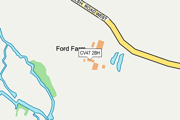
CV47 2BH is located in the Southam West electoral ward, within the local authority district of Stratford-on-Avon and the English Parliamentary constituency of Kenilworth and Southam. The Sub Integrated Care Board (ICB) Location is NHS Coventry and Warwickshire ICB - B2M3M and the police force is Warwickshire. This postcode has been in use since December 1999.


GetTheData
Source: OS OpenMap – Local (Ordnance Survey)
Source: OS VectorMap District (Ordnance Survey)
Licence: Open Government Licence (requires attribution)
| Easting | 440761 |
| Northing | 262381 |
| Latitude | 52.258110 |
| Longitude | -1.404237 |
GetTheData
Source: Open Postcode Geo
Licence: Open Government Licence
| Country | England |
| Postcode District | CV47 |
| ➜ CV47 open data dashboard ➜ See where CV47 is on a map | |
GetTheData
Source: Land Registry Price Paid Data
Licence: Open Government Licence
Elevation or altitude of CV47 2BH as distance above sea level:
| Metres | Feet | |
|---|---|---|
| Elevation | 80m | 262ft |
Elevation is measured from the approximate centre of the postcode, to the nearest point on an OS contour line from OS Terrain 50, which has contour spacing of ten vertical metres.
➜ How high above sea level am I? Find the elevation of your current position using your device's GPS.
GetTheData
Source: Open Postcode Elevation
Licence: Open Government Licence
| Ward | Southam West |
| Constituency | Kenilworth And Southam |
GetTheData
Source: ONS Postcode Database
Licence: Open Government Licence
| February 2022 | Violence and sexual offences | On or near Bascote Rise | 415m |
| February 2022 | Violence and sexual offences | On or near Bascote Rise | 415m |
| December 2021 | Other theft | On or near Gorse Lea | 436m |
| ➜ Get more crime data in our Crime section | |||
GetTheData
Source: data.police.uk
Licence: Open Government Licence
| Mill Crescent (Mill Road) | Southam | 681m |
| Mill Road (Mill Crescent) | Southam | 732m |
| Southam College (Welsh Road West) | Southam | 739m |
| Southam Primary School (St James Road) | Southam | 865m |
| Southam Primary School (St James Road) | Southam | 905m |
GetTheData
Source: NaPTAN
Licence: Open Government Licence
GetTheData
Source: ONS Postcode Database
Licence: Open Government Licence


➜ Get more ratings from the Food Standards Agency
GetTheData
Source: Food Standards Agency
Licence: FSA terms & conditions
| Last Collection | |||
|---|---|---|---|
| Location | Mon-Fri | Sat | Distance |
| Warwick Road | 17:00 | 09:00 | 1,098m |
| Tollgate Road | 16:00 | 09:00 | 1,194m |
| Coventry Street Post Office | 18:00 | 11:30 | 1,222m |
GetTheData
Source: Dracos
Licence: Creative Commons Attribution-ShareAlike
| Facility | Distance |
|---|---|
| Southam Leisure Centre Welsh Road West, Southam Swimming Pool, Health and Fitness Gym, Studio | 577m |
| Southam College Welsh Road West, Southam Sports Hall, Grass Pitches, Artificial Grass Pitch, Outdoor Tennis Courts | 658m |
| Dallas Burston Polo Club Southam Grass Pitches | 854m |
GetTheData
Source: Active Places
Licence: Open Government Licence
| School | Phase of Education | Distance |
|---|---|---|
| Southam College Welsh Road West, Southam, CV47 0JW | Secondary | 688m |
| Southam Primary School St James Road, Southam, CV47 0QB | Primary | 904m |
| Southam St James CofE Academy Tollgate Road, Southam, CV47 1EE | Primary | 1.2km |
GetTheData
Source: Edubase
Licence: Open Government Licence
The below table lists the International Territorial Level (ITL) codes (formerly Nomenclature of Territorial Units for Statistics (NUTS) codes) and Local Administrative Units (LAU) codes for CV47 2BH:
| ITL 1 Code | Name |
|---|---|
| TLG | West Midlands (England) |
| ITL 2 Code | Name |
| TLG1 | Herefordshire, Worcestershire and Warwickshire |
| ITL 3 Code | Name |
| TLG13 | Warwickshire CC |
| LAU 1 Code | Name |
| E07000221 | Stratford-on-Avon |
GetTheData
Source: ONS Postcode Directory
Licence: Open Government Licence
The below table lists the Census Output Area (OA), Lower Layer Super Output Area (LSOA), and Middle Layer Super Output Area (MSOA) for CV47 2BH:
| Code | Name | |
|---|---|---|
| OA | E00159172 | |
| LSOA | E01031221 | Stratford-on-Avon 004C |
| MSOA | E02006507 | Stratford-on-Avon 004 |
GetTheData
Source: ONS Postcode Directory
Licence: Open Government Licence
| CV47 0LH | Old Ford Avenue | 398m |
| CV47 0LQ | Bascote Rise | 404m |
| CV47 0JP | Welsh Road West | 422m |
| CV47 0LG | Gorse Lea | 440m |
| CV47 0LF | Windmill Way | 482m |
| CV47 0LE | Glebe Road | 489m |
| CV47 0LA | Hillyard Road | 523m |
| CV47 0LB | Hill Top Close | 598m |
| CV47 0LD | Hillyard Road | 624m |
| CV47 0LW | Mill Crescent | 640m |
GetTheData
Source: Open Postcode Geo; Land Registry Price Paid Data
Licence: Open Government Licence