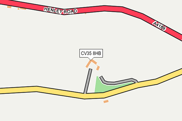
CV35 8HB is in Hampton On The Hill, Warwick. CV35 8HB is located in the Budbrooke electoral ward, within the local authority district of Warwick and the English Parliamentary constituency of Warwick and Leamington. The Sub Integrated Care Board (ICB) Location is NHS Coventry and Warwickshire ICB - B2M3M and the police force is Warwickshire. This postcode has been in use since January 1980.


GetTheData
Source: OS OpenMap – Local (Ordnance Survey)
Source: OS VectorMap District (Ordnance Survey)
Licence: Open Government Licence (requires attribution)
| Easting | 424718 |
| Northing | 263812 |
| Latitude | 52.271911 |
| Longitude | -1.639176 |
GetTheData
Source: Open Postcode Geo
Licence: Open Government Licence
| Locality | Hampton On The Hill |
| Town/City | Warwick |
| Country | England |
| Postcode District | CV35 |
| ➜ CV35 open data dashboard ➜ See where CV35 is on a map ➜ Where is Hampton on the Hill? | |
GetTheData
Source: Land Registry Price Paid Data
Licence: Open Government Licence
Elevation or altitude of CV35 8HB as distance above sea level:
| Metres | Feet | |
|---|---|---|
| Elevation | 80m | 262ft |
Elevation is measured from the approximate centre of the postcode, to the nearest point on an OS contour line from OS Terrain 50, which has contour spacing of ten vertical metres.
➜ How high above sea level am I? Find the elevation of your current position using your device's GPS.
GetTheData
Source: Open Postcode Elevation
Licence: Open Government Licence
| Ward | Budbrooke |
| Constituency | Warwick And Leamington |
GetTheData
Source: ONS Postcode Database
Licence: Open Government Licence
| Bus Shelter (Old School Lane) | Hampton On The Hill | 605m |
| Bus Shelter (Old School Lane) | Hampton On The Hill | 626m |
| Village Hall (Woodway) | Hampton On The Hill | 699m |
| Telephone Box (Woodway) | Hampton On The Hill | 823m |
| Littleworth Farm (Warwick Road) | Norton Lindsey | 1,012m |
| Warwick Parkway Station | 2.4km |
| Hatton (Warks) Station | 3.5km |
| Claverdon Station | 4km |
GetTheData
Source: NaPTAN
Licence: Open Government Licence
➜ Broadband speed and availability dashboard for CV35 8HB
| Percentage of properties with Next Generation Access | 100.0% |
| Percentage of properties with Superfast Broadband | 66.7% |
| Percentage of properties with Ultrafast Broadband | 0.0% |
| Percentage of properties with Full Fibre Broadband | 0.0% |
Superfast Broadband is between 30Mbps and 300Mbps
Ultrafast Broadband is > 300Mbps
| Median download speed | 30.3Mbps |
| Average download speed | 31.4Mbps |
| Maximum download speed | 37.50Mbps |
| Median upload speed | 4.6Mbps |
| Average upload speed | 5.0Mbps |
| Maximum upload speed | 8.07Mbps |
| Percentage of properties unable to receive 2Mbps | 0.0% |
| Percentage of properties unable to receive 5Mbps | 0.0% |
| Percentage of properties unable to receive 10Mbps | 0.0% |
| Percentage of properties unable to receive 30Mbps | 33.3% |
➜ Broadband speed and availability dashboard for CV35 8HB
GetTheData
Source: Ofcom
Licence: Ofcom Terms of Use (requires attribution)
GetTheData
Source: ONS Postcode Database
Licence: Open Government Licence


➜ Get more ratings from the Food Standards Agency
GetTheData
Source: Food Standards Agency
Licence: FSA terms & conditions
| Last Collection | |||
|---|---|---|---|
| Location | Mon-Fri | Sat | Distance |
| Hampton On The Hill | 16:45 | 09:20 | 679m |
| Hampton Magna Post Office | 17:00 | 11:30 | 1,654m |
| Holly Cottage | 16:45 | 10:55 | 2,076m |
GetTheData
Source: Dracos
Licence: Creative Commons Attribution-ShareAlike
| Facility | Distance |
|---|---|
| Ajax Park Hampton Road, Warwick Grass Pitches | 1.6km |
| Warwickian Rugby Club Hampton Road, Hampton Road, Warwick Grass Pitches | 1.8km |
| Warwickians Rugby Football Club (Closed) Hampton Road, Warwick Grass Pitches | 1.8km |
GetTheData
Source: Active Places
Licence: Open Government Licence
| School | Phase of Education | Distance |
|---|---|---|
| Budbrooke Primary School Styles Close, Hampton Magna, Warwick, CV35 8TP | Primary | 1.7km |
| Newburgh Primary School Kipling Avenue, Warwick, CV34 6LD | Primary | 2.6km |
| Aylesford School Warwick Tapping Way, Warwick, CV34 6XR | All-through | 2.6km |
GetTheData
Source: Edubase
Licence: Open Government Licence
The below table lists the International Territorial Level (ITL) codes (formerly Nomenclature of Territorial Units for Statistics (NUTS) codes) and Local Administrative Units (LAU) codes for CV35 8HB:
| ITL 1 Code | Name |
|---|---|
| TLG | West Midlands (England) |
| ITL 2 Code | Name |
| TLG1 | Herefordshire, Worcestershire and Warwickshire |
| ITL 3 Code | Name |
| TLG13 | Warwickshire CC |
| LAU 1 Code | Name |
| E07000222 | Warwick |
GetTheData
Source: ONS Postcode Directory
Licence: Open Government Licence
The below table lists the Census Output Area (OA), Lower Layer Super Output Area (LSOA), and Middle Layer Super Output Area (MSOA) for CV35 8HB:
| Code | Name | |
|---|---|---|
| OA | E00159424 | |
| LSOA | E01031267 | Warwick 014C |
| MSOA | E02006532 | Warwick 014 |
GetTheData
Source: ONS Postcode Directory
Licence: Open Government Licence
| CV35 8QX | Henley Road | 459m |
| CV35 8BJ | Hampton Croft | 580m |
| CV35 8QT | Henley Road | 591m |
| CV35 8RJ | Grove Croft | 631m |
| CV35 8QS | Old School Lane | 633m |
| CV35 8QR | 783m | |
| CV35 8QY | Henley Road | 835m |
| CV35 8QP | Montgomery Avenue | 1033m |
| CV35 8HD | 1065m | |
| CV35 8RF | 1075m |
GetTheData
Source: Open Postcode Geo; Land Registry Price Paid Data
Licence: Open Government Licence