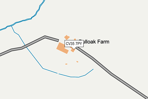
CV35 7PY is located in the Kenilworth Abbey & Arden electoral ward, within the local authority district of Warwick and the English Parliamentary constituency of Kenilworth and Southam. The Sub Integrated Care Board (ICB) Location is NHS Coventry and Warwickshire ICB - B2M3M and the police force is Warwickshire. This postcode has been in use since January 1980.


GetTheData
Source: OS OpenMap – Local (Ordnance Survey)
Source: OS VectorMap District (Ordnance Survey)
Licence: Open Government Licence (requires attribution)
| Easting | 425671 |
| Northing | 268956 |
| Latitude | 52.318127 |
| Longitude | -1.624809 |
GetTheData
Source: Open Postcode Geo
Licence: Open Government Licence
| Country | England |
| Postcode District | CV35 |
| ➜ CV35 open data dashboard ➜ See where CV35 is on a map | |
GetTheData
Source: Land Registry Price Paid Data
Licence: Open Government Licence
Elevation or altitude of CV35 7PY as distance above sea level:
| Metres | Feet | |
|---|---|---|
| Elevation | 100m | 328ft |
Elevation is measured from the approximate centre of the postcode, to the nearest point on an OS contour line from OS Terrain 50, which has contour spacing of ten vertical metres.
➜ How high above sea level am I? Find the elevation of your current position using your device's GPS.
GetTheData
Source: Open Postcode Elevation
Licence: Open Government Licence
| Ward | Kenilworth Abbey & Arden |
| Constituency | Kenilworth And Southam |
GetTheData
Source: ONS Postcode Database
Licence: Open Government Licence
| Warwick Parkway Station | 3.7km |
| Hatton (Warks) Station | 4.2km |
| Warwick Station | 4.6km |
GetTheData
Source: NaPTAN
Licence: Open Government Licence
GetTheData
Source: ONS Postcode Database
Licence: Open Government Licence


➜ Get more ratings from the Food Standards Agency
GetTheData
Source: Food Standards Agency
Licence: FSA terms & conditions
| Last Collection | |||
|---|---|---|---|
| Location | Mon-Fri | Sat | Distance |
| Hatton Park | 17:00 | 09:00 | 2,230m |
| Beausale | 15:30 | 08:45 | 2,456m |
| Little Woodcote | 16:00 | 08:00 | 2,790m |
GetTheData
Source: Dracos
Licence: Creative Commons Attribution-ShareAlike
| Facility | Distance |
|---|---|
| The Warwickshire Golf And Country Club Warwick Road, Leek Wootton Health and Fitness Gym, Swimming Pool, Golf, Studio | 2.6km |
| Warwickshire Police Hq (Leek Wootton) Woodcote Drive, Leek Wootton, Warwick Grass Pitches | 2.8km |
| Leek Wootton Sports Club Quarry Close, Leek Wootton, Warwick Grass Pitches | 3.2km |
GetTheData
Source: Active Places
Licence: Open Government Licence
| School | Phase of Education | Distance |
|---|---|---|
| The Ferncumbe CofE Primary School The Green, Hatton, Warwick, CV35 7EX | Primary | 2.8km |
| Northleigh House School Northleigh House, Five Ways Road, Hatton, Warwick, CV35 7HZ | Not applicable | 3.2km |
| All Saints Church of England Academy Warwick Road, Leek Wootton, Warwick, CV35 7QR | Primary | 3.3km |
GetTheData
Source: Edubase
Licence: Open Government Licence
The below table lists the International Territorial Level (ITL) codes (formerly Nomenclature of Territorial Units for Statistics (NUTS) codes) and Local Administrative Units (LAU) codes for CV35 7PY:
| ITL 1 Code | Name |
|---|---|
| TLG | West Midlands (England) |
| ITL 2 Code | Name |
| TLG1 | Herefordshire, Worcestershire and Warwickshire |
| ITL 3 Code | Name |
| TLG13 | Warwickshire CC |
| LAU 1 Code | Name |
| E07000222 | Warwick |
GetTheData
Source: ONS Postcode Directory
Licence: Open Government Licence
The below table lists the Census Output Area (OA), Lower Layer Super Output Area (LSOA), and Middle Layer Super Output Area (MSOA) for CV35 7PY:
| Code | Name | |
|---|---|---|
| OA | E00159508 | |
| LSOA | E01031284 | Warwick 004D |
| MSOA | E02006522 | Warwick 004 |
GetTheData
Source: ONS Postcode Directory
Licence: Open Government Licence
| CV35 7PB | Kites Nest Lane | 743m |
| CV8 1NN | Rouncil Lane | 1573m |
| CV35 7PE | Beausale Lane | 1606m |
| CV35 7UD | Pebworth Drive | 1731m |
| CV35 7UE | Todenham Way | 1794m |
| CV35 7UF | Claydon Grove | 1802m |
| CV35 7NZ | 1845m | |
| CV35 7SZ | Barcheston Mews | 1886m |
| CV35 7TQ | Highfield | 1888m |
| CV35 7TH | Dorsington Close | 1933m |
GetTheData
Source: Open Postcode Geo; Land Registry Price Paid Data
Licence: Open Government Licence