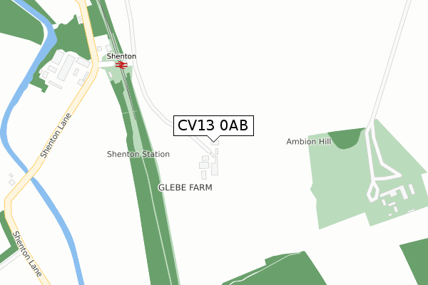
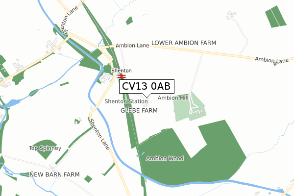
CV13 0AB is located in the Ambien electoral ward, within the local authority district of Hinckley and Bosworth and the English Parliamentary constituency of Bosworth. The Sub Integrated Care Board (ICB) Location is NHS Leicester, Leicestershire and Rutland ICB - 04V and the police force is Leicestershire. This postcode has been in use since January 1980.


GetTheData
Source: OS Open Zoomstack (Ordnance Survey)
Licence: Open Government Licence (requires attribution)
Attribution: Contains OS data © Crown copyright and database right 2024
Source: Open Postcode Geo
Licence: Open Government Licence (requires attribution)
Attribution: Contains OS data © Crown copyright and database right 2024; Contains Royal Mail data © Royal Mail copyright and database right 2024; Source: Office for National Statistics licensed under the Open Government Licence v.3.0
| Easting | 439917 |
| Northing | 300185 |
| Latitude | 52.597998 |
| Longitude | -1.412111 |
GetTheData
Source: Open Postcode Geo
Licence: Open Government Licence
| Country | England |
| Postcode District | CV13 |
| ➜ CV13 open data dashboard ➜ See where CV13 is on a map | |
GetTheData
Source: Land Registry Price Paid Data
Licence: Open Government Licence
Elevation or altitude of CV13 0AB as distance above sea level:
| Metres | Feet | |
|---|---|---|
| Elevation | 110m | 361ft |
Elevation is measured from the approximate centre of the postcode, to the nearest point on an OS contour line from OS Terrain 50, which has contour spacing of ten vertical metres.
➜ How high above sea level am I? Find the elevation of your current position using your device's GPS.
GetTheData
Source: Open Postcode Elevation
Licence: Open Government Licence
| Ward | Ambien |
| Constituency | Bosworth |
GetTheData
Source: ONS Postcode Database
Licence: Open Government Licence
| May 2022 | Violence and sexual offences | On or near Bosworth Battlefield | 412m |
| December 2021 | Vehicle crime | On or near Bosworth Battlefield | 412m |
| November 2021 | Burglary | On or near Bosworth Battlefield | 412m |
| ➜ Get more crime data in our Crime section | |||
GetTheData
Source: data.police.uk
Licence: Open Government Licence
| Bosworth Battlefield (Unnamed Road) | Sutton Cheney | 344m |
| Shenton Rail Station (Battlefield Line) | Shenton | 319m |
GetTheData
Source: NaPTAN
Licence: Open Government Licence
GetTheData
Source: ONS Postcode Database
Licence: Open Government Licence


➜ Get more ratings from the Food Standards Agency
GetTheData
Source: Food Standards Agency
Licence: FSA terms & conditions
| Last Collection | |||
|---|---|---|---|
| Location | Mon-Fri | Sat | Distance |
| Shenton | 16:15 | 09:30 | 326m |
| Shenton | 16:15 | 09:00 | 1,368m |
| Dadlington | 16:30 | 09:00 | 2,272m |
GetTheData
Source: Dracos
Licence: Creative Commons Attribution-ShareAlike
| Facility | Distance |
|---|---|
| The Engine Shed (Closed) Upton Lane, Stoke Golding, Nuneaton Health and Fitness Gym | 2.9km |
| The Market Bosworth High School Back Lane, Market Bosworth, Nuneaton Sports Hall, Swimming Pool, Grass Pitches | 3km |
| Saint Martin's Catholic Academy Convent Drive, Stoke Golding, Nuneaton Grass Pitches, Sports Hall, Outdoor Tennis Courts | 3km |
GetTheData
Source: Active Places
Licence: Open Government Licence
| School | Phase of Education | Distance |
|---|---|---|
| St Margaret's Church of England Primary School, Stoke Golding High Street, Stoke Golding, Nuneaton, CV13 6HE | Primary | 2.9km |
| Saint Martin's Catholic Voluntary Academy Stoke Road, Nuneaton, CV13 6BF | Secondary | 3km |
| The Market Bosworth School Station Road, Market Bosworth, Nuneaton, CV13 0JT | Secondary | 3km |
GetTheData
Source: Edubase
Licence: Open Government Licence
The below table lists the International Territorial Level (ITL) codes (formerly Nomenclature of Territorial Units for Statistics (NUTS) codes) and Local Administrative Units (LAU) codes for CV13 0AB:
| ITL 1 Code | Name |
|---|---|
| TLF | East Midlands (England) |
| ITL 2 Code | Name |
| TLF2 | Leicestershire, Rutland and Northamptonshire |
| ITL 3 Code | Name |
| TLF22 | Leicestershire CC and Rutland |
| LAU 1 Code | Name |
| E07000132 | Hinckley and Bosworth |
GetTheData
Source: ONS Postcode Directory
Licence: Open Government Licence
The below table lists the Census Output Area (OA), Lower Layer Super Output Area (LSOA), and Middle Layer Super Output Area (MSOA) for CV13 0AB:
| Code | Name | |
|---|---|---|
| OA | E00131011 | |
| LSOA | E01025818 | Hinckley and Bosworth 008B |
| MSOA | E02005384 | Hinckley and Bosworth 008 |
GetTheData
Source: ONS Postcode Directory
Licence: Open Government Licence
| CV13 0AD | Ambion Lane | 583m |
| CV13 6DP | 1088m | |
| CV13 6DS | Fenn Lanes | 1201m |
| CV13 6DH | Market Bosworth Road | 1312m |
| CV13 0AL | Wharf Lane | 1537m |
| CV13 0AH | 1640m | |
| CV13 0AJ | Twenty Acre Lane | 1886m |
| CV13 0AQ | The Square | 1889m |
| CV13 0AG | Main Street | 1973m |
| CV13 6JD | Shenton Lane | 2022m |
GetTheData
Source: Open Postcode Geo; Land Registry Price Paid Data
Licence: Open Government Licence