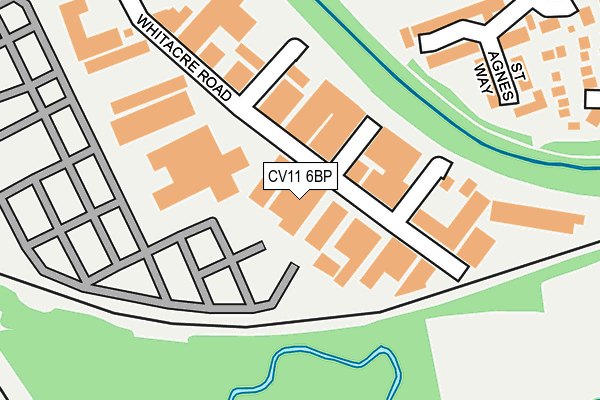
CV11 6BP is located in the St Nicolas electoral ward, within the local authority district of Nuneaton and Bedworth and the English Parliamentary constituency of Nuneaton. The Sub Integrated Care Board (ICB) Location is NHS Coventry and Warwickshire ICB - B2M3M and the police force is Warwickshire. This postcode has been in use since January 1980.


GetTheData
Source: OS OpenMap – Local (Ordnance Survey)
Source: OS VectorMap District (Ordnance Survey)
Licence: Open Government Licence (requires attribution)
| Easting | 437307 |
| Northing | 291757 |
| Latitude | 52.522420 |
| Longitude | -1.451587 |
GetTheData
Source: Open Postcode Geo
Licence: Open Government Licence
| Country | England |
| Postcode District | CV11 |
| ➜ CV11 open data dashboard ➜ See where CV11 is on a map ➜ Where is Nuneaton? | |
GetTheData
Source: Land Registry Price Paid Data
Licence: Open Government Licence
Elevation or altitude of CV11 6BP as distance above sea level:
| Metres | Feet | |
|---|---|---|
| Elevation | 80m | 262ft |
Elevation is measured from the approximate centre of the postcode, to the nearest point on an OS contour line from OS Terrain 50, which has contour spacing of ten vertical metres.
➜ How high above sea level am I? Find the elevation of your current position using your device's GPS.
GetTheData
Source: Open Postcode Elevation
Licence: Open Government Licence
| Ward | St Nicolas |
| Constituency | Nuneaton |
GetTheData
Source: ONS Postcode Database
Licence: Open Government Licence
| January 2024 | Anti-social behaviour | On or near Oaston Road | 434m |
| January 2024 | Violence and sexual offences | On or near Oaston Road | 434m |
| January 2024 | Anti-social behaviour | On or near Oaston Road | 434m |
| ➜ Get more crime data in our Crime section | |||
GetTheData
Source: data.police.uk
Licence: Open Government Licence
| Dawlish Close (Tiverton Drive) | Nuneaton | 477m |
| Tiverton Drive (Tavistock Way) | Nuneaton | 550m |
| Kelsey Close (Townsend Drive) | Attleborough | 551m |
| Tiverton Drive (Tavistock Way) | Nuneaton | 554m |
| Kelsey Close (Townsend Drive) | Attleborough | 557m |
| Nuneaton Station | 0.9km |
| Bermuda Park Station | 2.7km |
| Bedworth Station | 4.9km |
GetTheData
Source: NaPTAN
Licence: Open Government Licence
GetTheData
Source: ONS Postcode Database
Licence: Open Government Licence


➜ Get more ratings from the Food Standards Agency
GetTheData
Source: Food Standards Agency
Licence: FSA terms & conditions
| Last Collection | |||
|---|---|---|---|
| Location | Mon-Fri | Sat | Distance |
| Br Trent Valley Station | 17:30 | 11:45 | 915m |
| Stockingford Post Office | 17:00 | 12:00 | 974m |
| Harefield Road | 17:15 | 11:30 | 1,077m |
GetTheData
Source: Dracos
Licence: Creative Commons Attribution-ShareAlike
| Facility | Distance |
|---|---|
| Etone College Sports Field Tavistock Way, Nuneaton Grass Pitches | 305m |
| Bettabodies Fitness Ltd (Closed) Liberty Way, Attleborough Fields Ind Estate, Nuneaton Health and Fitness Gym, Studio | 574m |
| Focus Fitness (Closed) Liberty Way, Attleborough Fields Ind Estate, Nuneaton Health and Fitness Gym, Studio | 588m |
GetTheData
Source: Active Places
Licence: Open Government Licence
| School | Phase of Education | Distance |
|---|---|---|
| Etone College Leicester Road, Nuneaton, CV11 6AA | Secondary | 607m |
| King Edward VI College King Edward Road, Nuneaton, CV11 4BE | 16 plus | 684m |
| ALP Nuneaton Holman Way, Nuneaton, CV11 4PN | Not applicable | 759m |
GetTheData
Source: Edubase
Licence: Open Government Licence
The below table lists the International Territorial Level (ITL) codes (formerly Nomenclature of Territorial Units for Statistics (NUTS) codes) and Local Administrative Units (LAU) codes for CV11 6BP:
| ITL 1 Code | Name |
|---|---|
| TLG | West Midlands (England) |
| ITL 2 Code | Name |
| TLG1 | Herefordshire, Worcestershire and Warwickshire |
| ITL 3 Code | Name |
| TLG13 | Warwickshire CC |
| LAU 1 Code | Name |
| E07000219 | Nuneaton and Bedworth |
GetTheData
Source: ONS Postcode Directory
Licence: Open Government Licence
The below table lists the Census Output Area (OA), Lower Layer Super Output Area (LSOA), and Middle Layer Super Output Area (MSOA) for CV11 6BP:
| Code | Name | |
|---|---|---|
| OA | E00158539 | |
| LSOA | E01031102 | Nuneaton and Bedworth 003C |
| MSOA | E02006477 | Nuneaton and Bedworth 003 |
GetTheData
Source: ONS Postcode Directory
Licence: Open Government Licence
| CV11 6BY | Whitacre Road | 85m |
| CV11 6TN | St Agnes Way | 254m |
| CV11 6SZ | Wadebridge Drive | 327m |
| CV11 6LA | Oaston Road | 367m |
| CV11 6GW | Crantock Way | 380m |
| CV11 6YH | Holsworthy Close | 383m |
| CV11 6JE | Cottage Close | 398m |
| CV11 6TY | Pentire Close | 407m |
| CV11 6YD | Lynmouth Close | 412m |
| CV11 4FR | Raglan Close | 426m |
GetTheData
Source: Open Postcode Geo; Land Registry Price Paid Data
Licence: Open Government Licence