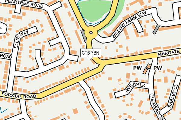
CT6 7BN is located in the Herne & Broomfield electoral ward, within the local authority district of Canterbury and the English Parliamentary constituency of North Thanet. The Sub Integrated Care Board (ICB) Location is NHS Kent and Medway ICB - 91Q and the police force is Kent. This postcode has been in use since February 2022.


GetTheData
Source: OS OpenMap – Local (Ordnance Survey)
Source: OS VectorMap District (Ordnance Survey)
Licence: Open Government Licence (requires attribution)
| Easting | 619294 |
| Northing | 166871 |
| Latitude | 51.358567 |
| Longitude | 1.148434 |
GetTheData
Source: Open Postcode Geo
Licence: Open Government Licence
| Country | England |
| Postcode District | CT6 |
| ➜ CT6 open data dashboard ➜ See where CT6 is on a map ➜ Where is Broomfield? | |
GetTheData
Source: Land Registry Price Paid Data
Licence: Open Government Licence
Elevation or altitude of CT6 7BN as distance above sea level:
| Metres | Feet | |
|---|---|---|
| Elevation | 40m | 131ft |
Elevation is measured from the approximate centre of the postcode, to the nearest point on an OS contour line from OS Terrain 50, which has contour spacing of ten vertical metres.
➜ How high above sea level am I? Find the elevation of your current position using your device's GPS.
GetTheData
Source: Open Postcode Elevation
Licence: Open Government Licence
| Ward | Herne & Broomfield |
| Constituency | North Thanet |
GetTheData
Source: ONS Postcode Database
Licence: Open Government Licence
36A, MARGATE ROAD, HERNE BAY, CT6 7BN 2022 28 APR £420,000 |
36, MARGATE ROAD, HERNE BAY, CT6 7BN 2022 28 FEB £470,000 |
GetTheData
Source: HM Land Registry Price Paid Data
Licence: Contains HM Land Registry data © Crown copyright and database right 2024. This data is licensed under the Open Government Licence v3.0.
| January 2024 | Other crime | On or near Arden Road | 291m |
| January 2024 | Violence and sexual offences | On or near Arden Road | 291m |
| September 2023 | Anti-social behaviour | On or near Hoopers Lane | 432m |
| ➜ Get more crime data in our Crime section | |||
GetTheData
Source: data.police.uk
Licence: Open Government Licence
| The Plough (Hunters Forstal Road) | Broomfield | 35m |
| The Plough (Hunters Forstal Road) | Broomfield | 51m |
| Margate Road The Plough (Margate Road) | Broomfield | 70m |
| Margate Road The Plough (Margate Road) | Broomfield | 125m |
| Arden Road (Hunters Forstal Road) | Broomfield | 265m |
| Herne Bay Station | 2.2km |
GetTheData
Source: NaPTAN
Licence: Open Government Licence
GetTheData
Source: ONS Postcode Database
Licence: Open Government Licence


➜ Get more ratings from the Food Standards Agency
GetTheData
Source: Food Standards Agency
Licence: FSA terms & conditions
| Last Collection | |||
|---|---|---|---|
| Location | Mon-Fri | Sat | Distance |
| Hunters Forstal | 16:15 | 11:00 | 50m |
| Broomfield Post Office | 17:00 | 11:45 | 509m |
| Broomfield Road | 16:15 | 11:00 | 542m |
GetTheData
Source: Dracos
Licence: Creative Commons Attribution-ShareAlike
| Facility | Distance |
|---|---|
| Snap Fitness (Herne Bay) The Boulevard, The Boulevard, Altira Business Park, Herne Bay Health and Fitness Gym | 466m |
| Broomfield Bmx Track Ford Road, Herne Cycling | 955m |
| Burton Downs Recreation Ground Thundersland Road, Herne Bay Grass Pitches | 1km |
GetTheData
Source: Active Places
Licence: Open Government Licence
| School | Phase of Education | Distance |
|---|---|---|
| Herne Church of England Infant and Nursery School Palmer Close, Herne, Herne Bay, CT6 7AH | Primary | 1.2km |
| Herne Church of England Junior School School Lane, Herne, Herne Bay, CT6 7AL | Primary | 1.2km |
| Herne Bay Infant School Stanley Road, Herne Bay, CT6 5SH | Primary | 1.7km |
GetTheData
Source: Edubase
Licence: Open Government Licence
The below table lists the International Territorial Level (ITL) codes (formerly Nomenclature of Territorial Units for Statistics (NUTS) codes) and Local Administrative Units (LAU) codes for CT6 7BN:
| ITL 1 Code | Name |
|---|---|
| TLJ | South East (England) |
| ITL 2 Code | Name |
| TLJ4 | Kent |
| ITL 3 Code | Name |
| TLJ44 | East Kent |
| LAU 1 Code | Name |
| E07000106 | Canterbury |
GetTheData
Source: ONS Postcode Directory
Licence: Open Government Licence
The below table lists the Census Output Area (OA), Lower Layer Super Output Area (LSOA), and Middle Layer Super Output Area (MSOA) for CT6 7BN:
| Code | Name | |
|---|---|---|
| OA | E00122227 | |
| LSOA | E01024076 | Canterbury 006D |
| MSOA | E02005015 | Canterbury 006 |
GetTheData
Source: ONS Postcode Directory
Licence: Open Government Licence
| CT6 7XP | Pintail Way | 39m |
| CT6 7BG | Hunters Forstal Road | 64m |
| CT6 7BL | Margate Road | 125m |
| CT6 7XW | Peartree Road | 131m |
| CT6 7XN | Peartree Road | 140m |
| CT6 7XD | Rye Walk | 143m |
| CT6 7XR | Curlew Close | 162m |
| CT6 7DB | Goldfinch Close | 167m |
| CT6 7DW | Hunters Forstal Road | 171m |
| CT6 7BH | Margate Road | 188m |
GetTheData
Source: Open Postcode Geo; Land Registry Price Paid Data
Licence: Open Government Licence