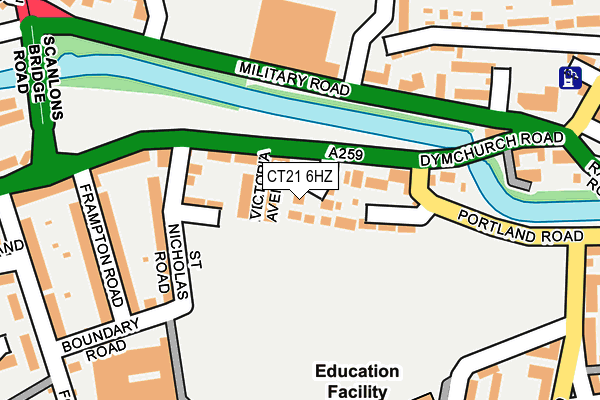
CT21 6HZ lies on Hermitage Close in Hythe. CT21 6HZ is located in the Hythe electoral ward, within the local authority district of Folkestone and Hythe and the English Parliamentary constituency of Folkestone and Hythe. The Sub Integrated Care Board (ICB) Location is NHS Kent and Medway ICB - 91Q and the police force is Kent. This postcode has been in use since January 1980.


GetTheData
Source: OS OpenMap – Local (Ordnance Survey)
Source: OS VectorMap District (Ordnance Survey)
Licence: Open Government Licence (requires attribution)
| Easting | 615627 |
| Northing | 134630 |
| Latitude | 51.070478 |
| Longitude | 1.076448 |
GetTheData
Source: Open Postcode Geo
Licence: Open Government Licence
| Street | Hermitage Close |
| Town/City | Hythe |
| Country | England |
| Postcode District | CT21 |
➜ See where CT21 is on a map ➜ Where is Hythe? | |
GetTheData
Source: Land Registry Price Paid Data
Licence: Open Government Licence
Elevation or altitude of CT21 6HZ as distance above sea level:
| Metres | Feet | |
|---|---|---|
| Elevation | 10m | 33ft |
Elevation is measured from the approximate centre of the postcode, to the nearest point on an OS contour line from OS Terrain 50, which has contour spacing of ten vertical metres.
➜ How high above sea level am I? Find the elevation of your current position using your device's GPS.
GetTheData
Source: Open Postcode Elevation
Licence: Open Government Licence
| Ward | Hythe |
| Constituency | Folkestone And Hythe |
GetTheData
Source: ONS Postcode Database
Licence: Open Government Licence
2024 11 DEC £620,000 |
2023 15 MAR £510,000 |
3, HERMITAGE CLOSE, HYTHE, CT21 6HZ 2015 11 DEC £365,000 |
2015 30 JAN £420,000 |
2005 15 NOV £380,000 |
HERMITAGE HOUSE, DYMCHURCH ROAD, HYTHE, CT21 6HZ 1998 27 MAR £133,000 |
GetTheData
Source: HM Land Registry Price Paid Data
Licence: Contains HM Land Registry data © Crown copyright and database right 2025. This data is licensed under the Open Government Licence v3.0.
| Red Lion Square (Dymchurch Road) | Hythe | 201m |
| Red Lion Square (Military Road) | Hythe | 235m |
| Sir John Moore Avenue (Military Road) | Hythe | 247m |
| Hythe Light Railway Station (Scanlons Bridge Road) | Hythe | 280m |
| Fort Road (Dymchurch Road) | Hythe | 338m |
| Hythe Station (Rhdr) | Hythe | 345m |
| Sandling Station | 2.3km |
| Westenhanger Station | 3.8km |
GetTheData
Source: NaPTAN
Licence: Open Government Licence
| Percentage of properties with Next Generation Access | 100.0% |
| Percentage of properties with Superfast Broadband | 100.0% |
| Percentage of properties with Ultrafast Broadband | 0.0% |
| Percentage of properties with Full Fibre Broadband | 0.0% |
Superfast Broadband is between 30Mbps and 300Mbps
Ultrafast Broadband is > 300Mbps
| Percentage of properties unable to receive 2Mbps | 0.0% |
| Percentage of properties unable to receive 5Mbps | 0.0% |
| Percentage of properties unable to receive 10Mbps | 0.0% |
| Percentage of properties unable to receive 30Mbps | 0.0% |
GetTheData
Source: Ofcom
Licence: Ofcom Terms of Use (requires attribution)
Estimated total energy consumption in CT21 6HZ by fuel type, 2015.
| Consumption (kWh) | 143,578 |
|---|---|
| Meter count | 9 |
| Mean (kWh/meter) | 15,953 |
| Median (kWh/meter) | 14,123 |
| Consumption (kWh) | 33,063 |
|---|---|
| Meter count | 8 |
| Mean (kWh/meter) | 4,133 |
| Median (kWh/meter) | 2,795 |
GetTheData
Source: Postcode level gas estimates: 2015 (experimental)
Source: Postcode level electricity estimates: 2015 (experimental)
Licence: Open Government Licence
GetTheData
Source: ONS Postcode Database
Licence: Open Government Licence


➜ Get more ratings from the Food Standards Agency
GetTheData
Source: Food Standards Agency
Licence: FSA terms & conditions
| Last Collection | |||
|---|---|---|---|
| Location | Mon-Fri | Sat | Distance |
| St Leonards Road | 17:15 | 11:30 | 298m |
| Orchard Valley | 17:00 | 11:30 | 342m |
| Malthouse | 17:30 | 11:30 | 344m |
GetTheData
Source: Dracos
Licence: Creative Commons Attribution-ShareAlike
| Risk of CT21 6HZ flooding from rivers and sea | Very Low |
| ➜ CT21 6HZ flood map | |
GetTheData
Source: Open Flood Risk by Postcode
Licence: Open Government Licence
The below table lists the International Territorial Level (ITL) codes (formerly Nomenclature of Territorial Units for Statistics (NUTS) codes) and Local Administrative Units (LAU) codes for CT21 6HZ:
| ITL 1 Code | Name |
|---|---|
| TLJ | South East (England) |
| ITL 2 Code | Name |
| TLJ4 | Kent |
| ITL 3 Code | Name |
| TLJ44 | East Kent |
| LAU 1 Code | Name |
| E07000112 | Folkestone and Hythe |
GetTheData
Source: ONS Postcode Directory
Licence: Open Government Licence
The below table lists the Census Output Area (OA), Lower Layer Super Output Area (LSOA), and Middle Layer Super Output Area (MSOA) for CT21 6HZ:
| Code | Name | |
|---|---|---|
| OA | E00124479 | |
| LSOA | E01024524 | Shepway 010B |
| MSOA | E02005111 | Shepway 010 |
GetTheData
Source: ONS Postcode Directory
Licence: Open Government Licence
| CT21 6JE | Dymchurch Road | 41m |
| CT21 6JG | Victoria Avenue | 54m |
| CT21 6JF | Dymchurch Road | 73m |
| CT21 6JD | Portland Close | 95m |
| CT21 6JH | St Nicholas Terrace | 108m |
| CT21 6JA | Portland Road | 108m |
| CT21 6JQ | St Nicholas Road | 142m |
| CT21 5DD | Military Road | 144m |
| CT21 5AS | Military Road | 167m |
| CT21 6JN | Dymchurch Road | 182m |
GetTheData
Source: Open Postcode Geo; Land Registry Price Paid Data
Licence: Open Government Licence