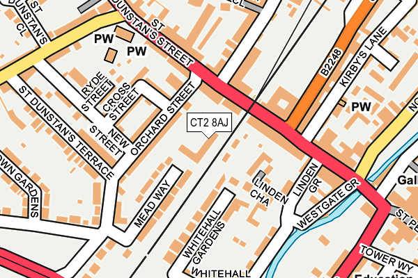
CT2 8AJ is located in the Westgate electoral ward, within the local authority district of Canterbury and the English Parliamentary constituency of Canterbury. The Sub Integrated Care Board (ICB) Location is NHS Kent and Medway ICB - 91Q and the police force is Kent. This postcode has been in use since June 1997.


GetTheData
Source: OS OpenMap – Local (Ordnance Survey)
Source: OS VectorMap District (Ordnance Survey)
Licence: Open Government Licence (requires attribution)
| Easting | 614365 |
| Northing | 158163 |
| Latitude | 51.282255 |
| Longitude | 1.072487 |
GetTheData
Source: Open Postcode Geo
Licence: Open Government Licence
| Country | England |
| Postcode District | CT2 |
| ➜ CT2 open data dashboard ➜ See where CT2 is on a map ➜ Where is Canterbury? | |
GetTheData
Source: Land Registry Price Paid Data
Licence: Open Government Licence
Elevation or altitude of CT2 8AJ as distance above sea level:
| Metres | Feet | |
|---|---|---|
| Elevation | 10m | 33ft |
Elevation is measured from the approximate centre of the postcode, to the nearest point on an OS contour line from OS Terrain 50, which has contour spacing of ten vertical metres.
➜ How high above sea level am I? Find the elevation of your current position using your device's GPS.
GetTheData
Source: Open Postcode Elevation
Licence: Open Government Licence
| Ward | Westgate |
| Constituency | Canterbury |
GetTheData
Source: ONS Postcode Database
Licence: Open Government Licence
| January 2024 | Criminal damage and arson | On or near Pine Tree Avenue | 432m |
| January 2024 | Vehicle crime | On or near Pine Tree Avenue | 432m |
| January 2024 | Violence and sexual offences | On or near Pine Tree Avenue | 432m |
| ➜ Get more crime data in our Crime section | |||
GetTheData
Source: data.police.uk
Licence: Open Government Licence
| St Dunstan's Church (St Dunstan's Street) | St Dunstan's | 162m |
| Westgate Towers (St Dunstan's Street) | St Dunstan's | 176m |
| St Dunstan's Church (St Dunstan's Street) | St Dunstan's | 189m |
| St Dunstan's Church (London Road) | St Dunstan's | 222m |
| Westgate Towers (North Lane) | St Dunstan's | 259m |
| Canterbury West Station | 0.3km |
| Canterbury East Station | 0.9km |
| Sturry Station | 4.1km |
GetTheData
Source: NaPTAN
Licence: Open Government Licence
GetTheData
Source: ONS Postcode Database
Licence: Open Government Licence


➜ Get more ratings from the Food Standards Agency
GetTheData
Source: Food Standards Agency
Licence: FSA terms & conditions
| Last Collection | |||
|---|---|---|---|
| Location | Mon-Fri | Sat | Distance |
| St Dunstans | 17:30 | 12:00 | 144m |
| Lionard House | 17:30 | 11:45 | 185m |
| London Road | 17:30 | 11:45 | 321m |
GetTheData
Source: Dracos
Licence: Creative Commons Attribution-ShareAlike
| Facility | Distance |
|---|---|
| Dynamic Fitness St. Dunstans Street, Canterbury Health and Fitness Gym, Studio | 147m |
| The Kings School Recreation Centre St. Stephens Road, Canterbury Sports Hall, Swimming Pool, Health and Fitness Gym, Artificial Grass Pitch, Studio, Squash Courts, Outdoor Tennis Courts | 634m |
| Victoria Recreation Ground (Canterbury) Knight Avenue, Canterbury Grass Pitches | 672m |
GetTheData
Source: Active Places
Licence: Open Government Licence
| School | Phase of Education | Distance |
|---|---|---|
| St Peter's Methodist Primary School St Peter's Grove, Canterbury, CT1 2DH | Primary | 403m |
| Haven Nook 73-75, Castle Street, Canterbury, Kent, CT1 2QD | Not applicable | 649m |
| St Johns Church of England Primary School St John's Place, Northgate, Canterbury, CT1 1BD | Primary | 731m |
GetTheData
Source: Edubase
Licence: Open Government Licence
The below table lists the International Territorial Level (ITL) codes (formerly Nomenclature of Territorial Units for Statistics (NUTS) codes) and Local Administrative Units (LAU) codes for CT2 8AJ:
| ITL 1 Code | Name |
|---|---|
| TLJ | South East (England) |
| ITL 2 Code | Name |
| TLJ4 | Kent |
| ITL 3 Code | Name |
| TLJ44 | East Kent |
| LAU 1 Code | Name |
| E07000106 | Canterbury |
GetTheData
Source: ONS Postcode Directory
Licence: Open Government Licence
The below table lists the Census Output Area (OA), Lower Layer Super Output Area (LSOA), and Middle Layer Super Output Area (MSOA) for CT2 8AJ:
| Code | Name | |
|---|---|---|
| OA | E00122474 | |
| LSOA | E01024121 | Canterbury 020B |
| MSOA | E02006856 | Canterbury 020 |
GetTheData
Source: ONS Postcode Directory
Licence: Open Government Licence
| CT2 8BS | St Dunstans Street | 62m |
| CT2 8DD | Linden Chase | 75m |
| CT2 8AP | Orchard Street | 77m |
| CT2 8BN | St Dunstans Street | 89m |
| CT2 8BT | St Dunstans Street | 91m |
| CT2 8AS | Church Street | 108m |
| CT2 8BD | Whitehall Gardens | 109m |
| CT2 8BB | Mead Way | 113m |
| CT2 8DA | St Dunstans Street | 115m |
| CT2 8FD | Roper Road | 115m |
GetTheData
Source: Open Postcode Geo; Land Registry Price Paid Data
Licence: Open Government Licence