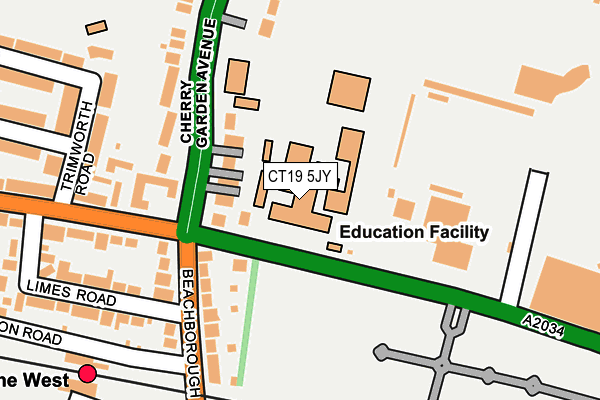
CT19 5JY is located in the Broadmead electoral ward, within the local authority district of Folkestone and Hythe and the English Parliamentary constituency of Folkestone and Hythe. The Sub Integrated Care Board (ICB) Location is NHS Kent and Medway ICB - 91Q and the police force is Kent. This postcode has been in use since January 1980.


GetTheData
Source: OS OpenMap – Local (Ordnance Survey)
Source: OS VectorMap District (Ordnance Survey)
Licence: Open Government Licence (requires attribution)
| Easting | 621202 |
| Northing | 136613 |
| Latitude | 51.086166 |
| Longitude | 1.157142 |
GetTheData
Source: Open Postcode Geo
Licence: Open Government Licence
| Country | England |
| Postcode District | CT19 |
| ➜ CT19 open data dashboard ➜ See where CT19 is on a map ➜ Where is Folkestone? | |
GetTheData
Source: Land Registry Price Paid Data
Licence: Open Government Licence
Elevation or altitude of CT19 5JY as distance above sea level:
| Metres | Feet | |
|---|---|---|
| Elevation | 40m | 131ft |
Elevation is measured from the approximate centre of the postcode, to the nearest point on an OS contour line from OS Terrain 50, which has contour spacing of ten vertical metres.
➜ How high above sea level am I? Find the elevation of your current position using your device's GPS.
GetTheData
Source: Open Postcode Elevation
Licence: Open Government Licence
| Ward | Broadmead |
| Constituency | Folkestone And Hythe |
GetTheData
Source: ONS Postcode Database
Licence: Open Government Licence
| June 2022 | Violence and sexual offences | On or near Beachborough Road | 141m |
| June 2022 | Violence and sexual offences | On or near Beachborough Road | 141m |
| June 2022 | Anti-social behaviour | On or near Beachborough Road | 141m |
| ➜ Get more crime data in our Crime section | |||
GetTheData
Source: data.police.uk
Licence: Open Government Licence
| Harvey Grammar School (Cheriton Road) | Folkestone | 51m |
| Harvey Grammar School (Cheriton Road) | Folkestone | 95m |
| Cemetery (Cheriton Road) | Folkestone | 157m |
| Limes Road (Cheriton Road) | Folkestone | 230m |
| Folkestone West Railway Station (Station Road) | Folkestone | 292m |
| Folkestone West Station | 0.3km |
| Folkestone Central Station | 0.9km |
GetTheData
Source: NaPTAN
Licence: Open Government Licence
GetTheData
Source: ONS Postcode Database
Licence: Open Government Licence


➜ Get more ratings from the Food Standards Agency
GetTheData
Source: Food Standards Agency
Licence: FSA terms & conditions
| Last Collection | |||
|---|---|---|---|
| Location | Mon-Fri | Sat | Distance |
| Beachborough Road | 17:45 | 12:00 | 154m |
| Shornecliffe Road | 17:45 | 12:00 | 378m |
| Morehall Old Post Office | 18:00 | 12:00 | 398m |
GetTheData
Source: Dracos
Licence: Creative Commons Attribution-ShareAlike
| Facility | Distance |
|---|---|
| The Harvey Grammar School Cheriton Road, Folkestone Sports Hall | 1m |
| Folkestone Indoor Bowls Club Cheriton Road, Folkestone Indoor Bowls | 147m |
| Alcaline Stadium Cheriton Road, Folkestone Grass Pitches, Outdoor Tennis Courts | 183m |
GetTheData
Source: Active Places
Licence: Open Government Licence
| School | Phase of Education | Distance |
|---|---|---|
| The Harvey Grammar School Cheriton Road, Folkestone, CT19 5JY | Secondary | 1m |
| Morehall Primary School and Nursery Morehall Primary School and Nursery, Chart Road, Folkestone, CT19 4PN | Primary | 502m |
| Earlscliffe (Sussex Summer Schools Ltd) 29 Shorncliffe Road, Folkestone, CT20 2NB | Not applicable | 739m |
GetTheData
Source: Edubase
Licence: Open Government Licence
The below table lists the International Territorial Level (ITL) codes (formerly Nomenclature of Territorial Units for Statistics (NUTS) codes) and Local Administrative Units (LAU) codes for CT19 5JY:
| ITL 1 Code | Name |
|---|---|
| TLJ | South East (England) |
| ITL 2 Code | Name |
| TLJ4 | Kent |
| ITL 3 Code | Name |
| TLJ44 | East Kent |
| LAU 1 Code | Name |
| E07000112 | Folkestone and Hythe |
GetTheData
Source: ONS Postcode Directory
Licence: Open Government Licence
The below table lists the Census Output Area (OA), Lower Layer Super Output Area (LSOA), and Middle Layer Super Output Area (MSOA) for CT19 5JY:
| Code | Name | |
|---|---|---|
| OA | E00124448 | |
| LSOA | E01024517 | Shepway 015D |
| MSOA | E02006880 | Shepway 015 |
GetTheData
Source: ONS Postcode Directory
Licence: Open Government Licence
| CT19 5LB | Cherry Garden Avenue | 81m |
| CT19 4AB | Beachborough Road | 125m |
| CT19 5LA | Cherry Garden Avenue | 159m |
| CT19 4AA | Beachborough Road | 168m |
| CT19 4AT | Cheriton Road | 200m |
| CT19 4DN | Cheriton Road | 205m |
| CT19 4EJ | Trimworth Road | 214m |
| CT19 5LD | Cherry Garden Avenue | 216m |
| CT19 4AU | Limes Road | 240m |
| CT19 4EL | Trimworth Road | 247m |
GetTheData
Source: Open Postcode Geo; Land Registry Price Paid Data
Licence: Open Government Licence