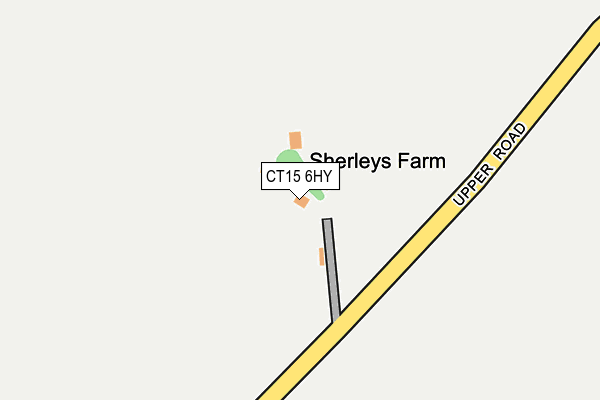
CT15 6HY is located in the Guston, Kingsdown & St Margaret's-at-Cliffe electoral ward, within the local authority district of Dover and the English Parliamentary constituency of Dover. The Sub Integrated Care Board (ICB) Location is NHS Kent and Medway ICB - 91Q and the police force is Kent. This postcode has been in use since January 1983.


GetTheData
Source: OS OpenMap – Local (Ordnance Survey)
Source: OS VectorMap District (Ordnance Survey)
Licence: Open Government Licence (requires attribution)
| Easting | 634674 |
| Northing | 143408 |
| Latitude | 51.141810 |
| Longitude | 1.353548 |
GetTheData
Source: Open Postcode Geo
Licence: Open Government Licence
| Country | England |
| Postcode District | CT15 |
| ➜ CT15 open data dashboard ➜ See where CT15 is on a map | |
GetTheData
Source: Land Registry Price Paid Data
Licence: Open Government Licence
Elevation or altitude of CT15 6HY as distance above sea level:
| Metres | Feet | |
|---|---|---|
| Elevation | 110m | 361ft |
Elevation is measured from the approximate centre of the postcode, to the nearest point on an OS contour line from OS Terrain 50, which has contour spacing of ten vertical metres.
➜ How high above sea level am I? Find the elevation of your current position using your device's GPS.
GetTheData
Source: Open Postcode Elevation
Licence: Open Government Licence
| Ward | Guston, Kingsdown & St Margaret's-at-cliffe |
| Constituency | Dover |
GetTheData
Source: ONS Postcode Database
Licence: Open Government Licence
| Swingate Inn (A258 To Dover) | Guston | 1,300m |
| Swingate Inn (A258) | Guston | 1,314m |
| West Cliffe Church (Dover Road) | St Margaret's At Cliffe | 1,355m |
| West Cliffe Church (Dover Road) | St Margaret's At Cliffe | 1,385m |
| Hope Inn (Sea Street) | St Margaret's At Cliffe | 1,835m |
| Martin Mill Station | 3.2km |
| Dover Priory Station | 3.8km |
GetTheData
Source: NaPTAN
Licence: Open Government Licence
GetTheData
Source: ONS Postcode Database
Licence: Open Government Licence


➜ Get more ratings from the Food Standards Agency
GetTheData
Source: Food Standards Agency
Licence: FSA terms & conditions
| Last Collection | |||
|---|---|---|---|
| Location | Mon-Fri | Sat | Distance |
| Reach Road | 17:00 | 11:45 | 1,634m |
| St Margarets At Cliffe P.o. | 17:00 | 12:15 | 1,864m |
| The Droveway | 17:00 | 12:15 | 2,032m |
GetTheData
Source: Dracos
Licence: Creative Commons Attribution-ShareAlike
| Facility | Distance |
|---|---|
| Balance Spa And Health Club Reach Road, St. Margarets-at-cliffe, Dover Swimming Pool, Health and Fitness Gym | 1.3km |
| Walletts Court Country House Hotel And Spa (Closed) Dover Road, Westcliffe, Dover Health and Fitness Gym, Swimming Pool, Outdoor Tennis Courts | 1.4km |
| Portal House School Sea Street, St. Margarets-at-cliffe, Dover Outdoor Tennis Courts, Grass Pitches | 1.9km |
GetTheData
Source: Active Places
Licence: Open Government Licence
| School | Phase of Education | Distance |
|---|---|---|
| Portal House School Sea Street, St Margaret's-At-Cliffe, Dover, CT15 6SS | Not applicable | 1.9km |
| Duke of York's Royal Military School Duke of York's Royal Military School, Dover, CT15 5EQ | Secondary | 1.9km |
| St Margaret's-at-Cliffe Primary School Sea Street, St Margaret's-At-Cliffe, Dover, CT15 6SS | Primary | 1.9km |
GetTheData
Source: Edubase
Licence: Open Government Licence
The below table lists the International Territorial Level (ITL) codes (formerly Nomenclature of Territorial Units for Statistics (NUTS) codes) and Local Administrative Units (LAU) codes for CT15 6HY:
| ITL 1 Code | Name |
|---|---|
| TLJ | South East (England) |
| ITL 2 Code | Name |
| TLJ4 | Kent |
| ITL 3 Code | Name |
| TLJ44 | East Kent |
| LAU 1 Code | Name |
| E07000108 | Dover |
GetTheData
Source: ONS Postcode Directory
Licence: Open Government Licence
The below table lists the Census Output Area (OA), Lower Layer Super Output Area (LSOA), and Middle Layer Super Output Area (MSOA) for CT15 6HY:
| Code | Name | |
|---|---|---|
| OA | E00123040 | |
| LSOA | E01024236 | Dover 009B |
| MSOA | E02005049 | Dover 009 |
GetTheData
Source: ONS Postcode Directory
Licence: Open Government Licence
| CT15 5DP | Swingate Cottages | 1295m |
| CT15 6AG | St Margarets Country Club | 1300m |
| CT15 6EN | Dover Road | 1337m |
| CT15 6JP | Langdon Close | 1462m |
| CT15 6AH | Roman Way | 1468m |
| CT15 6AF | Glebe Close | 1522m |
| CT15 6AE | Reach Road | 1561m |
| CT15 6AJ | Churchill Close | 1574m |
| CT15 6HU | St Georges Place | 1603m |
| CT15 5ES | Brickfield Cottages | 1621m |
GetTheData
Source: Open Postcode Geo; Land Registry Price Paid Data
Licence: Open Government Licence