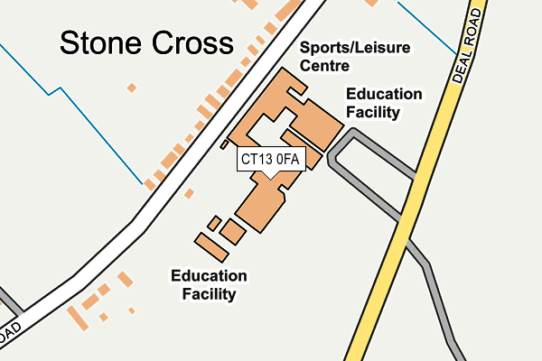
CT13 0FA is located in the Sandwich electoral ward, within the local authority district of Dover and the English Parliamentary constituency of South Thanet. The Sub Integrated Care Board (ICB) Location is NHS Kent and Medway ICB - 91Q and the police force is Kent. This postcode has been in use since May 2006.


GetTheData
Source: OS OpenMap – Local (Ordnance Survey)
Source: OS VectorMap District (Ordnance Survey)
Licence: Open Government Licence (requires attribution)
| Easting | 632835 |
| Northing | 157009 |
| Latitude | 51.264660 |
| Longitude | 1.336151 |
GetTheData
Source: Open Postcode Geo
Licence: Open Government Licence
| Country | England |
| Postcode District | CT13 |
| ➜ CT13 open data dashboard ➜ See where CT13 is on a map ➜ Where is Sandwich? | |
GetTheData
Source: Land Registry Price Paid Data
Licence: Open Government Licence
Elevation or altitude of CT13 0FA as distance above sea level:
| Metres | Feet | |
|---|---|---|
| Elevation | 10m | 33ft |
Elevation is measured from the approximate centre of the postcode, to the nearest point on an OS contour line from OS Terrain 50, which has contour spacing of ten vertical metres.
➜ How high above sea level am I? Find the elevation of your current position using your device's GPS.
GetTheData
Source: Open Postcode Elevation
Licence: Open Government Licence
| Ward | Sandwich |
| Constituency | South Thanet |
GetTheData
Source: ONS Postcode Database
Licence: Open Government Licence
| June 2022 | Drugs | On or near Dover Road | 111m |
| June 2022 | Drugs | On or near Dover Road | 111m |
| June 2022 | Drugs | On or near Dover Road | 111m |
| ➜ Get more crime data in our Crime section | |||
GetTheData
Source: data.police.uk
Licence: Open Government Licence
| Technology School Grounds (School Grounds) | Sandwich | 100m |
| Sandwich Technology School (Deal Road) | Sandwich | 140m |
| Sandwich Technology School (Deal Road) | Sandwich | 189m |
| Stone Cross (Deal Road) | Sandwich | 341m |
| Stone Cross (Dover Road) | Sandwich | 420m |
| Sandwich Station | 0.7km |
| Deal Station | 6.4km |
GetTheData
Source: NaPTAN
Licence: Open Government Licence
GetTheData
Source: ONS Postcode Database
Licence: Open Government Licence


➜ Get more ratings from the Food Standards Agency
GetTheData
Source: Food Standards Agency
Licence: FSA terms & conditions
| Last Collection | |||
|---|---|---|---|
| Location | Mon-Fri | Sat | Distance |
| Stone Cross Lees | 17:00 | 11:45 | 190m |
| Johns Green | 17:00 | 11:45 | 459m |
| St Barts Road | 16:15 | 11:45 | 582m |
GetTheData
Source: Dracos
Licence: Creative Commons Attribution-ShareAlike
| Facility | Distance |
|---|---|
| Sandwich Leisure Centre Dover Road, Sandwich Sports Hall, Health and Fitness Gym, Artificial Grass Pitch, Studio, Squash Courts, Outdoor Tennis Courts | 18m |
| Sandwich Technology School Dover Road, Sandwich Grass Pitches, Sports Hall, Artificial Grass Pitch | 74m |
| Sir Roger Manwoods School Manwood Road, Sandwich Swimming Pool, Health and Fitness Gym, Grass Pitches, Sports Hall, Artificial Grass Pitch | 1km |
GetTheData
Source: Active Places
Licence: Open Government Licence
| School | Phase of Education | Distance |
|---|---|---|
| Sandwich Technology School Deal Road, Sandwich, CT13 0FA | Secondary | 67m |
| Sandwich Junior School St Bart's Road, Sandwich, CT13 0AS | Primary | 442m |
| Sir Roger Manwood's School Manwood Road, Sandwich, CT13 9JX | Secondary | 1km |
GetTheData
Source: Edubase
Licence: Open Government Licence
The below table lists the International Territorial Level (ITL) codes (formerly Nomenclature of Territorial Units for Statistics (NUTS) codes) and Local Administrative Units (LAU) codes for CT13 0FA:
| ITL 1 Code | Name |
|---|---|
| TLJ | South East (England) |
| ITL 2 Code | Name |
| TLJ4 | Kent |
| ITL 3 Code | Name |
| TLJ44 | East Kent |
| LAU 1 Code | Name |
| E07000108 | Dover |
GetTheData
Source: ONS Postcode Directory
Licence: Open Government Licence
The below table lists the Census Output Area (OA), Lower Layer Super Output Area (LSOA), and Middle Layer Super Output Area (MSOA) for CT13 0FA:
| Code | Name | |
|---|---|---|
| OA | E00123080 | |
| LSOA | E01024242 | Dover 002B |
| MSOA | E02005042 | Dover 002 |
GetTheData
Source: ONS Postcode Directory
Licence: Open Government Licence
| CT13 0DA | Dover Road | 115m |
| CT13 0BZ | Stone Cross Lees | 247m |
| CT13 0BY | Dover Road | 266m |
| CT13 0BX | Dover Road | 283m |
| CT13 0DB | Dover Road | 309m |
| CT13 0BU | Deal Road | 341m |
| CT13 0AR | Hazelwood Meadow | 394m |
| CT13 0BT | Dover Road | 437m |
| CT13 0QU | Foster Court | 444m |
| CT13 0AP | Hazelwood Meadow | 456m |
GetTheData
Source: Open Postcode Geo; Land Registry Price Paid Data
Licence: Open Government Licence